Welcome to MountainViews
If you want to use the website often please enrol (quick and free) at top right.
If you want to use the website often please enrol (quick and free) at top right.
Overview

For more map options click on any overview map area or any detail map feature.
Detail Map Features
Showing 1 items:
Brown Mountain 224m,
Brown Mountain 224m,
Find Suggested Walks
Find hill, mountain, island, coastal feature.
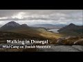
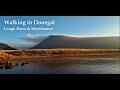
Videos
Recent Contributions
 Get Notifications
Get Notifications
Knockatee: Short but unpleasant hill
 Collaborative entry
Beann Bhán: Passage tomb?
 Colin Murphy
Challenging enough loop walk with wonderful views.
 Colin Murphy
Ben Goram: Up pilgram path to reek then west down via ridge. hot sun, cloud inve
Croagh Patrick: Up pilgram path to reek then west down via ridge Ben Goram. hot
 gaoithe
Knocknagullion: Relatively challenging climb with great views.
 Collaborative entry
Tough enough Carn with very fine views
 Colin Murphy
Nowen Hill Far West Top: Previous access issue to this simple stroll seems to ha
 Colin Murphy
Good tracks to two Carns.
 Colin Murphy
Crott Mountain, near Croagh Patrick, now demo
 simon3
Minaun: Towards Keem
 magnumpig
Saggart Hill: Masts and prehistoric tombs
 hibby
hibby
Conditions and Info
Use of MountainViews is governed by conditions and a privacy policy.
Read general information about the site.
Opinions in material here are not necessarily endorsed by MountainViews.
Hillwalking is a risk sport. Information in comments, walks, shared GPS tracks or about starting places may not be accurate for example as regards safety or access permission. You are responsible for your safety and your permission to walk.
See the credits and list definitions.
 Visit our Facebook page.
Video display
Donegal Central
Area SW: Glendowan Mountains Subarea
Place count in area: 15,
OSI/LPS Maps: 1, 2, 6
Highest place: Moylenanav, 539m
Maximum height for area: 539 metres,
Maximum prominence for area: 364 metres,
Places in area Donegal Central:
NE: Loughsalt Hills:Crockmore 349mCroaghmore 278mEdenacarnan 192mLoughaskerry 252mLoughsalt Mountain 469mMoyle Hill 148mStragraddy Mountain 285m
SW: Glendowan Mountains:Binswilly 337mBrown Mountain 224mCionn Bheatha 384mCrockastoller 418mFarscallop 420.6mGartan Mountain 357mLeahanmore 442mMoylenanav 539m
Note: this list of places includes island features such as summits, but not islands as such.
Highest place:
Moylenanav, 539mPlaces in area Donegal Central:
NE: Loughsalt Hills:
Crockmore 349mCroaghmore 278mEdenacarnan 192mLoughaskerry 252mLoughsalt Mountain 469mMoyle Hill 148mStragraddy Mountain 285mSW: Glendowan Mountains:
Binswilly 337mBrown Mountain 224mCionn Bheatha 384mCrockastoller 418mFarscallop 420.6mGartan Mountain 357mLeahanmore 442mMoylenanav 539mNote: this list of places includes island features such as summits, but not islands as such.

Bedrock type: Banded semi-pelitic & psammitic schist, (Termon Formation)
Brown Mountain is the 1350th highest place in Ireland.
Linkback: https://mountainviews.ie/summit/1256/
COMMENTS for Brown Mountain 1 of 1  Follow this place's comments

|
|
|
|
||
| MountainViews.ie, a Hill-walking Website for the island of Ireland. 2400 Summiteers, 1480 Contributors, maintainer of lists: Arderins, Vandeleur-Lynams, Highest Hundred, County Highpoints etc | |||