Members and Supporters, the MountainViews Committee requests your help to meet the costs of the website and of other activities such as insured events or publications.
Feature count in area: 27, by county: Donegal: 27, Derry: 1, of which 1 is in both Derry and Donegal,
OSI/LPS Maps: 2, 3, 4, 6, 7
Highest Place: Slieve Snaght 614.6m
Starting Places (43) in area Inishowen: Adderville Upper, Barnes Bend, Bunacrick, Butlers Bridge, Carnaghan Presbyterian Church, Castruse Upper, Craignacoolagh, Craignamuck, Croaghglengad West, Crockavishane South, Diarmuid and Gráinne's Bed, Doherty's Dún, Dunree Bay Carpark, EEl Hole, Effishmore Upper, Evishbreedy Bridge, Five Fingers Strand, Gap of Mamore Grotto, Gap of Mamore Road, Gap of Mamore Viewpoint, Glack, Glasmullan, Golan Bridge Track, Goorey Hill, Grania's Gap, Gransha Árd, Green Hill, Leamacrossan Hill East, Lisfannon Beach, Lough Shivnagh, Lough Turk North, Magilligan Point View, Meenabroagh, Meenyollan River, Moor House, Mullagh, Pincher's Corner, Rashenny, Roosky Upper, Rowantree Hill, St Michael's Church, Stroove Beach, Tullagh Beach
Summits & other features in area Inishowen: Cen: Slieve Snaght: Damph 420m, Slieve Main 514m, Slieve Snaght 614.6m N: Malin: Croaghglengad 259m, Crockalough 282m, Soldiers hill 174m NE: North East Inishowen: Crockavishane 322m, Crocknasmug 327.5m, Grinlieve 371m NW: Urris: Binnion 250m, Bulbin 494m, Coolcross Hill 291m, Croaghcarragh 400m, Crockmain 460m, Dunaff Hill 230m, Mamore Hill 423m, Raghtin More 502m, Slievekeeragh 389m, Urris Hills 417m S: Iskaheen: Crockglass 397m, Eskaheen Mountain 418m, Greenan Mountain 241m, Holywell Hill 260m, Inch Top 222m, Leamacrossan Hill 392m, Mouldy Hill 312m, Scalp Mountain 484m
Note: this list of places may include island features such as summits, but not
islands as such.
Urris Hills, 417mHill Cnoic Iorrais A name in Irish,
Place Rating ..
(Ir. Cnoic Iorrais [OSI], 'hills of the peninsula'), Donegal County in Ulster province, in Carn Lists, Urris Hills is the 868th highest place in Ireland. Urris Hills is the most westerly summit in the Inishowen area.
Grid Reference C30682 41861,
OS 1:50k mapsheet 7 Place visited by: 78members, recently by: johncusack, Claybird007, Meenat, Carolyn105, padstowe, Colin Murphy, eamonoc, Kilcoobin, cairns-pj, Lauranna, Q35on, Cathal-Kelly, marcellawalking, gerwalking, madfrankie
I visited this place: NO (You need to be a logged-in member for this.)
Longitude: -7.518685, Latitude: 55.222816, Easting: 230682, Northing: 441861,
Prominence: 167m, Isolation: 1km ITM: 630624 941840 Bedrock type: Whitish quartzite with pebble beds, (Slieve Tooey Quartzite Formation) Notes on name: Iorras is an obsolete word for a peninsula now only found in place-names, e.g. Iorras Beag / Errisbeg, Iorras Aithneach, Iorras Fhlannáin / Errislanan and Ceann Iorrais / Erris Head. In this name it seems to denote that part of Inishowen which projects into Lough Swilly in the vicinity of Dunaff Head.
Short or GPS IDs, 6 char: UrsHls, 10 char: Uris Hils Linkback: https://mountainviews.ie/summit/752/
Gallery for Urris Hills (Cnoic Iorrais) and surrounds
Summary
for Urris Hills (Cnoic Iorrais):
Trail leads to fine summit.
Summary created by Colin Murphy
2022-04-18 13:55:08
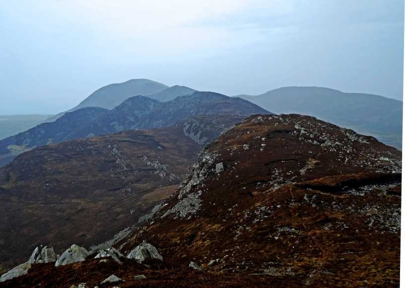
Picture: View from summit to NE, Raghtin More in distance
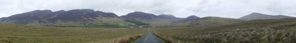
The most straightforward approach is to park at A (C319 432) starA (there is also more parking at the religious grotto 100m up the road) and proceed up the substantial track. This winds its way as far as B (C317 429) starB where it diminishes, but continues as a much narrower, occasionally muddy trail that will take you to Croaghcarragh. The trail continues to the SW in an up-down fashion, occasionally over rugged, rocky ground, taking you to Urris after about 1.5km. The top is marked by a large cairn and affords fine views of Lough Fad and Crunlough below and Lough Swilly to the west.
I took this photo on my way from Buncrana to the Gap of Mamore. Left to right: Urris Hills; Croaghcarragh; above the forestry is the Gap of Mamore; Mamore Hill; Crockmain; Raghtin More. In the foreground right is Aghaweel Hill, and finally Bulbin. Linkback: mountainviews.ie/summit/752/comment/15013/
Read Less
Read More
Picture: Stunning scenery no matter which direction you look.
Magnificence Beyond Its Height
by Aidy
28 Mar 2017
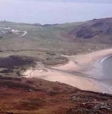
I've had the group of hills around here on my list for a while, as it looks spectacular from other mountains, or from nearby along the coast, and it doesn't disappoint when you actually get up there. Urris Hills may not be very high, but it is brilliantly rugged and rocky with some very steep slopes, and there are several minor tops around it, hence the "hills" plural I suppose. I approached from the Mamore Gap via Croaghcarragh and some of the slopes, particularly the last stretch up to the summit area, were very steep. Coming down, the wet ground would often dangerously give way under my boots. In snow or wetter conditions I imagine it could be difficult. The views, both near over the immediate mini range, and far over Inishowen, Lough Swilly and Fanad are the equal of anywhere in the country I think. It would no doubt be worth varying the route to come up on the far side from Lenan beach maybe to take in the loughs, but according to some signs, the route was closed on the day I visited. Highly recommended, and more challenging than you would think for its height. Linkback: mountainviews.ie/summit/752/comment/18867/
Read Less
Read More
NICKY on Urris Hills
by NICKY
20 Feb 2008
From Croaghcarrragh (C (C316 428)) all you do is simply follow the path over to the Urris Hills. This is a pleasant stroll with a few ups and downs with no difficulty. From the Urris keep following the path over the rest of the ridge. If you lose the path at any point the ground is not too difficult. Please make sure you follow the ridge right to the end. If you come down too early you will give yourself a harder descent with awkward fences and difficult ground. As you start to descend you should see Crummie's Bay straight ahead of you. As you keep going you should aim to come down in-line with the right hand side of the beach. If you have taken the correct path you should come to the beach through a large gap in the fence. Then simply walk over the beach to the path on the left hand side just past the two streams which come down to meet the sea and follow it up to the layby. All in all it is an excellent walk in which you climb every metre of the hills and have a very rewarding descent!! (Although the photo isn't great it shows the exact line of your descent and you should be able to make out the rest of your route from it when you set it as a background or make it bigger) Linkback: mountainviews.ie/summit/752/comment/2971/
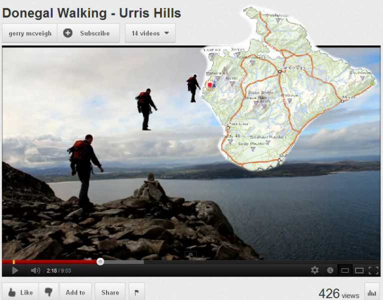
Published by MV's Gerry McVeigh this beautiful and instructive video is described on YouTube as: "A stunning walk over the Urris Hills and Raghtin More on Inishowen, Donegal, Ireland. Climbing from the golden sands of Lenan Strand to the hills overlooking Lough Swilly and the northernmost reaches of Ireland. Dropping to Mamore Gap and the holy well & grotto then climbing to the heights of Raghtin More. A mini mountain range that can be easily walked in a day." If you have any notion of walking this way you really must watch this video. And if you can't or won't walk, you should watch it anyway!!
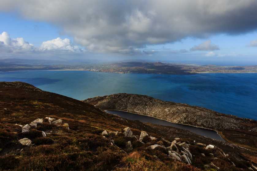
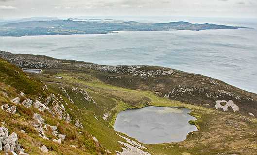
Approaching Urris Hills top you will see these two small lakes, Crunlough the nearer and Lough Fad. Across a very windy Lough Swilly sea-inlet there's Fanad Head and the further complex inlets of the north Donegal coast. Just visible around quarter way in from the left and near the horizon is the scarp and sharp drop into the sea of Horn Head. Linkback: mountainviews.ie/summit/752/comment/3195/
Use of MountainViews is governed by conditions and a privacy policy.
Read general information about the site. Opinions in material here are not necessarily endorsed by MountainViews.
Hillwalking is a risk sport. Information in comments, walks, shared GPS tracks or about starting places may
not be accurate for example as regards safety or access permission. You are responsible for your safety and your permission to walk.
See the credits and list definitions.


 Our Facebook page.