Members and Supporters, the MountainViews Committee requests your help to meet the costs of the website and of other activities such as insured events or publications.
Feature count in area: 29, all in Kerry,
OSI/LPS Maps: 78, EW-KNP, EW-R
Highest Place: Carrauntoohil 1038.6m
Starting Places (19) in area MacGillycuddy's Reeks: Ballaghbeama Gap, Bridia Valley End, Cronins Yard, Gap of Dunloe Head of, Gap of Dunloe Kate K, Glashaknockbrassel Stream, Glasheenoultagh Stream, Hydro Road CP, Knocknsallagh Bridge, Lisleibane Trail Head, Lough Acoose North, Lough Acoose West, Lough Cappanlea OEC, Lough Caragh SW, Lough Fada N, Lough Reagh N, Maghanlawaun Bridia Valley, Shamrock Farmhouse B&B, Tomies Lough Leane NW
Summits & other features in area MacGillycuddy's Reeks: Cen: Reeks West: Beenkeragh 1008.2m, Caher 1000m, Caher West Top 973.4m, Carrauntoohil 1038.6m, Cnoc Íochtair 746.3m, Hag's Tooth 662m, Knockbrinnea East Top 845.4m, Knockbrinnea West Top 852.2m, The Bones Peak 956.5m, Skregmore 847.7m, Stumpa Bharr na hAbhann 852.1m E: Cnoc an Bhráca: Cnoc an Bhráca 728m, Cnoc na dTarbh 655m, Strickeen 440m N: Reeks North: Knockbrack 425m, Knocknabrone Hill 353m, Skregbeg 573m NW: Gortnagan: Gortnagan Beg 298m SE: Reeks East: Brassel Mountain 575m, Cnoc an Chuillinn 954.6m, Cnoc an Chuillinn East Top 922.9m, Knocknapeasta 985.1m, Cnoc na Toinne 844.1m, Cruach Mhór 930.8m, Maolán Buí 968.9m, The Big Gun 939.9m SW: Bridia: Beann Bhán 459.5m, Beendarrig 449.7m, Beann Dubh 450.5m
Note: this list of places may include island features such as summits, but not
islands as such.
Knockbrack, 425mHill Gulba Mór A name in Irish,
Place Rating ..
, Kerry County in Munster province, in Carn Lists, Knockbrack is the 831st highest place in Ireland.
Grid Reference V80186 88102,
OS 1:50k mapsheet 78 Place visited by: 26members, recently by: annem, Grumbler, John.geary, chelman7, eamonoc, Fergalh, bryanmccabe, flynnke, Deise-Man, ciarraioch, scapania, Wilderness, Wildrover, Martinpeak, melohara
I visited this place: NO (You need to be a logged-in member for this.)
Picture: Knockbrack and the lower Cloghfaunaglibbaun from above Lisleibane
jackill on Knockbrack
by jackill
5 Apr 2010
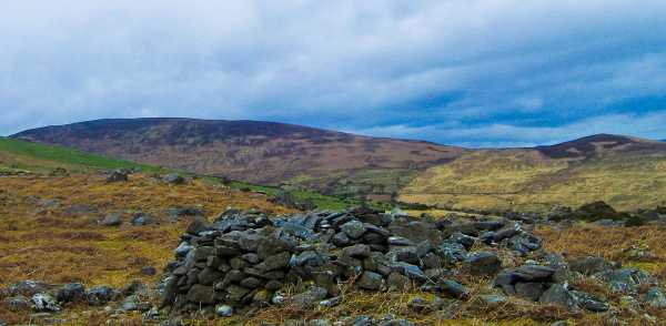
Knockbrack was the last stop on the way back to Lisleibane reached from the flat col after Skegbeg.Brown, flat and boggy, dwarfed by the mighty Skegmore.A long 3kms at the end of a long day back to the carpark skirting the cultivated fields occasionally picking up boggy tracks. Linkback: mountainviews.ie/summit/717/comment/4587/
Use of MountainViews is governed by conditions and a privacy policy.
Read general information about the site. Opinions in material here are not necessarily endorsed by MountainViews.
Hillwalking is a risk sport. Information in comments, walks, shared GPS tracks or about starting places may
not be accurate for example as regards safety or access permission. You are responsible for your safety and your permission to walk.
See the credits and list definitions.


 Our Facebook page.