Members and Supporters, the MountainViews Committee requests your help to meet the costs of the website and of other activities such as insured events or publications.
Feature count in area: 24, by county: Kerry: 12, Cork: 14, of which 2 are in both Cork and Kerry,
OSI/LPS Maps: 79
Highest Place: The Paps East 694m
Starting Places (28) in area Derrynasaggart: Carrigallisy, Clonee, Dromiscane Castle, Fuhiry Wood, Garrane Bridge, Garries Bridge, Glannafreaghaun Lough N, Glannafreaghaun Lough S1, Glannafreaghaun Lough S2, Gortavehy Lough, Grousemount Wind Farm, Inchamore Woods N, Inchamore Woods W, Kippagh Lough, Knocknabro Wood, Knockullane, Liam Hegarty Monument, Loo River Junction, Lough Murtagh, Millstreet, Mullaghanish Transmitter Gate, Old Rail Level Crossing, Paps Walk S, River Roughty, Rossacroo na Loo Forest, Sillahertane Stream, The Mills Inn, Top of Coom
Summits & other features in area Derrynasaggart: Cen: Knocknabro: Knocknabro East Top 530m, Knocknabro NE Top 535m, Knocknabro West Top 592m, Knocknagowan 574m N: Caherbarnagh: Caherbarnagh 681m, Caherbarnagh East Top 549m, Caherbarnagh NW Top 668m, Claragh Mountain 452m, Curracahill 478m SE: Mullaghanish: Ballyvouskill 401m, Knockacommeen 426m, Knockullane 462m, Knockullane East Top 408m, Mullaghanish 649m, Mullaghanish North-East Top 586.4m, Mullaghanish Far North-East Top 558.5m SW: Coomagearlahy: Knockbwee 461m, Cummeenboy 442m, Coomagearlahy 506m, Coomagearlahy West Top 462m, Dereenaculling 303m W: The Paps: Coolcurtoga 425m, The Paps East 694m, The Paps West 690m
Note: this list of places may include island features such as summits, but not
islands as such.
Cummeenboy, 442mHill An Coimín Buí A name in Irish,
Place Rating ..
Ir. An Coimín Buí [logainm.ie], 'the yellow commonage’, Cork County in Munster province, in Carn Lists, An Coimín Buí is the 764th highest place in Ireland. An Coimín Buí is the most southerly summit in the Derrynasaggart area.
Grid Reference W11653 74386,
OS 1:50k mapsheet 79 Place visited by: 20members, recently by: Colin Murphy, Wilderness, John.geary, markmjcampion, chelman7, Wildrover, Daingean, CaminoPat, Fergalh, Aongus, ciarraioch, eamonoc, frankmc04, simoburn, thomas_g
I visited this place: NO (You need to be a logged-in member for this.)
Longitude: -9.284408, Latitude: 51.915112, Easting: 111653, Northing: 74386,
Prominence: 67m, Isolation: 3km ITM: 511640 574443 Bedrock type: Green-grey sandstone & purple siltstone, (Gun Point Formation) Notes on name: Cummeenboy is the first peak to the north of the pass known as Top of Coom. It is in the Cúil Aodha Gaeltacht.
Short or GPS IDs, 6 char: Cmnby, 10 char: Cummeenboy Linkback: https://mountainviews.ie/summit/646/
Gallery for Cummeenboy (An Coimín Buí) and surrounds
Summary
for Cummeenboy (An Coimín Buí):
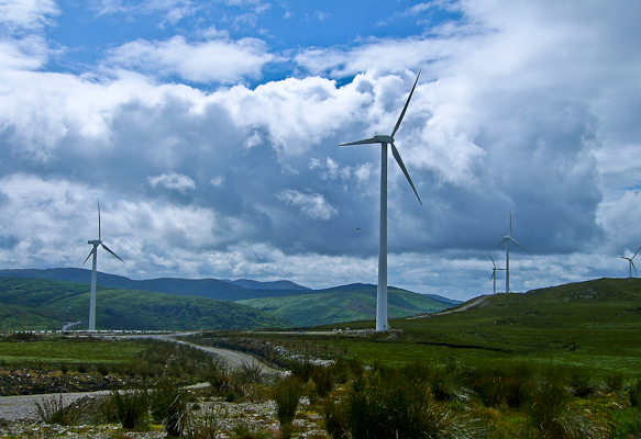
Tilting at windmills
Summary created by jackill
2010-08-06 17:13:40
You can park at the wide entrance to the windfarm at A (W10616 73267).
Climb over the double gates and walk uphill on a good track until you come to a second set of gates.
Go through these passing turf cuttings and look for the sign for windmill three.
Go up the track to windmill three B (W11317 73889) and climb the bank to your left.
Pick up a boggy track leading roughly north east which will bring you close to a wire fence heading
north.
Cross the fence and skirt the forest edge to the unmarked summit.
Note this area was very wet in July.
Picture: Looking towards Coomataggart on the left and Knockboy behind
Did I mention its wet?
by jackill
17 Jul 2010
Theres a lot to be said for windmills. Clean, green energy machines harvesting power from boggy hills for the next quarter century, not to mention nice gravel roads.
Buried to my bogged knees on Esknabrock and then powerhosed clean on Knockbwee, I arrived at A (W10616 73267), hopped a gate and walked to windmill 3 at B (W11317 73889) on a very lovely gravel road.
A 10 minute swim brought me to the summit and vistas of a vast wetness across to the Paps and back towards Gougane Barra. Linkback: mountainviews.ie/summit/646/comment/5952/
Read Less
Read More
Still wet - bring gaiters
by thomas_g
26 Jul 2013
Even after the massive dry spell we've had, it was still wet on the way from the turbine to the top. I met the farmer who was heading off with the horse and cart to draw in the turf, he's a lovely gent who seems bemused by people coming here walking. Linkback: mountainviews.ie/summit/646/comment/15050/
Read Less
Read More
Enjoy the gravel access road before the bog!
by three5four0
4 Oct 2011
Followed Jackill's route out to Windmill 3 then across soft ground to the forestry boundary, following this round, then struck out across the heather to the kidney shaped contour ring of the summit area. The summit being just out sided the spot height but being within the margin of error, for a 1:50000 map.
There were lots of people around the wind farm on my visit. All waved to me as I passed, including a large group collecting peat and loading it onto their trailers. Linkback: mountainviews.ie/summit/646/comment/6570/
Use of MountainViews is governed by conditions and a privacy policy.
Read general information about the site. Opinions in material here are not necessarily endorsed by MountainViews.
Hillwalking is a risk sport. Information in comments, walks, shared GPS tracks or about starting places may
not be accurate for example as regards safety or access permission. You are responsible for your safety and your permission to walk.
See the credits and list definitions.


 Our Facebook page.