Members and Supporters, the MountainViews Committee requests your help to meet the costs of the website and of other activities such as insured events or publications.
Feature count in area: 12, by county: Offaly: 8, Laois: 5, of which 1 is in both Laois and Offaly,
OSI/LPS Maps: 54
Highest Place: Arderin 527m
Starting Places (1) in area Slieve Bloom: General's Road
Summits & other features in area Slieve Bloom: Cen: Wolftrap Mountain: Carroll's Hill 482m, Castleconor 407m, Stillbrook Hill 514m, Wolftrap Mountain 487m E: Capard: Baunreaghcong 508.2m, Ridge of Capard 482.1m S: Arderin: Arderin 527m, Barcam 484m, Farbreague 430m, Garraunbaun 406m W: Kinnitty: Cumber Hill 316m, Knocknaman 337m
Note: this list of places may include island features such as summits, but not
islands as such.
Barcam, 484mHill An Barr Cam A name in Irish,
Place Rating ..
, Offaly County in Leinster province, in Carn Lists, Barcam is the 617th highest place in Ireland.
Grid Reference N22793 00056,
OS 1:50k mapsheet 54 Place visited by: 87members, recently by: Arcticaurora, childminder05, finkey86, Wilderness, paulbrown, TippHiker, markwallace, Taisce, chelman7, John.geary, Colin Murphy, Bunsen7, abcd, Carolyn105, GoldCircle
I visited this place: NO (You need to be a logged-in member for this.)
Short or GPS IDs, 6 char: Barcam, 10 char: Barcam Linkback: https://mountainviews.ie/summit/504/
Gallery for Barcam (An Barr Cam) and surrounds
Summary
for Barcam (An Barr Cam):
The least amount of bog crossing has its merits
Summary created by jackill
2012-07-30 08:06:22
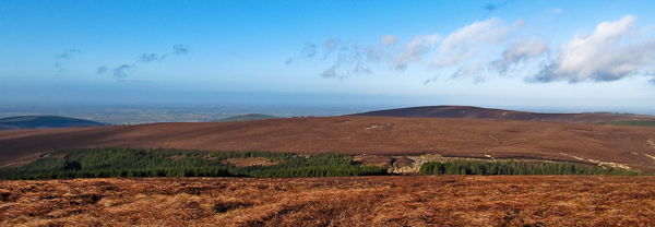
Picture: Barcam as viewed from Arderin
Park in the car park at A (S231 996) just on the county bounds, room for 10 cars.Cross the road and head north uphill following a faint track. The road up from the Mountrath side has a very good surface however the road down the western side is rutted and collapsed in sections.
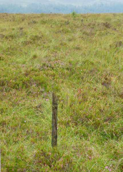
Picture: The so-called summit of Barcam and view over to Arderin
csd on Barcam
by csd
1 Jul 2007
This one's really quite easy to get to. If you park at Glendine Gap it's less than 500 metres over to the summit. A boggy sheep track brings you to within 200 m of the summit. The trickiest bit will be deciding that you've actually reached anything that could be called a summit. Barcam's top is similar to Arderin or Stillbrook Hill: very difficult to find! I selected the only feature of note in the vicinity of the summit: a lone pole protruding from the bog. Some nice views of Arderin, Stillbrook, and Lough Derg and the Shannon to the west. Those wanting a bit more of a challenge could approach from the forest track, which turns off the Glendine road at B (S213 992). Linkback: mountainviews.ie/summit/504/comment/2760/
Read Less
Read More
madfrankie on Barcam
by madfrankie
30 Mar 2009
If you want to get a sense of what an ascent of Barcam is like, here are is the data from my GPS, following our 'climb' from the road to the south: Time - 18 minutes. Distance - 0.93 kilometers. Ascent - 16 meters. Linkback: mountainviews.ie/summit/504/comment/3688/
Read Less
Read More
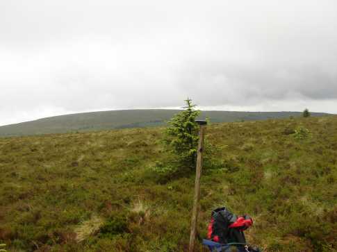
Picture: The summit 'stick'
Blooming awful
by Colin Murphy
3 Sep 2021
Simple to reach, but the last 100m when you leave the faint track is a leg-wearying trudge through knee-high heather over uneven ground. Featureless summit and utterly drab. The nearest thing to a summit marker is a stick someone jammed into the turf. The Slieve Blooms aren't the most dramatic hills by any means, and Barcam is probably the most uninspiring. One for the baggers. Linkback: mountainviews.ie/summit/504/comment/23257/
Read Less
Read More
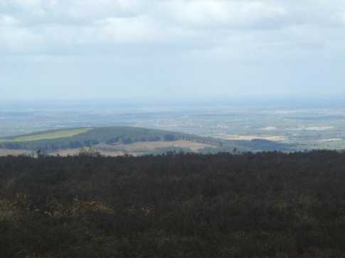
Picture: The view from Barcam looking towards Offaly and the Shannon (Knocknaman in foreground)
peterturner on Barcam
by peterturner
23 Mar 2008
Barcam is a little more challenging at the end of a traverse along the Laois / Offaly border from Wolftrap and the views on the day I climbed were expansive. For beak-baggers it is possible to head out from the SBW near Castleconor and do Stillbrook Hill, Carrolls Hill and Barcam returning via the SBW or for those really getting on with peak-bagging you can start at Wolftrap and just follow the traverse along the Laois/Offaly border all the way off Garraunbaun mountain (two cars needed) Linkback: mountainviews.ie/summit/504/comment/3011/
Read Less
Read More
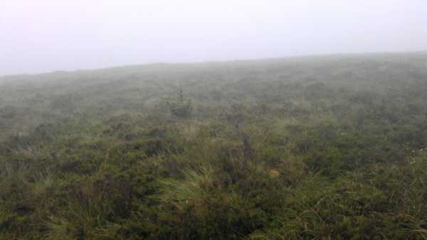
Picture: Lonesome pine in the mist on Barcam
Mist in Slieve Bloom region
by tmsr
8 Jul 2012
Very heavy mist came in as we climbed Barcam. We'd parked at the car park across the road at the JI Fanning Pass. Unfortunately the faint track has been flooded and very boggy ground made it very difficult to day. Having tracked sideways to see decent footing, we then got lost in mist ( GPS was all over the place with low cloud) and ended up coming back through the forest paths down to the safety but distant car park up from Tulla and Crumlin. Saw the pole referred to in summit area, but took picture of some of the lonesome pines growing in the heather.
Wouldn't recommend it as a climb! Linkback: mountainviews.ie/summit/504/comment/14712/
Use of MountainViews is governed by conditions and a privacy policy.
Read general information about the site. Opinions in material here are not necessarily endorsed by MountainViews.
Hillwalking is a risk sport. Information in comments, walks, shared GPS tracks or about starting places may
not be accurate for example as regards safety or access permission. You are responsible for your safety and your permission to walk.
See the credits and list definitions.


 Our Facebook page.