Welcome to MountainViews
If you want to use the website often please enrol (quick and free) at top right.
If you want to use the website often please enrol (quick and free) at top right.
Overview

For more map options click on any overview map area or any detail map feature.
Detail Map Features
Find Suggested Walks
Find hill, mountain, island, coastal feature.
Videos
Recent Contributions
 Get Notifications
Get Notifications
Carricktriss Gorse: Safe access to this hill no longer seems possible
 TommyMc
Binnion: Tullagh Bay and Rockstown Harbour
 Jim_Brady
Donations Drive, now finished.
Good, relatively easy double bag
 Colin Murphy
Crocknapeast: Long walk up windfarm roads.
 Collaborative entry
Mulnanaff: Longish walk up windfarm road.
 Collaborative entry
Lake District: Dale Head Horseshoe
Double bag mostly on windfarm tracks.
 Colin Murphy
Binbane NE Top: Simple bag from its neighbouring top.
 Collaborative entry
Lake District: Coledale Horseshoe
Binbane: Steepish approach to relatively easy Carn.
 Collaborative entry
Crucknaree: Magnificent views!
 paddyhillsbagger
Conditions and Info
Use of MountainViews is governed by conditions and a privacy policy.
Read general information about the site.
Opinions in material here are not necessarily endorsed by MountainViews.
Hillwalking is a risk sport. Information in comments, walks, shared GPS tracks or about starting places may not be accurate for example as regards safety or access permission. You are responsible for your safety and your permission to walk.
See the credits and list definitions.
 Visit our Facebook page.
Video display
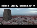
Donegal Islands
Area
Place count in area: 60,
OSI/LPS Maps: 1, 10, 11, 12, 13, 2, 3, 6, 7
Highest place: Gull Island, 95m
Places in area Donegal Islands:
Allagh Island 8mAn Bhuidéal 45mAn tOileán leathan 20mBo Island 13mCalf Island (1) 5mCruit Island 32mEdernishree 11mEdernish 11mEighter Island 24mFall Island 11mGola Island 68mGarvan Isles Green Isle 16mGarvan Isles Middle Isle 5mGarvan Isles White Isle 5mGlashedy Island 35mGo Island 5mGull Island 95mIllanarva 5mIllancarragh 20mIllancrone SE 5mIllannanaff 11mIllanngall 23mIniscoo 15mInishal 6mInishbarnog 16mInishbeg 22mInishbofin (1) 33mInishcoole 13mInishdooey 38mInishduff 22mInisheane 5mInishfree Lower 25mInishfree Upper 14mInishillintry 21mInishinny (1) 27mInishinny (2) 16mInishkeel 19mInishkeeragh (1) 6mInishmeal 5mInishmeane 33mInishsirrer 23mInishtrahull 49mIsland Reagh 12mIsland Roy 15mMullaghtan 10mDuck Island (1) 5mRathlin O'Birne Island 26mRoaninish 9mRutland Island 20mTor Beg 5mTorglass 25mTor More 35mToralayden 84mTorhonadoogha 20mTornacolpagh Island 21mTory Island 83mTramore Point 5mTullyillan 11mTullavane Island 5mUmfin Island 42m
Note: this list of places includes island features such as summits, but not islands as such.
Highest place:
Gull Island, 95mPlaces in area Donegal Islands:
Allagh Island 8mAn Bhuidéal 45mAn tOileán leathan 20mBo Island 13mCalf Island (1) 5mCruit Island 32mEdernishree 11mEdernish 11mEighter Island 24mFall Island 11mGola Island 68mGarvan Isles Green Isle 16mGarvan Isles Middle Isle 5mGarvan Isles White Isle 5mGlashedy Island 35mGo Island 5mGull Island 95mIllanarva 5mIllancarragh 20mIllancrone SE 5mIllannanaff 11mIllanngall 23mIniscoo 15mInishal 6mInishbarnog 16mInishbeg 22mInishbofin (1) 33mInishcoole 13mInishdooey 38mInishduff 22mInisheane 5mInishfree Lower 25mInishfree Upper 14mInishillintry 21mInishinny (1) 27mInishinny (2) 16mInishkeel 19mInishkeeragh (1) 6mInishmeal 5mInishmeane 33mInishsirrer 23mInishtrahull 49mIsland Reagh 12mIsland Roy 15mMullaghtan 10mDuck Island (1) 5mRathlin O'Birne Island 26mRoaninish 9mRutland Island 20mTor Beg 5mTorglass 25mTor More 35mToralayden 84mTorhonadoogha 20mTornacolpagh Island 21mTory Island 83mTramore Point 5mTullyillan 11mTullavane Island 5mUmfin Island 42mNote: this list of places includes island features such as summits, but not islands as such.

Landing grid ref.: B71000 17600
Reachable "On Foot " N
Linkback: https://mountainviews.ie/island/2040/
COMMENTS for Fall Island 1 of 1  Follow this place's comments

|
|
|
|
||
| MountainViews.ie, a Hill-walking Website for the island of Ireland. 2400 Summiteers, 1480 Contributors, maintainer of lists: Arderins, Vandeleur-Lynams, Highest Hundred, County Highpoints etc | |||