Members and Supporters, the MountainViews Committee requests your help to meet the costs of the website and of other activities such as insured events or publications.
MacGillycuddy's ReeksArea, E: Cnoc an Bhráca
Subarea
Feature count in area: 29, all in Kerry,
OSI/LPS Maps: 78, EW-KNP, EW-R
Highest Place: Carrauntoohil 1038.6m
Starting Places (19) in area MacGillycuddy's Reeks: Ballaghbeama Gap, Bridia Valley End, Cronins Yard, Gap of Dunloe Head of, Gap of Dunloe Kate K, Glashaknockbrassel Stream, Glasheenoultagh Stream, Hydro Road CP, Knocknsallagh Bridge, Lisleibane Trail Head, Lough Acoose North, Lough Acoose West, Lough Cappanlea OEC, Lough Caragh SW, Lough Fada N, Lough Reagh N, Maghanlawaun Bridia Valley, Shamrock Farmhouse B&B, Tomies Lough Leane NW
Summits & other features in area MacGillycuddy's Reeks: Cen: Reeks West: Beenkeragh 1008.2m, Caher 1000m, Caher West Top 973.4m, Carrauntoohil 1038.6m, Cnoc Íochtair 746.3m, Hag's Tooth 662m, Knockbrinnea East Top 845.4m, Knockbrinnea West Top 852.2m, The Bones Peak 956.5m, Skregmore 847.7m, Stumpa Bharr na hAbhann 852.1m E: Cnoc an Bhráca: Cnoc an Bhráca 728m, Cnoc na dTarbh 655m, Strickeen 440m N: Reeks North: Knockbrack 425m, Knocknabrone Hill 353m, Skregbeg 573m NW: Gortnagan: Gortnagan Beg 298m SE: Reeks East: Brassel Mountain 575m, Cnoc an Chuillinn 954.6m, Cnoc an Chuillinn East Top 922.9m, Knocknapeasta 985.1m, Cnoc na Toinne 844.1m, Cruach Mhór 930.8m, Maolán Buí 968.9m, The Big Gun 939.9m SW: Bridia: Beann Bhán 459.5m, Beendarrig 449.7m, Beann Dubh 450.5m
Note: this list of places may include island features such as summits, but not
islands as such.
Cnoc na dTarbh, 655mMountain
Place Rating ..
(Ir. Cnoc na dTarbh [OSI 1:25,000], 'hill of the bulls')Srón an extra name in Irish, Kerry County in Munster province, in Arderin, Vandeleur-Lynam Lists, Cnoc na dTarbh is the 187th highest place in Ireland. Cnoc na dTarbh is the second most easterly summit in the MacGillycuddy's Reeks area.
Grid Reference V86237 84995,
OS 1:50k mapsheet 78 Place visited by: 219members, recently by: kieran117, rhw, maoris, ToughSoles, Krzysztof_K, therealcrow, Ansarlodge, bagoff, farmerjoe, noelcurt, abcd, childminder05, Moses, johncusack, John.geary
I visited this place: NO (You need to be a logged-in member for this.)
Longitude: -9.657359, Latitude: 52.005839, Easting: 86237, Northing: 84995,
Prominence: 60m, Isolation: 0.6km ITM: 486215 585054 Bedrock type: Well-bedded grey sandstone, (Lough Acoose Sandstone Formation) Notes on name: Ó Cíobháin also gives the alternative name Srón, 'nose'.
Short or GPS IDs, 6 char: CncndT, 10 char: CncndTrbh Linkback: https://mountainviews.ie/summit/179/
Gallery for Cnoc na dTarbh and surrounds
Summary
for Cnoc na dTarbh :
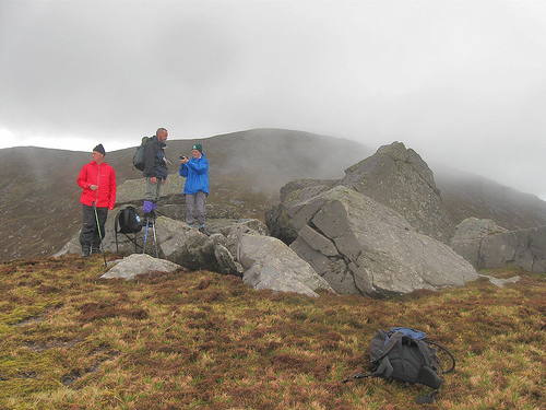
Heathery boulder topped peak at the SE corner of the Reeks.
Summary created by simon3
2015-05-04 10:20:55
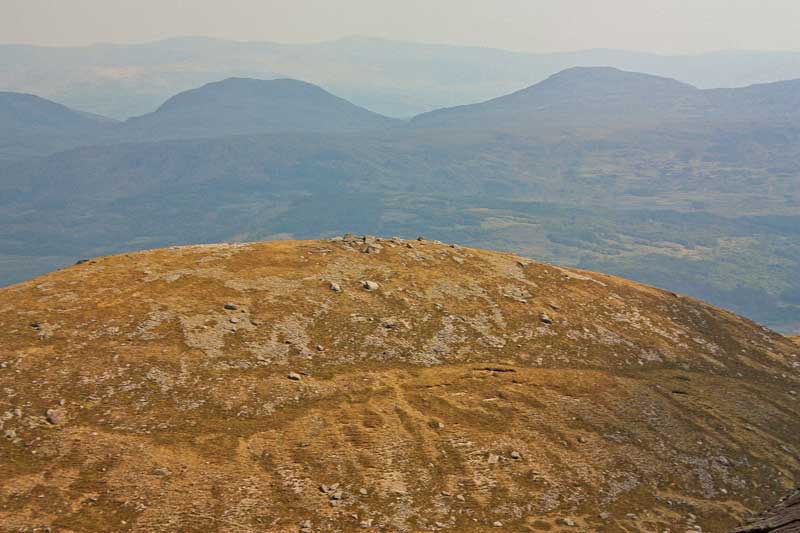
Picture: Cnoc na dTarbh from the NW
This a summit whose highest point is one of a number of large boulders. In their immediate vicinity there are fine views of Purple Mountain, much of the Reeks and from east of here are views into the Gap of Dunloe.
It can be reached from the south at the head of the Gap of Dunloe around A (V870 833). Be careful to pick a good route for ascent and particularly descent amongst the cliffs here. An intermediate spur on this route is marked Drishana on the OS 1:50000.
It can also be easily reached from Cnoc an Bhráca which in turn can be reached from the track ascending from B (V877 883) south of Kate Kearney's Cottage, Gap of Dunloe.
Please note. Descending from this summit is not possible in a number of places to the east.
Approaching from the south, Cnoc na dTarbh is the first rung on the ladder that leads to the eastern ridge of the Reeks.
We parked on the Gap of Dunloe road, south of the rocky knoll Drishana. A straightforward ascent over heathery slopes brought us up onto the ridge between Drishana and Cnoc Na dTarbh. Large boulders crown the summit, and it's not a bad place to take the first breather of the day. Linkback: mountainviews.ie/summit/179/comment/3784/
Read Less
Read More
mart on Cnoc na dTarbh
by mart
1 Feb 2006
This summit appears as an extra to Cnoc an Bhraca so the same access applies
We approached from Kate Kearney's. climbing a trrack up the side of Strickeen mountain, which petered out leaving us with more than a mile of bog to cross. It was January so it was half-frozen but this area is a big disincentive. The summit is rounded with a scattering of large boulders. Descent to the E is very dange . Go S over the lower summit of Drishana and then down by following a fence down to the head of the gap. Linkback: mountainviews.ie/summit/179/comment/2163/
Read Less
Read More
Cnoc na dTarbh from Gap Cottage
by Conor74
24 May 2010
Car park at the Head of the Gap full, so went down into the Gap about half a mile and parked on the left hand side near the Gap Cottage. Pushed through the rhodos and trees behind the cottage, and came to the stream that winds down the south east side of Cnoc na dTarbh. Follwed this stream for an hour or so, almost up to the ridge between Drishana and the summit. All fairly easy, though baking sun didn't help. At the ridge turned north east and it was a quick 10 min jaunt to the summit. Good route, enables a quick ascent, no fences or obstacles after first minute or two behind the cottage itself. Went on around the Big Gun and along Reeks from there. Linkback: mountainviews.ie/summit/179/comment/5823/
Read Less
Read More
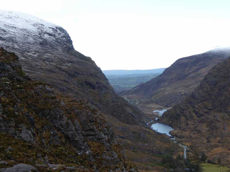
Picture: Looking North into the Gap
Grabbing the Bull...
by peter1
11 Jan 2016
Nice easy ascent from the road south of the Gap, as mentioned by others. Three hours
up and down, lunch and photos included. Lots of snow on the upper slopes. Linkback: mountainviews.ie/summit/179/comment/18420/
Read Less
Read More
paulocon on Cnoc na dTarbh
by paulocon
20 Feb 2010
Straightforward walk from Cnoc an Bhraca to the boulder covered summit for my last top of the day. I presume the mountain dereives its name from the unusual rock formation at the top which vaguely resembles the horns of a bull. Descended to the west (Black Valley side) of Drishana on the advice of a very helpful walker I had met on Tomies earlier in the day and indeed the terrain proved easy taking this route. This left a short walk back to the Head of the Gap. Linkback: mountainviews.ie/summit/179/comment/4413/
Use of MountainViews is governed by conditions and a privacy policy.
Read general information about the site. Opinions in material here are not necessarily endorsed by MountainViews.
Hillwalking is a risk sport. Information in comments, walks, shared GPS tracks or about starting places may
not be accurate for example as regards safety or access permission. You are responsible for your safety and your permission to walk.
See the credits and list definitions.


 Our Facebook page.