Donation Request 2024

DONATE
Members and Supporters, the MountainViews Committee requests your help to meet the costs of the website and of other activities such as insured events or publications.
You do not have to be logged in to donate.
Features
Nearby features appear when you click the map.
Declutter tracks on map.
Place Search
Video
X
Pub: by
Dunkerron Mountains Area , Cen: An Bheann Mhór Subarea
Feature count in area: 65, all in Kerry, OSI/LPS Maps: 78, 83, 84, 85, EW-KNP, EW-R
Highest Place: Stumpa Dúloigh 784m

Starting Places (66) in area Dunkerron Mountains:
Ballaghasheen Coilte, Ballaghasheen Pass Viewpoint, Ballaghbeama Gap, Bohacullia, Bridia Valley End, Cahersavane Road, Cahersavane Schoolhouse, Cloon Lough NE, Cloon Lough SE, Coad Cemetery, Coad Road End, Com an Chiste, Coomaclarig Bridge, Coomnahorna River, Coomyanna Bridge, Dereenavurrig, Derreendarragh Church, Derrynane Quay, Dunkerron Mid, Eagles Lough Access Trailhead, Esknaloughoge Forest Trailhead, Fermoyle Farm, Foot Stick Ford Road, Gap of Dunloe Head of, Glashaknockbrassel Stream, Glasheenoultagh Stream, Gortaclohane Lane End, Gortaclohane Lane NE Branch, Gortagowan Wood, Gowlane School Ruin, Gowlanes Wood, Graces Landing, Inchimore West, Isknagahinney Lough E, Kenmare Bridge, Knockanamadane, Knockanaskill N, Knocknasullig, Knocknsallagh Bridge, Laghtacallow, Lissatinnig Bridge Boreen, Looscaunagh Lough W, Lough Barfinnihy CP, Lough Brin S, Lough Coomeen SE, Lough Dromtine NE, Lough Dromtine SE, Lough Fada N, Lough Iskanamacteery N, Lough Iskanamacteery NW, Lough Reagh N, Maghanlawaun Bridia Valley, Molls Gap, Ochtiabh Road, Poulacapple, River Owroe Source, River Sneem Fermoyle Loop, Rossacoosane Mid, Sahaleen Bridge, Scarriff Island, Shamrock Farmhouse B&B, Sneem, Tooreenboy Lough, Tooreennafersha Mid, Tooreennafersha South, Waterville Promenade

Summits & other features in area Dunkerron Mountains:
Knocknagantee Near West Top 628m
Cen: An Bheann Mhór: An Bheann Mhór 674.7m, An Bhinn Láir 514m, Coomcallee 648.9m, Beann na Stiocairí 673.1m, Coomnahorna 590m, Glanbeg 485.8m, Slievenashaska 578m, Slievenashaska South Top 565.4m
Cen: Knocknagantee: Knockmoyle 682.1m, Finnararagh 667m, Cnoc Breasail 591m, Knocknagantee 674.3m, Knocknagantee West Top 553m, Coomnacronia 636m, Coomura Mountain 666m
Cen: Mullaghanattin: An Cnoc Riabhach 534m, Beann 752m, Beann Far SW Top 636.2m, Beann NE Top 692m, Beann South Top 639m, Beann SW Top 657m, Sallagh 570m, Mullaghanattin 773m, Mullaghanattin East Top 594m, Sallagh South-West Top 543m
E: Kenmare: Gortamullin 205m, Knockanaskill 356m, Letter South 362m
N: Knocknacusha: Knocknacusha 547m
NE: Knocknabreeda Ridge: Crossderry 489m, Knocknabreeda 569m, Mothaillín 506m
NE: Knocknagapple: Bascadh 595m, Bascadh West Top 569m, Boughil 631m, Cnoc na gCapall 639m, Knocklomena 641m
NE: Stumpa Dúloigh: Broaghnabinnia 745m, Knockaunanattin 569m, Knockaunanattin West Top 466.1m, Stumpa Dúloigh 784m, Stumpa Dúloigh SE Top 780m, Stumpa Dúloigh SW Top 663m
SW: Caherdaniel: Farraniaragh Mountain 468m, Eagle Hill 155m, Reenearagh 162m, Beenarourke 304m, Knocknasullig 117m, Cahernageeha Mountain 498.7m
SW: Coad ( Castle Cove ): Beenrour 418m, Eagles Hill 549m, Mullaghbeg 509m
SW: Coomduff: Coomduff 244m
SW: Deenish: Deenish Island (2) 144m
SW: Esknaloughoge: Esknaloughoge 416m, Esknaloughoge North Top 420m
SW: Scarriff: Scarriff Island 252m
SW: Sneem: An Bheann Mhór 309.3m, Dereenavurrig Hill 261m, Knockanamadane 270m, Knocknafreaghane 316.5m, Knocknagullion 413m
SW: Staigue: Staigue Top 459m, Staigue NE Top 435m

Note: this list of places may include island features such as summits, but not islands as such.
Rating graphic.
Beann na Stiocairí, 673.1m Mountain
Place Rating ..
(Ir. Beann na Stiocairí [TH], 'peak of the niggardly persons'), Kerry County in Munster province, in Arderin Beg, Vandeleur-Lynam Lists, Beann na Stiocairí is the 157th highest place in Ireland.
Grid Reference V59888 68207, OS 1:50k mapsheet 83
Place visited by: 104 members, recently by: rhw, maoris, NualaB, ToughSoles, Carolyn105, jackos, Krzysztof_K, mdehantschutter, bryanmccabe, conrad1179, chelman7, derekfanning, glencree, Beti13, Barrington1978
I visited this place: NO (You need to be a logged-in member for this.)
Longitude: -10.03403, Latitude: 51.849045, Easting: 59889, Northing: 68208, Prominence: 19.7m,  Isolation: 0.5km
ITM: 459869 568270
Bedrock type: Green sandstone & siltstone, (St. Finans Sandstone Formation)
Notes on name: Previously L. Iskanamacteery East Top in MV.
  Short or GPS IDs, 6 char: BnnStc, 10 char: BnnStcrí

Linkback: https://mountainviews.ie/summit/152/
Gallery for Beann na Stiocairí and surrounds
No summary yet for this place .
Member Comments for Beann na Stiocairí
Comment create / edit display placeholder

            MountainViews.ie picture about <em>Beann na Stiocairí</em>
Picture: Rugged southwest slopes of Beann na Stiocairì
One man and not his dog
by wicklore 11 Sep 2015
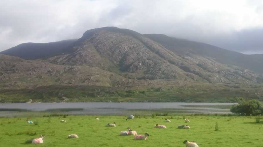
In his post on nearby Coomcallee, Skyehigh mentions the farm track in the Glenmore valley to the south. I used this to reach Beann na Stiocairì. A slow and scenic drive along several kilometres of narrow road through the valley from Waterville ends at a farm. The rough southern slopes of Beann na Stiocairì to the north can be appreciated along the road, while the equally rough and rugged slopes of the Beanrour-Mullaghbeg-Eagles Hill ridge of hills fills the views to your right.

I was readily granted permission to park in the farm by the friendly lady there. A cow and two collies in the farmyard watched me as I parked - the cow with languid interest and the collies with frantic uncontained excitement. One of the collies wasn’t tethered and decided to accompany me on my walk – all the way up the track to where it emerged onto the broad ridge at about 600m. Along the way the collie disappeared several times and I spotted it intermittently herding sheep across the slopes in my direction. It correctly interpreted that I was impressed with this private ‘’sheep dog trials’ show, and tried harder still until several sheep were paraded in front of me. A cartoon I had seen sprung to mind. Two sheep are in a field with a collie at one end and a farmer at the other. One sheep turns to the other and says ‘I’m telling ya, I might be paranoid, but these guys are definitely working together!’ Back in real life the befuddled sheep continued on their way, as did I. At the top of the track the dog took off back down the hill after more hapless sheep.

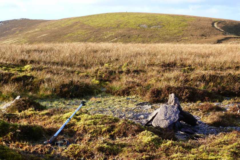
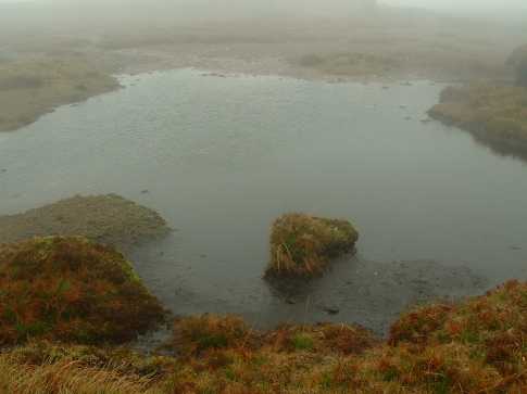
Initially the track passes through gates as it rises from the farm, and is clearly used by farm vehicles to access the lower slopes. However from around the 300m altitude mark it gets steeper and the last kilometre was tough enough make me stop for breath several times. Once onto the broad ridge it was a straightforward slog up through the bog onto Beann na Stiocairì and An Bheann Mhòr. An initial wet track through the bog on the ridge disappears after it passes through a gate but navigation was straightforward enough. The summit area does not have an obvious ‘highest point’ and as Colin Murphy said in his post, a bit of slogging around the wet boggy area will be required of the purist. The simple boggy nature of the summit of Beann na Stiocairì belies the steep rugged slopes to the north and southwest..

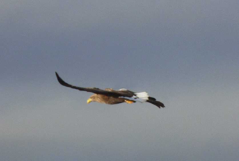
In between intermittent rain and cloud enough could be seen across the Glenmore valley of the rough slopes of Staigue, Mullaghbeg and Eagles Hill to see why White Tailed eagles have set up home in this area. I didn’t see any but could easily imagine them gliding and swooping in this remote corner of Kerry.

On my return down the mountain, the collie rejoined me and I marvelled to think that it was probably up and down the mountain several times a day, I studiously skirted some cattle on the track near the farm while the dog brazenly walked right through them! Linkback: mountainviews.ie/summit/152/comment/18310/
Read Less
Read More

            MountainViews.ie picture about <em>Beann na Stiocairí</em>
Picture: A beautiful white tailed eagle
Eagle eye view
by Colin Murphy 19 Nov 2012
See comments above Linkback: mountainviews.ie/summit/152/comment/14883/
Read Less
Read More

            MountainViews.ie picture about <em>Beann na Stiocairí</em>
Picture: Summit stones
Eagle territory
by Colin Murphy 19 Nov 2012
To complete this top or An Bheann Mhór in isolation, suggest you take the track that leads from the valley to the SW of Coomcallee - the track continues all the way to the col between Coomcallee and this top. From there it is a fairy easy climb to the west over grassy terrain. The summit itself is little to look at and I had to wander around with my GPS before I finally located the small pile of stones which seems to mark the highest point. The ordinary nature of the top was compensated however when a sheep farmer called out to me and pointed skywards, where a pair of white tailed eagles were soaring majestically. Later on spotted several more of the birds which can have an impressive wingspan of over two metres. Linkback: mountainviews.ie/summit/152/comment/14882/
Read Less
Read More

            MountainViews.ie picture about <em>Beann na Stiocairí</em>
Picture: Looking to An Bheann Mhór from Beann na Stiocairí: note colossal depression
Peter Walker on Beann na Stiocairí
by Peter Walker 16 Dec 2008
A separate top? Hmm...dubious. (Although it's positively Kilimanjaro-esque compared to Beennabrack near the Conor Pass). Coming from the east there's a steady, relentless ascent of about 100m alongside the fence, then a pretty indeterminate top: I pity skyehigh coming here when the ground wasn't frozen, as all I had to worry about was locating the highest point (accomplished by my usual method of clomping around all likely-looking hummocks and laying down on top of some of them in an elementary levelling exercise) rather than drenching myself. Anyway, the surroundings are gorgeous even if the immediate environment isn't especially dramatic. Linkback: mountainviews.ie/summit/152/comment/3479/
Read Less
Read More

            MountainViews.ie picture about <em>Beann na Stiocairí</em>
Picture: Summit area
skyehigh on Beann na Stiocairí
by skyehigh 12 Jun 2005
This must be the least deserving top featured in our lists, as the depression between this and the main top is a mere 22 metres. Any doubts as to whether we are talking about the top of a mountain or the top of a lough can be dispelled by the accompanying photograph, which shows the top to be - a lough. In fact, point 672 lies somewhere in the middle of a peaty area which the ridge fence sensibly skirts around. There is no point describing descents, as nobody in their right mind will descend north or south, but will follow the ridge. Linkback: mountainviews.ie/summit/152/comment/1746/
Read Less
Read More
EDIT Point of Interest
text
Videos


Recent Contributions
x
Conditions and Info
Use of MountainViews is governed by conditions and a privacy policy.
Read general information about the site.
Opinions in material here are not necessarily endorsed by MountainViews.
Hillwalking is a risk sport. Information in comments, walks, shared GPS tracks or about starting places may not be accurate for example as regards safety or access permission. You are responsible for your safety and your permission to walk.
See the credits and list definitions.

OSi logo
OSNI/LPS logo
Open Street Map
(Various variations used.)
British summit data courtesy:
Database of British & Irish Hills