This website uses cookies, which are small text files that the website puts on your device to facilitate operation. Cookies help us provide a better service to you. They are used to track general user traffic information and to help the website function properly.
Feature count in area: 10, all in Sligo,
OSI/LPS Maps: 16, 25
Highest Place: Dernish Island 32m
Starting Places (2) in area Sligo Islands: Queen Maeve's Grave, Rathcarrick Wood
Summits & other features in area Sligo Islands: Ardboline Island 5m, Black Rock (1) 16m, Black Rock (2) 5m, Coney Island (1) 13m, Dernish Island 32m, Horse Island (1) 5m, Inishmurray 22m, Maguins Island 5m, Oyster Island 5m, Perch Rock 2m
Note: this list of places may include island features such as summits, but not
islands as such.
Coney Island (1), 13mIsland Inis uí Mhaolchluiche (1) A name in Irish,
Place Rating ..
Inishmulclohy an extra name in English, Sligo County in Connacht province, in Irish Islands Lists Reachable "On Foot " N Grid Reference G61775 39555,
OS 1:50k mapsheet 16 Place visited by: 6members, recently by: Geo, Fergalh, rollingwave, IncaHoots, GoldCircle, DavidWalsh, Island visited by 12 members.
I visited this place: NO (You need to be a logged-in member for this.)
New York's Coney island is named after this little gem of an island
by Fergalh
25 Jun 2023
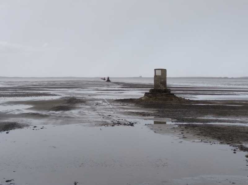
Leave the main Sligo to Strandhill road and follow the brown signs to the edge of the sea at A (G641 368). Here you make a choice either walk or drive the 2.5 km to Coney Island following the 14 pillars built in the sea bed. At the last of the pillars (14) turn right past the abandoned big house to two white pillars where the island road starts. (The tide times are vital for a safe journey a simple text to the RNLI at 51155 with the word Coney and they will SMS you the safe crossing times) The road from this point leads the heart of the village. On the island there are a few things to visit the village, St. Patrick's wishing chair and Carty's strand and the village pump. All are shown on the map in the village centre and the high point is near the Strand which is accessed via a stoney road. But after romping around the island a welcome pint in the tiny pub on the island which is situated in an Lár of the village has to be done ! Linkback: mountainviews.ie/island/2072/comment/23997/
Read Less
Read More
Intersection of three fences
by Geo
27 Jan 2024
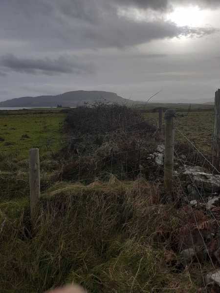
Nice little walk, I parked at Cartys strand on the island's west side. Easy walk around the northern headland stopping to make a wish at St Patrick's Chair B (G61352 39513). I made the summit to be a three way intersection of fences in a grassy field, C (G61775 39555)
This is an island well worth a visit, just remember it's accessed by a long causeway so check your tides times. Linkback: mountainviews.ie/island/2072/comment/24121/
Use of MountainViews is governed by conditions and a privacy policy.
Read general information about the site. Opinions in material here are not necessarily endorsed by MountainViews.
Hillwalking is a risk sport. Information in comments, walks, shared GPS tracks or about starting places may
not be accurate for example as regards safety or access permission. You are responsible for your safety and your permission to walk.
See the credits and list definitions.


 Our Facebook page.