Guestuser: Login or enrol?
- Home
- Main Display
- Main Display (Old)
- Find a Walk
- Display INTRODUCTION
- DONATE
- Click below for your
profile & contributions
guestuser- New
- Tracks, Walks
- Challenge
- Community
- Lists & Logs
- Popular Lists:
- County Highpoints
- Range & Area Highpoints
- Local 100
- Highest Hundred
- Vandeleur-Lynams
- Arderins
- Carns
- Best rated
- Irish 900 up
- Irish Island
- Munros
- All Lists
- Shorter Irish
- County Highpoints
- Range & Area Highpoints
- Highest Hundred
- Local 100
- Local 100 (pre2014)
- Local Historical Cultural
- Best rated
- Irish 900 up
- Larger Irish
- Arderins
- Arderin Begs
- Arderins + Arderin Begs
- Vandeleur-Lynams
- Vandeleur-Lynams + Arderins
- Carns
- Binnions
- Highest 50 per Province
- Island Features
- Irish Island
- Coastal Hills
- Irish 600 up
- Irish 500 up
- British
- Munros
- British 600 up
- British 500-600
- British Marilyns
- Comprehensive
- All Irish summits
- All Irish features
- All British summits
- All Britain+ Ireland
- Special
- Analysis List
- Simple Irish Listings
- Simple Irish & British Listings
-
- More
- Motley Views
Welcome to MountainViews
If you want to use the website often please enrol (quick and free) at top right.OverviewFor more map options click on any overview map area or any detail map feature.Detail Map FeaturesFind Suggested Walks
Find hill, mountain, island, coastal feature.Videos


Recent Contributions
 Get Notifications
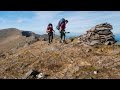
Garraun: Flat and Featureless Summit
Lago Maggiore: Stresa to Belgirate
Ben Gorm: Flattish Summit - high point of an exciting and rugged range.
Lake Como: Como Greenway from Cadenabbia to Lenno
Rutland Island: Interesting history on small island
A circuit of Leenaun Hill.
Inishfree Upper: W.A.W. Trail-point
Inishfree Upper: Free and easy on Inishfree
Steep ascent, stunning views
Inishkeeragh: Flat island in the sun
Long trail to rewarding tops.
Knocknaskea: Truly idyllic
Conditions and Info
Use of MountainViews is governed by conditions and a privacy policy.
Read general information about the site.
Opinions in material here are not necessarily endorsed by MountainViews.
Hillwalking is a risk sport. Information in comments, walks, shared GPS tracks or about starting places may not be accurate for example as regards safety or access permission. You are responsible for your safety and your permission to walk.
See the credits and list definitions.Video displayBrandon Group Area N: Brandon Ridge North SubareaPlace count in area: 15, OSI/LPS Maps: 70, EW-DC, EW-DW
Highest place: Brandon, 951.7m
Maximum height for area: 951.7 metres, Maximum prominence for area: 934 metres,
Places in area Brandon Group:
Cen: Faha Ridge:Benagh 822.5mFaha Ridge 809.2m
N: Brandon Point:Faill an tSáis 430.7m
N: Brandon Ridge North:Brandon Far North Top 840.1mBrandon North Top 895.4mMasatiompan 761.9mPierasmore North Top 700mPierasmore 745.7m
S: Ballysitteragh:An Bhinn Dubh 479.2mBallysitteragh 623mBeennabrack 608.5m
S: Brandon Ridge South:Gearhane 803mBrandon Peak 840mBrandon 951.7mBrandon South Top 790m
Note: this list of places includes island features such as summits, but not islands as such.
For origin of name, see Cnoc Bréanainn / Brandon. Kerry County in Munster Province, in Arderin Beg, Vandeleur-Lynam, Irish Best Hundred Lists, Rhythmically bedded sandstone Bedrock
Height: 840.1m OS 1:50k Mapsheet: 70 Grid Reference: Q45949 12861
Place visited by 187 members. Recently by: KellyA, nesa1206, srr45, orlaithfitz, DarrenY, jimmytherabbit, Ansarlodge, Aidan_Ennis, discovering_dann, knightsonhikes, Arcticaurora, RosieMc, chelman7, DeirdreM, farmerjoe1I have visited this place: NO (You need to be a logged-in member to change this.)Longitude: -10.256269, Latitude: 52.246367 , Easting: 45950, Northing: 112862 Prominence: 17.3m, Isolation: 0.4km
ITM: 445933 612914 , GPS IDs, 6 char: BrndFr, 10 char: BrndnFrNrt
Bedrock type: Rhythmically bedded sandstone, (Ballymore Sandstone Formation)
Cnoc Bréanainn (mullach i gcéin thuaidh) is the third highest mountain in the Brandon Group area and the 24th highest in Ireland. Cnoc Bréanainn (mullach i gcéin thuaidh) is the most westerly summit in the Brandon Group area.
Linkback: https://mountainviews.ie/summit/1391/COMMENTS for Brandon Far North Top (Cnoc Bréanainn (mullach i gcéin thuaidh)) 1 of 1  Follow this place's comments
 Height layer: © MapTiler

MountainViews.ie, a Hill-walking Website for the island of Ireland. 2500 Summiteers, 1480 Contributors, maintainer of lists such as: Arderins, Vandeleur-Lynams, Highest Hundred, County Highpoints etc

 Collaborative entry
 Collaborative entry
 Fergalh
 simon3
 Fergalh
 Fergalh
 Colin Murphy
 Fergalh
 Colin Murphy
 Damian120
 Visit our Facebook page.