This website uses cookies, which are small text files that the website puts on your device to facilitate operation. Cookies help us provide a better service to you. They are used to track general user traffic information and to help the website function properly.
Feature count in area: 34, all in Kerry,
OSI/LPS Maps: 63, 64, 70, 71, 72, 78, 79, 83, 84, 85
Highest Place: Beennaman 378m
Starting Places (76) in area Kerry Coastal Hill: Ardgroom, Ballybrack Mid, Ballydavid, Ballyduff Grave Yard, Ballyferriter, Ballyoughteragh Cross, Béal Bán Carpark, Blasket Centre, Brandon Pilgrimage Trail, Brandon Point, Brandon Village, Cahersiveen, Carriganine, Cashelkeelty Stone Circles Carpark, Cat Dubh Hostel, Cloghane Community Centre, Cnoc na dTobar Pilgrims Path, Coad Cemetery, Coad Road End, Com an Chiste, Coomaglaslaw Outflow, Coomasaharn Lake, Coonanna Harbour, Cooncrome Harbour, Coosavuddig Quay Brandon Creek, Coumeenoole Bay, unuseableCúm an Easpaig, Derrynane Quay, Dooneen Pier, Doorah, Drung Hill Layby, Ducalla, Dún Chaoin E, Eask Tower Path, Faha, Farrannakilla School, Foilatallav, Glan Mountain, Gleensk Forest, Gleensk Viaduct, Glenbeigh Village, Glennahoo River, Gowlaun Lough, Hostel Cloghane Village, Kildurrihy, Killurly SW, Kilmore Lodge, Kimego Forest E, Knocknasullig, Laghtacallow, Lios Pole Church, Lisduff Rath, Lough Camclaun, Lough Caragh SW, Maumanorig, Minard Beach, Mount Eagle Lough, Old Lansdowne School, Old Town, Pedlars Lodge, Pilgrimage Trail Owenmore River, Puffin Island, Red Trout Lake, River Behy Road, River Drimminboy Track, Sauce Creek Walkway Dingle Way, Shronebirrane Farm, Shronebirrane Road, Slea Head Carpark, Smerwick, Strand St Dingle, Teerbrin, Tetrapod CP, Tiduff, Villa Nuovo, Waterville Promenade
Summits & other features in area Kerry Coastal Hill: Beenbane 79m, The Three Sisters Middle Top 140m, Bookeen 251m, Drom 101m, Dunmore Head 97.3m, An Ghráig 165.7m, Tooreen 218m, Ballynabloun 315m, Baslickane 110m, Beakeen 138m, The Three Sisters NE Top 153m, The Three Sisters SW Top 134m, Beennaman 378m, Carrigower 145m, Lamb's Head Hill 95m, Clogher Head 116.4m, Cloonee 61m, Ballymore Hill 128m, Glan Mountain 91m, Knockstooka 296m, Bolus SW Top 284m, Sea Hill 224m, Doulus Head 145m, Drung Hill 175m, Hillville 135m, Kilfenora Hill 56m, Killelan Mountain East Top 267m, Kilpaddoge Hill 58m, Knockatinna 206m, Knockboy 159m, Nedanone 98m, Ross-Behy East 274m, Slievagh 207m, Stookaniller 261m
Note: this list of places may include island features such as summits, but not
islands as such.
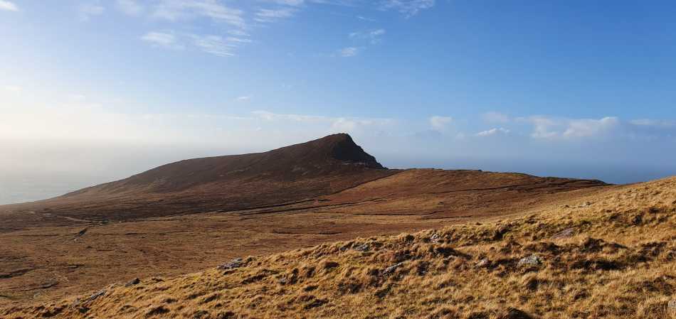
Beennaman, 378mCoastal Hill Binn na mBan A name in Irish,
Place Rating ..
OSI, Beenamore, Kerry County in Munster province, in no lists Grid Reference Q44000 13800,
OS 1:50k mapsheet 70 Place visited by: 17members, recently by: markwallace, chelman7, Moses, eiremoss34, Fergalh, CaminoPat, mh400nt, TipsyDempy, JohnAshton, justynagru, liz50, aidand, markmjcampion, peter1, ciarraioch
I visited this place: NO (You need to be a logged-in member for this.)
Picture: Binn na mBan from Dingle Way during storm Dennis
Calm during a storm
by strangeweaver
17 Feb 2020
On a day when storm Dennis scuppered my plans to ascend Masatiompa Binn na mBan offered some solace and magnificent views off to the west. It is easily taken in by a slight detour from the Dingle way with a fence line providing a guide to just below the obvious summit. Linkback: mountainviews.ie/summit/5110/comment/20758/
Read Less
Read More
Picture: Summit area from the east
Short trek to summit
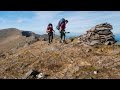
by Fergalh
14 Nov 2022
Followed Strangeweavers excellent comments on this coastal Hill. Parked at A (Q433 124) extensive car parking for at least ten cars and followed to summit on a windy day. Only thing to add of note is as these are crumbly cliffs extreme caution is needed. Linkback: mountainviews.ie/summit/5110/comment/23753/
Use of MountainViews is governed by conditions and a privacy policy.
Read general information about the site. Opinions in material here are not necessarily endorsed by MountainViews.
Hillwalking is a risk sport. Information in comments, walks, shared GPS tracks or about starting places may
not be accurate for example as regards safety or access permission. You are responsible for your safety and your permission to walk.
See the credits and list definitions.


 Our Facebook page.