This website uses cookies, which are small text files that the website puts on your device to facilitate operation. Cookies help us provide a better service to you. They are used to track general user traffic information and to help the website function properly.
Feature count in area: 15, all in Kerry,
OSI/LPS Maps: 70, EW-DC, EW-DW
Highest Place: Brandon 951.7m
Starting Places (18) in area Brandon Group: Ballinloghig, Ballybrack Mid, Brandon Pilgrimage Trail, Brandon Point, Brandon Village, Cloghane Community Centre, Conor Pass, Coosavuddig Quay Brandon Creek, Faha, Feoghanagh River, Hostel Cloghane Village, Lough Camclaun, Lough Doon CP, Mullaghveal Farm, Pedlars Lodge, Pilgrimage Trail Owenmore River, Sauce Creek Walkway Dingle Way, Tiduff
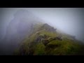
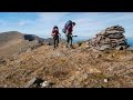
Summits & other features in area Brandon Group: Cen: Faha Ridge: Benagh 822.5m, Faha Ridge 809.2m N: Brandon Point: Faill an tSáis 430.7m N: Brandon Ridge North: Brandon Far North Top 840.1m, Brandon North Top 895.4m, Masatiompan 761.9m, Pierasmore North Top 700m, Pierasmore 745.7m S: Ballysitteragh: An Bhinn Dubh 479.2m, Ballysitteragh 623m, Beennabrack 608.5m S: Brandon Ridge South: Gearhane 803m, Brandon Peak 840m, Brandon 951.7m, Brandon South Top 790m
Note: this list of places may include island features such as summits, but not
islands as such.
Pierasmore North Top, 700.0mMountain Piaras Beag A name in Irish,
Place Rating ..
From OSI, Kerry County in Munster province, in no lists, Piaras Beag is the 114th highest place in Ireland.
Grid Reference Q46427 13808,
OS 1:50k mapsheet 70 Place visited by: 77members, recently by: jackos, markwallace, maoris, fingalscave, Jai-mckinney, Carolyn105, Beti13, chelman7, Krzysztof_K, johncusack, Seamy13, TommyV, simon3, TipsyDempy, Tifred
I visited this place: NO (You need to be a logged-in member for this.)
Use of MountainViews is governed by conditions and a privacy policy.
Read general information about the site. Opinions in material here are not necessarily endorsed by MountainViews.
Hillwalking is a risk sport. Information in comments, walks, shared GPS tracks or about starting places may
not be accurate for example as regards safety or access permission. You are responsible for your safety and your permission to walk.
See the credits and list definitions.


 Add a Place Comment for Pierasmore North Top, Piaras Beag


 Our Facebook page.