This website uses cookies, which are small text files that the website puts on your device to facilitate operation. Cookies help us provide a better service to you. They are used to track general user traffic information and to help the website function properly.
simon3: Track/713 in area near Ireland, Near Coomnacronia, Iveragh (Ireland)
Great help, wild land, huge views - Coomnacronia Finnararagh Sallagh
Ascent: 870m,
Length: 14.2km,
Creator time taken: 6h32m
Descent: 855m,
Time predicted from Naismith's rule: 4h 17m + breaks
Click here to rate track
PlacesStart at Fermoyle Farm (Fermoyle F) V69370 71264, Coomnacronia, Finnararagh, Sallagh South-West Top, Sallagh, end at Start
Track Rating ..
[RWD version 1 ]
This is an unusual, rewarding route reaching a great section of the Dunkerron ridge on the Iveragh peninsula. Note that at many points great care would be required to find an escape route.The general view of this part of the Dunkerrons.
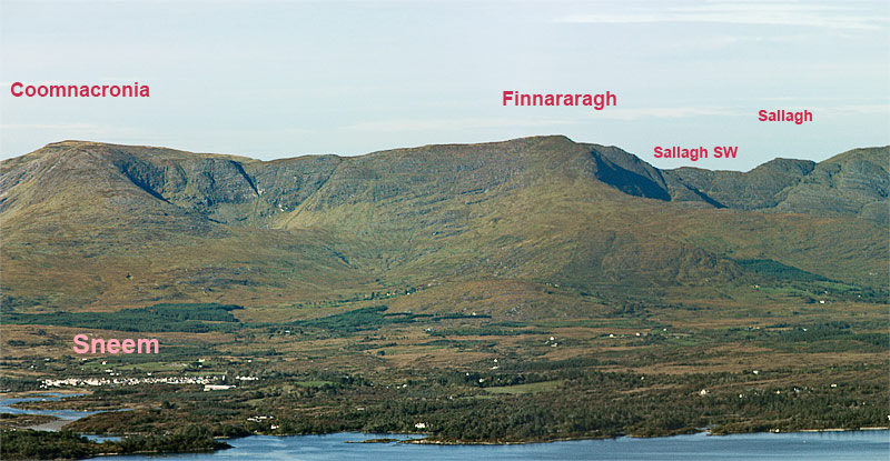
Overview of the walk viewed from the Beara Peninsula.
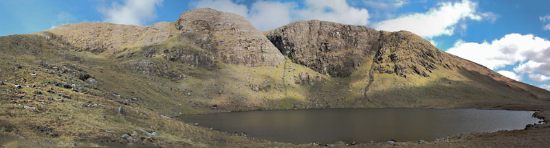
This walk starts in the hinterland of Sneem in a townland called Fermoyle. It goes up the broad spur visible in the picture towards Coomnacronia and then along the skyline to Sallagh, returning via Finnararagh. You need to get permission at the start to follow the route we took. We found the owner of the land extremely helpful. Climb up until you get to Lough Coomnacronia:
High cliffs almost encircle Lough Coomnacronia.
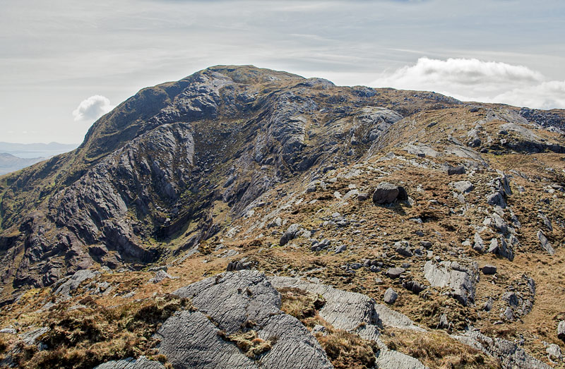
The way up from here is via the steep ground to the left which will give you access to the main ridge. Pause a while to look at the huge views of Knocknagantee and Eagles Lough to the west and left of the last picture.The ridge to Finnararagh has more spectacular views and is reasonably easy. Finnararghs summit is very rough. Take care picking out the correct ridge to continue on towards Sallagh as there are two or three small and confusing ridges going almost the right way.
Finnararagh from the East
Sallagh SW is small and you could almost walk over it without noticing. If you look back you can see the easterly aspect of Finararagh which is also known as An Corrán. Sallagh itself is an exhibition of twisted geology with a fine anticline. Beyond it on a good day you can see the ridge snaking out towards Beann and Mullaghanattin and beyond that there are views of the Macgillycuddys Reeks.
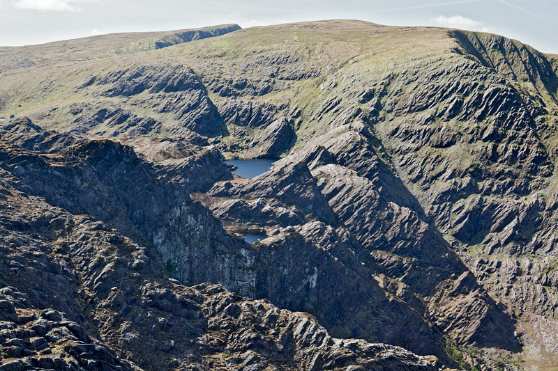
Coomura from near Sallagh SW
On the way back take a look to the right, that is NW. and you can see the extraordinary twisted valley enroute to Coomura. Finally you need to return via Finnararagh. ( Alternative routes SE towards Lough Sallagh look extreme. )
Quick way down
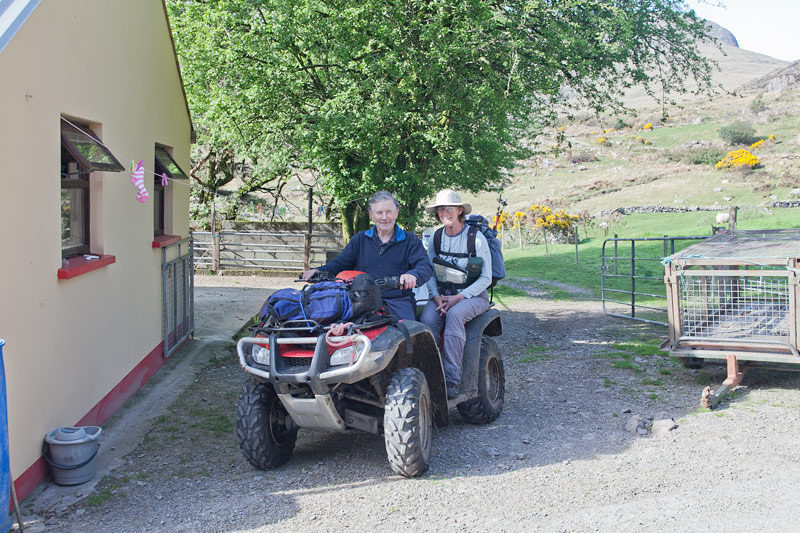
On the occasion that we did it were were unexpectedly greeted by the local farmer who came out from his farm on a large quad bike which was able to take two extra people plus gear quickly down the hill. If you look at the track you can see what appears to be running. That was the quad ride! Thanks to that farmer of Fermoyle!
Editing Details for track/713
NOTE: ALL information such as Ascent, Length and Creator time taken etc should be regarded as approximate. The creator's comments are opinions and may not be accurate or still correct.
Your time to complete will depend on the speed of the slowest plus break time and your mode of transport.
NOTE: It is up to you to ensure that your route is appropriate for you and your party to follow bearing in mind all factors such as safety, weather conditions, experience and access permission.
Uploaded on: Fri, 30 Sep 2011 (07:41:01), Linkback: https://mountainviews.ie/track/713/
* Note: A GPS Height in the elevation profile is sourced from the device that recorded the track. An "SRTM" height is derived from a model of elevations for parts of the earth. More detail
Use of MountainViews is governed by conditions and a privacy policy.
Read general information about the site. Opinions in material here are not necessarily endorsed by MountainViews.
Hillwalking is a risk sport. Information in comments, walks, shared GPS tracks or about starting places may
not be accurate for example as regards safety or access permission. You are responsible for your safety and your permission to walk.
See the credits and list definitions.


 Our Facebook page.