If you want to use the website often please enrol (quick and free) at top right.

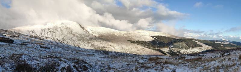
Lugnaquilla 924.7m, Corrigasleggaun 794.6m, Slievemaan 759.7m, Ballineddan Mountain 652.3m, Carrig Mountain 571m,

 Get Notifications
Carricktriss Gorse: Safe access to this hill no longer seems possible
 TommyMc
Binnion: Tullagh Bay and Rockstown Harbour
 Jim_Brady
Donations Drive, now finished.
Good, relatively easy double bag
 Colin Murphy
Crocknapeast: Long walk up windfarm roads.
 Collaborative entry
Mulnanaff: Longish walk up windfarm road.
 Collaborative entry
Lake District: Dale Head Horseshoe
Double bag mostly on windfarm tracks.
 Colin Murphy
Binbane NE Top: Simple bag from its neighbouring top.
 Collaborative entry
Lake District: Coledale Horseshoe
Binbane: Steepish approach to relatively easy Carn.
 Collaborative entry
Crucknaree: Magnificent views!
 paddyhillsbagger
Use of MountainViews is governed by conditions and a privacy policy.
Read general information about the site.
Opinions in material here are not necessarily endorsed by MountainViews.
Hillwalking is a risk sport. Information in comments, walks, shared GPS tracks or about starting places may not be accurate for example as regards safety or access permission. You are responsible for your safety and your permission to walk.
See the credits and list definitions.
 Visit our Facebook page.
 Length: 11.3km, Creator time taken: 5h28m, Ascent: 594m,
Descent: 603m
Places: Start at S9867690273, Ballineddan Mountain, Slievemaan, end at Start
Logged as completed by 1

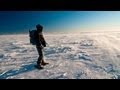
This route starts at Ballinfoyle, a road junction. Nowadays there is off road parking there for around 4 cars though it is still possible to park on the verge.
Climbing Ballineddan is straightforward with an ascent of about 330m
The day was cold with occasional hail showers.
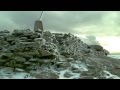
Returning, we dropped down towards the public road. But this wasn't easy. We successfully got to our target track as shown which did the final work of bringing us to the road and not infringing on any cultivated fields or too near any farm. But the land was extremely rough and slow going. There were only snatches of animal tracks to assist. In retrospect it would have been better to stay to the north side of the stream we came down beside, because the land is flatter and there some quad tracks. We didn't do this because we didn't know if it was possible to cross the stream nearer to the road. Crossing is possible to within perhaps 700m NE of the road.
The surveying results: Ballineddan is not an Arderin because it has a prominence of 26.5. Slievemaan has a height of 759.7m
NOTE: ALL information such as Ascent, Length and Creator time taken etc should be regarded as approximate. The creator's comments are opinions and may not be accurate or still correct.
Your time to complete will depend on your speed plus break time and your mode of transport. For walkers: Naismith's rule, an approximate though often inaccurate estimate, suggests a time of 3h 15m + time stopped for breaks
NOTE: It is up to you to ensure that your route is appropriate for you and your party to follow bearing in mind all factors such as safety, weather conditions, experience and access permission.
* Note: A GPS Height in the elevation profile is sourced from the device that recorded the track. An "SRTM" height is derived from a model of elevations for parts of the earth. More detail![]()
|
|
|
||
| MountainViews.ie, a Hill-walking Website for the island of Ireland. 2400 Summiteers, 1480 Contributors, maintainer of lists: Arderins, Vandeleur-Lynams, Highest Hundred, County Highpoints etc | |||