This website uses cookies, which are small text files that the website puts on your device to facilitate operation. Cookies help us provide a better service to you. They are used to track general user traffic information and to help the website function properly.
simon3: Track/2292 in area near Dublin/Wicklow (Ireland)
Fenton's, Lugnaquillia, Camenabologue
Ascent: 893m,
Length: 19.3km,
Creator time taken: 4h50m
Descent: 890m,
Time predicted from Naismith's rule: 5h 20m + breaks
Click here to rate track
PlacesStart at Fentons Pub (Fentons) S97336 93586, Lugnaquilla, Camenabologue, end at Start
Track Rating ..
[RWD version 1 ]
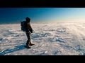
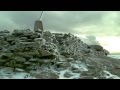
This triangular walk starts from the vicinity of Fenton's Pub at which there is a certain amount of casual parking. (Always have something at the pub if parking around here, please.) It's then straight up Camara Hill and up Lug. (Note: sometimes this route is closed due to Army activity.) There's a little relief from the climbing as you get onto Camara Hill. From Lug take the north route as shown until you can turn left at the allowed point through the Army lands as shown. When on top of Camenabologue look out for Keadeen, the 653m peak to the west of Lug. If you can see a summit above and very slightly to the left of it, you are looking at Slievenamon (721m) 97km away. Sorry, off the hill, it's a bit of a road walk back to Fenton's.
Editing Details for track/2292
NOTE: ALL information such as Ascent, Length and Creator time taken etc should be regarded as approximate. The creator's comments are opinions and may not be accurate or still correct.
Your time to complete will depend on the speed of the slowest plus break time and your mode of transport.
NOTE: It is up to you to ensure that your route is appropriate for you and your party to follow bearing in mind all factors such as safety, weather conditions, experience and access permission.
Uploaded on: Mon, 12 Aug 2013 (10:13:20), Linkback: https://mountainviews.ie/track/2292/
* Note: A GPS Height in the elevation profile is sourced from the device that recorded the track. An "SRTM" height is derived from a model of elevations for parts of the earth. More detail
Use of MountainViews is governed by conditions and a privacy policy.
Read general information about the site. Opinions in material here are not necessarily endorsed by MountainViews.
Hillwalking is a risk sport. Information in comments, walks, shared GPS tracks or about starting places may
not be accurate for example as regards safety or access permission. You are responsible for your safety and your permission to walk.
See the credits and list definitions.


 Our Facebook page.