Cookies.
This website uses cookies, which are small text files that the website puts on your device to facilitate operation. Cookies help us provide a better service to you. They are used to track general user traffic information and to help the website function properly.
Features
Nearby features appear when you click the map.
Declutter tracks on map.
Place Search
Video
X
Pub: by
peter1: Track/4934 in area near MothaillĂ­n, Dunkerron Mountains (Ireland)
Knocknabreeda group: peak bagging near the Black Valley
Ascent: 646m, Length: 11.7km, Creator time taken: 5h11m
Descent: 649m, Time predicted from Naismith's rule: 3h 25m + breaks
Rating graphic
Click here to rate track
Places Start at V84366 78810, MothaillĂ­n, Crossderry, Knocknabreeda, end at Start
Track Rating ..
[RWD version 1 ] The ascent from the valley is over quite difficult terrain - long grass, tussocks, rocks and boggy ground, lots of boggy ground! Parking places in this valley are very scarce and both sides of the road are well protected by barbed wire fences. However, there is a small tea/coffee cafe where I asked permission to park and the owner was very friendly.

MountainViews.ie picture 1 for track/4934


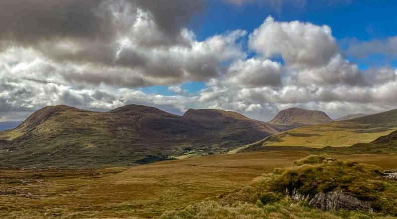
Looking across to the Knocknagapple group of hills from the slopes of Mothaillin, L to R: Boughil, Cnoc na gCapall, Bascadh, and Knocklomena.
Overall, the weather was pleasant, cool with some showers. However, walking this route after a wet August, was probably not my best idea, although I'm not sure it would have been much drier in June's drought!

MountainViews.ie picture 2 for track/4934


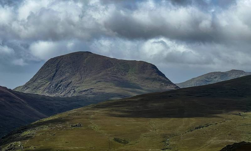
East face of Knocklomena, the cliffs fall down to Lough Fadda.
Editing Details for track/4934
NOTE: ALL information such as Ascent, Length and Creator time taken etc should be regarded as approximate. The creator's comments are opinions and may not be accurate or still correct.
Your time to complete will depend on the speed of the slowest plus break time and your mode of transport.
NOTE: It is up to you to ensure that your route is appropriate for you and your party to follow bearing in mind all factors such as safety, weather conditions, experience and access permission.
Uploaded on: Mon, 28 Aug 2023 (19:11:25), Linkback: https://mountainviews.ie/track/4934/
* Note: A GPS Height in the elevation profile is sourced from the device that recorded the track. An "SRTM" height is derived from a model of elevations for parts of the earth. More detail
EDIT Point of Interest
text
Videos


Recent Contributions
x
Conditions and Info
Use of MountainViews is governed by conditions and a privacy policy.
Read general information about the site.
Opinions in material here are not necessarily endorsed by MountainViews.
Hillwalking is a risk sport. Information in comments, walks, shared GPS tracks or about starting places may not be accurate for example as regards safety or access permission. You are responsible for your safety and your permission to walk.
See the credits and list definitions.

OSi logo
OSNI/LPS logo
Open Street Map
(Various variations used.)
British summit data courtesy:
Database of British & Irish Hills