This website uses cookies, which are small text files that the website puts on your device to facilitate operation. Cookies help us provide a better service to you. They are used to track general user traffic information and to help the website function properly.
simon3: Track/3870 in area near An Bhinn BhuĂ, North Mayo (Ireland)
Benwee Coastal Walk
Ascent: 245m,
Length: 8.1km,
Creator time taken: 3h55m
Descent: 315m,
Time predicted from Naismith's rule: 2h 1m + breaks
Click here to rate track
PlacesStart at Proesoon (Proesoon) F80307 43235, Benwee Head, Doonvinalla W Top, Doonvinalla E Top, end at Portacloy Bay (Portacloy) F84034 43908, 3.8km E from Start
Track Rating ..
[RWD version 1 ]
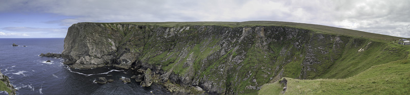
The walk starts at a small carpark and Wild Atlantic Way sign just west of Benwee. In fact some of the local rock has red, ochre as well as the eponymous yellow.
This picture was taken from the west of the start. The car park is on the extreme right.
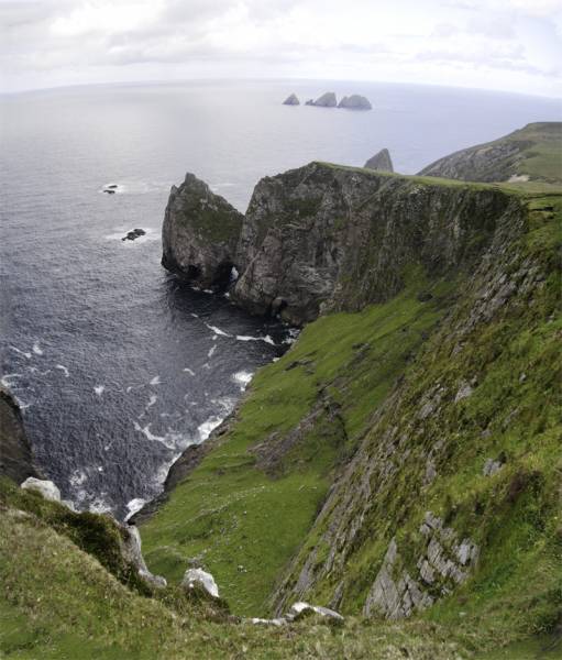
The initial walking goes via an easy track along the coast. The cliffs are not safe and everyone particularly children and animals need to be careful. There are a series of exciting or interesting views and this report can only include a few. Off the coast there are various islands. At the start is Kid's Island (not shown in photos here) and also the Staggs of Broadhaven, an unnamed peak fo 46m just off the top of the head and various others.
Part of the coastline with an arch and the distant Stags of Broad Haven.
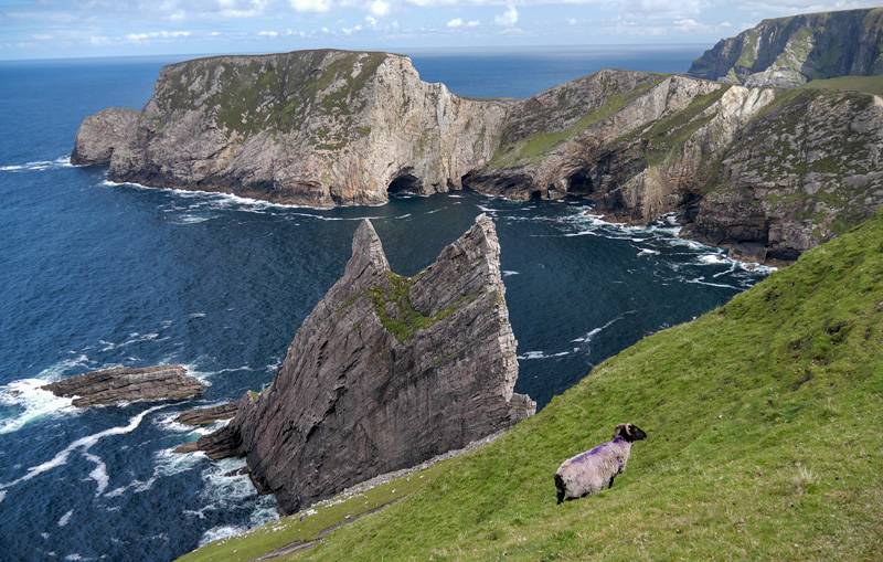
At one point there is a huge jutting rock evocative of a crashing ship. Apparently it was climbed from the sea side many years ago, with the climbers being benighted in their efforts.
Titanic wrock.
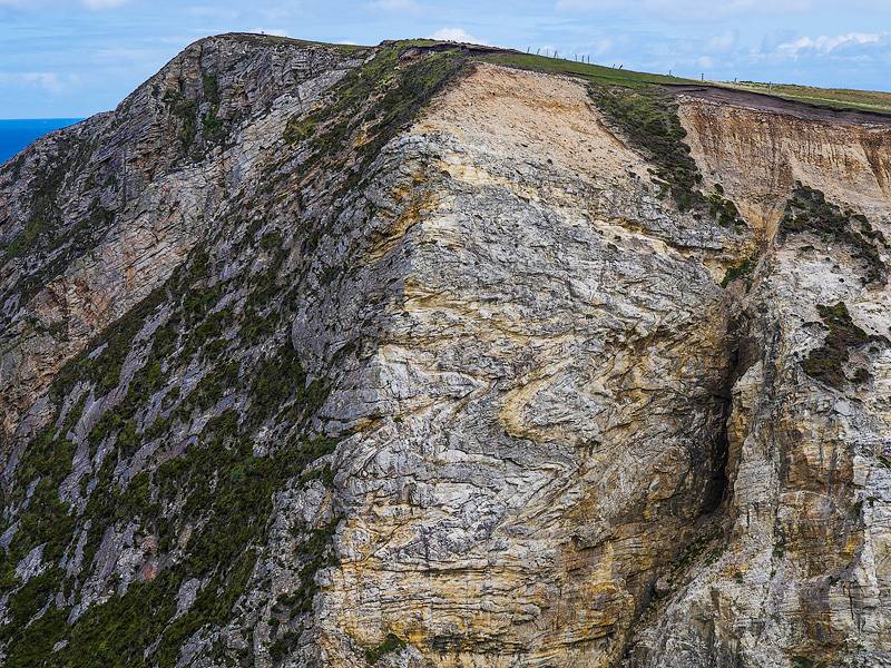
One place we passed was Doonvinalla N Top. It is relatively easy to get over the connecting ridge to it, but then it became too difficult. According to the OS 1:50k there was a promontory fort there - amazing location. See photo for this with the summit. Towards the end some of the geology is particularly exposed such as this amazing twisted and sheered rock.
Twisted yellow and grey rocks.
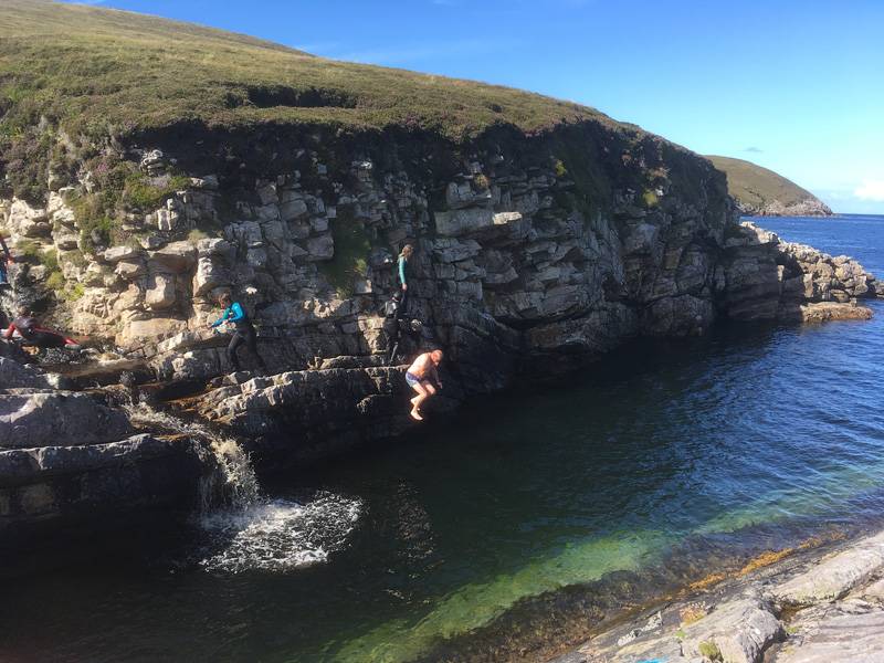
Finally you come down to Portacloy which is a great beach but also has this plunge pool for the adventurous.
A Portacloy swim at the end. Photo courtesy Una Campbell.
A fine walk!
Editing Details for track/3870
NOTE: ALL information such as Ascent, Length and Creator time taken etc should be regarded as approximate. The creator's comments are opinions and may not be accurate or still correct.
Your time to complete will depend on the speed of the slowest plus break time and your mode of transport.
NOTE: It is up to you to ensure that your route is appropriate for you and your party to follow bearing in mind all factors such as safety, weather conditions, experience and access permission.
Uploaded on: Sat, 11 Aug 2018 (07:37:14), Linkback: https://mountainviews.ie/track/3870/
* Note: A GPS Height in the elevation profile is sourced from the device that recorded the track. An "SRTM" height is derived from a model of elevations for parts of the earth. More detail
Use of MountainViews is governed by conditions and a privacy policy.
Read general information about the site. Opinions in material here are not necessarily endorsed by MountainViews.
Hillwalking is a risk sport. Information in comments, walks, shared GPS tracks or about starting places may
not be accurate for example as regards safety or access permission. You are responsible for your safety and your permission to walk.
See the credits and list definitions.


 Our Facebook page.