This website uses cookies, which are small text files that the website puts on your device to facilitate operation. Cookies help us provide a better service to you. They are used to track general user traffic information and to help the website function properly.
Feature count in area: 59, all in ,
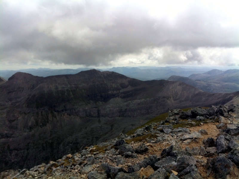
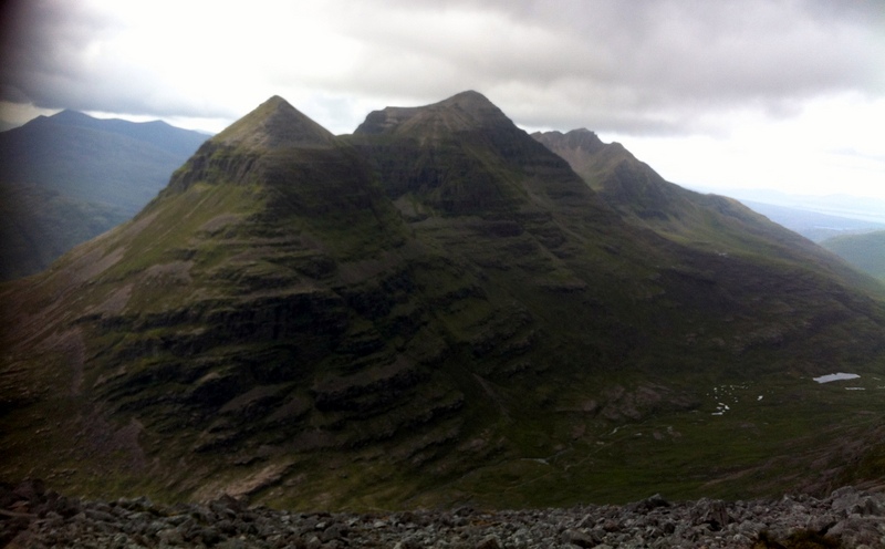
Highest Place: Liathach - Spidean a'Choire Leith 1055m
Starting Places in area Loch Torridon to Loch Maree:
None for this area
Summits & other features in area Loch Torridon to Loch Maree: A'Choineach Beag 558m, A'Choineach Beag South Top 543m, Am Fasarinen 930m, An Cuaidh 296m, An Ruadh-mheallan 671m, Baosbheinn 875m, Baosbheinn East Top 805m, Baosbheinn North Top 841m, Beinn a'Chearcaill 725.2m, Beinn Alligin - Sgurr Mhor 986m, Beinn Alligin - Tom na Gruagaich 922m, Beinn an Eoin 855m, Beinn an Eoin North Top 716m, Beinn Bhreac 625m, Beinn Bhreac East Top 624m, Beinn Dearg 913.7m, Beinn Dearg East Top 843m, Beinn Dearg Far East Top 792m, Beinn Eighe - Ruadh-stac Mor 1010m, Beinn Eighe - Spidean Coire nan Clach 993m, Carn na Feola 761m, Ceann Beag 705m, Cliff Hill [Meall a'Cliuth] 229m, Coinneach Mhor 976m, Coinneach Mhor (old GR) 954m, Creag a'Chinn Duibh 675m, Creag an Fhithich 801m, Creag Dhubh 929m, Creag Dhubh (North Top) 907m, Creag Mhor Thollaidh 343m, Creag na Feol 642.4m, Leathad Buidhe 559m, Liathach - Mullach an Rathain 1023m, Liathach - Spidean a'Choire Leith 1055m, Meall a'Ghiubhais [Meall a'Ghiuthais] 887m, Meall an Doirein 420m, Meall an Spardain 415m, Meall an Tuim Bhuidhe 477m, Meall Aundrary 327m, Meall Deise 252m, Meall Fuaraidh 369m, Meall Lochan a'Chleirich 403m, Meall na h-Araid 144m, Meall na h-Odhar-aghaidh 537m, Meall na Meine 420m, Mullach an Rathain East Top 903m, Mullach nan Cadhaichean 293m, Na Rathanan 864m, Na Rathanan East Top 858m, Northern Pinnacles [Meall Dearg] 955m, Ruadh-stac Beag 896m, Sail Mhor 980m, Sgurr Ban 970m, Sgurr Mhor West Top 859m, Sgurr nan Fhir Duibhe 963m, Sidhean Mor [Sithean Mor] 384m, Stob a'Choire Liath Mhor [Stob a'Coire Liath Mhor] 983m, Stuc a'Choire Dhuibh Bhig 915m, Stuc Loch na Cabhaig 889m
Note: this list of places may include island features such as summits, but not
islands as such.
Beinn Eighe - Spidean Coire nan Clach, 993mMountain
Place Rating ..
, in British over 600m, British Marilyn, Munro Lists Grid Reference NG96615 59780,
OS 1:50k mapsheet 25 Place visited by: 22members, recently by: rhw, joreidy, OutdoorBill, annem, nordicstar, bolton12, gerrybowes, Matrim, melohara, DeltaP, IainT, Wildcat, oakesave, eamonoc, skyehigh
I visited this place: NO (You need to be a logged-in member for this.)
Use of MountainViews is governed by conditions and a privacy policy.
Read general information about the site. Opinions in material here are not necessarily endorsed by MountainViews.
Hillwalking is a risk sport. Information in comments, walks, shared GPS tracks or about starting places may
not be accurate for example as regards safety or access permission. You are responsible for your safety and your permission to walk.
See the credits and list definitions.


 Our Facebook page.