This website uses cookies, which are small text files that the website puts on your device to facilitate operation. Cookies help us provide a better service to you. They are used to track general user traffic information and to help the website function properly.
Feature count in area: 97, all in ,
Highest Place: Beinn Udlamain 1011m
Starting Places in area Loch Ericht to Glen Tromie and Glen Garry:
None for this area
Summits & other features in area Loch Ericht to Glen Tromie and Glen Garry: A'Bhuidheanach 881.1m, A'Bhuidheanach Bheag 936m, A'Mharconaich 975m, A'Mharconaich 882m, Am Buachaille 480m, Am Meadar 803m, An Dun 827m, An Dun 827m, An Sgulan 865m, An Torc 739m, Beinn a'Chuallaich 892m, Beinn Bhoidheach 790m, Beinn Mholach 841m, Beinn Udlamain 1011m, Bogha-cloiche 898m, Bogha-cloiche West Top 875m, Bruach nan Iomairean (1974 position) 972m, Bruthach na Craoibhe [Bruthaich na Craoibhe] 824m, Carn Dearg 787m, Carn Dearg 558m, Carn Fiaclach 748m, Carn na Caim 941m, Carn na Caim South Top 914m, Ceann Caol na Creige 587m, Clach-Mheall Dubh 619m, Cnoc na Craoibhe 426m, Craig Fonvuick 422m, Creag a'Mhadaidh 612m, Creag an Dubh-chadha 840m, Creag an Eirionnaich 443m, Creag an Fhithich 453m, Creag Mhic an t-Saoir 514m, Creag nam Bodach 491m, Creag nan Caisean 477m, Creag nan Gabhar 730m, Creag Ruadh 658m, Creag Stalcair 689m, Creagan a'Bhruic 433m, Creagan Doire Dhonaich 722.8m, Creagan Mor 772m, Creagan Odhar 400m, Druim nan Sac 644m, Druim nan Sac West Top 603m, Drumcroy Hill 512m, Garbh-mheall Beag 485m, Garbh-mheall Mor 594m, Geal-charn 917.1m, Glas Meall a'Chumhainn 827m, Glas Mheall Beag 881m, Glas Mheall Mor 830m, Glas Mheall Mor 928m, Gualann Sheileach 612m, Leacainn 527m, Leathad nan Craobh Fearna 456m, Meall a'Chaorainn 916m, Meall a'Chathaidh 521m, Meall Ban 504m, Meall Ban 547m, Meall Breac 685m, Meall Chuaich 951m, Meall Dail-chealach 519m, Meall Dail-chealach SE Top 513m, Meall Doire 732m, Meall Dubh 607m, Meall Dubh West Top 599m, Meall Garbh 600m, Meall Gorm 526m, Meall na h'Imrich 420m, Meall na h'Iolaire 442m, Meall na Leitreach 775m, Meall na Moine 743m, Meall nan Eun 852m, Meall nan Ruaig 579m, Meall Odhar Loch Monaidh 748m, Meall Odhar Mor 890m, Meall Odhar Mor 834m, Meall Reamhar 493m, Meall Uaine 902m, Meallan Buidhe 879m, Meallanan Odhar 750m, Sgairneach Mhor 991m, Sgairneach Mhor (old GR) 963m, Sgairneach Mhor East Top 758m, Sgor Dearg 801m, Sgurran Dearg 525m, Sidhean Coire an Dubh-chadha 567m, Sron a'Chlaonaidh 628m, Sron Bheag 516m, Sron Chon 566m, Sron na Gaoithe 521m, Sron na h-Eiteich 748m, Stac Dearg 809m, Stob an Aonaich Mhoir 855m, Stob Loch Monaidh 743m, The Sow of Atholl [Meall an Dobharchain] 803m, Tom an Stoil 493m, Tulach Hill 470m
Note: this list of places may include island features such as summits, but not
islands as such.
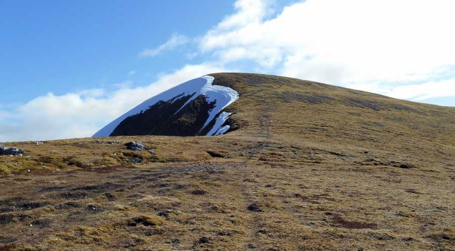
A'Mharconaich, 975mMountain
Place Rating ..
, in British over 600m, Munro Lists Grid Reference NN60422 76292,
OS 1:50k mapsheet 42 Place visited by: 30members, recently by: rhw, joreidy, ochils_trekker, OutdoorBill, bryanjbarry, melohara, LauraG, Lauranna, annem, nordicstar, Bernieor, madfrankie, schwann10, rangertobi, bolton12
I visited this place: NO (You need to be a logged-in member for this.)
Use of MountainViews is governed by conditions and a privacy policy.
Read general information about the site. Opinions in material here are not necessarily endorsed by MountainViews.
Hillwalking is a risk sport. Information in comments, walks, shared GPS tracks or about starting places may
not be accurate for example as regards safety or access permission. You are responsible for your safety and your permission to walk.
See the credits and list definitions.


 Our Facebook page.