This website uses cookies, which are small text files that the website puts on your device to facilitate operation. Cookies help us provide a better service to you. They are used to track general user traffic information and to help the website function properly.
Feature count in area: 149, by county: : 131, Cheshire West and Chester (UA): 1, Merseyside (CoA) St Helens (CoU): 1, Rochdale (UA): 2, Bury (UA): 1, Calderdale (UA): 1, Blackburn with Darwen (UA): 1, Bolton (UA): 1, Bradford (UA): 1, Greater Manchester (CoA) Oldham (CoU): 1, Cheshire (CoH) West Yorkshire (CoA) Kirk: 1, Staffordshire (CoH) Staffordshire (CoA): 1, Barnsley (UA): 1, Tameside (UA): 1, South Yorkshire (CoA) Sheffield (CoU): 1, Derbyshire (CoH) Derbyshire (CoA) Derbys: 1, Staffordshire (CoH): 1, Cheshire (CoA) Cheshire East (CoU): 1,
Highest Place: Kinder Scout 636.3m
Starting Places in area Lancashire, Cheshire & the Southern Pennines:
None for this area
Summits & other features in area Lancashire, Cheshire & the Southern Pennines: Bamford Moor 426m, Barker Bank 426m, Baxton Fell 469m, Bee Low 413m, Birchenough Hill 459m, Blake Moor 422m, Bole Hill 403m, Booth Hill 407m, Bowland Knotts 430m, Bradwell Moor 471m, Brown Wardle Hill 401m, Burn Moor 402m, Carr and Craggs Moor 441m, Chelmorton Low 446m, Chrome Hill 443m, Cown Edge 411m, Cowpe Lowe 440m, Cribden Hill 401m, Dow Low [Brier Low] 437m, Durham Edge 416m, Ely Brow 403m, Fox Low 408m, Gautries Hill 410m, Grin Low 434m, Grit Fell 468m, Hailshowers Fell 486m, Hameldon 467m, Hawthornthwaite Fell Top 479m, Hen Cloud 410m, High Edge 462m, High Moor 415m, High Wheeldon 422m, Hind Low 447m, Hollins Hill 450m, Lodge Moor 409m, Lose Hill 476m, Manshead End 417m, Merryton Low 489m, Mount Famine 473m, Nab Hill 451m, Nether Low 414m, Old Man of Mow 337m, Parlick 432m, Pule Hill 437m, Ramshaw Rocks 460m, Revidge 401m, Rishworth Moor 435m, Shatton Edge [Burton Bole] 417m, Slitherstone Hill 477m, Soil Hill 403m, Sponds Hill 413m, Stoodley Pike 402m, The Tower 460m, Thieveley Pike 449m, Thirkelow Rocks 451m, Top of Blaze Moss 424m, Upper Edge 436m, Upper Hey 446m, Waggonshaw Brow 407m, Wharncliffe Chase 317m, White Path Moss 457m, Whitehills 477m Cheshire & Southern Pennines: Ashley Heath 236m, Bolehill 322m, High Billinge 178.6m, Idle Hill [Werneth Low] 279m, Overmoor 288m, Raw Head 227.1m, The Cloud 343m Forest of Bowland: Caton Moor 361m, Clougha Pike 416m, Easington Fell 396m, Fair Snape Fell 521m, Longridge Fell 350m, Totridge 496m, Ward's Stone 563m, Whins Brow 476m, White Hill 544m, Wolfhole Crag 527m Lancashire: Billinge Hill 179m, Billinge Hill 245m, Blackstone Edge 474m, Boulsworth Hill - Lad Law 517m, Bull Hill 418m, Cartridge Hill 402m, Freeholds Top 454m, Great Hameldon 409m, Hail Storm Hill 476.6m, Hail Storm Hill (boundary) 474.5m, Hoof Stones Height 479m, Little Wolf Stones 443m, Oaken Head 163m, Pendle Hill 557m, Pinhaw Beacon 388m, Scholes Height & Bull Hill 415m, Warton Crag 163m, Way Stone Edge [Moss Moor] 482m, Winter Hill 456m, Winter Hill (boundary) 449m, Withins Height [Round Hill] 459m, Withins Height [Round Hill] (boundary) 457m The Peak District: Alport Moor 535m, Axe Edge 549m, Axe Edge Moor 551m, Back Tor 538m, Black Chew Head 542m, Black Edge 507m, Black Hill 582m, Bleaklow Head 633m, Brown Knoll 569m, Burbage Edge 500m, Cats Tor 522m, Cheeks Hill 520m, Chinley Churn 457m, Chinley Churn (old GR) 451.8m, Combs Head 503m, Croker Hill [Sutton Common] 404m, Dead Edge End 499m, Eccles Pike 370m, Featherbed Moss 541m, Featherbed Top 544m, Gun 385m, High Neb 458m, Higher Shelf Stones 621m, Hoar Stones - Howden Edge 514m, Hoarstone Edge 497m, Horse Stone Naze 527m, Howden Edge [High Stones] 550m, Kinder Scout 636.3m, Lees Moor 304m, Longstone Moor 395m, Lord's Seat [Rushup Edge] 550m, Mam Tor 517m, Mill Hill 544m, Oliver Hill 513m, Outer Edge 541m, Shining Tor 559m, Shutlingsloe 506m, Sir William Hill 429m, South Head 494m, Stanton Moor 323m, The Roaches 505m, West Nab 501m, Wetton Hill 371m, Whaley Moor 411m, Whetstone Ridge 547m, White Low 530m, Win Hill 463m, Wolfscote Hill 388m
Note: this list of places may include island features such as summits, but not
islands as such.
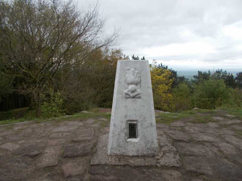
Raw Head, 227.1mHill
Place Rating ..
, Cheshire West and Chester (UA) County, in no lists Grid Reference SJ50844 54841,
OS 1:50k mapsheet 117 Place visited by: 4members, recently by: rhw, Fergalh, chalky, Peter Walker
I visited this place: NO (You need to be a logged-in member for this.)
Parking on New Lane at bend in road just up from village of Harthill. Short walk along ridge in forest, interesting feature on trig pillar. Linkback: mountainviews.ie/summit/B2828/comment/21342/
Use of MountainViews is governed by conditions and a privacy policy.
Read general information about the site. Opinions in material here are not necessarily endorsed by MountainViews.
Hillwalking is a risk sport. Information in comments, walks, shared GPS tracks or about starting places may
not be accurate for example as regards safety or access permission. You are responsible for your safety and your permission to walk.
See the credits and list definitions.


 Our Facebook page.