This website uses cookies, which are small text files that the website puts on your device to facilitate operation. Cookies help us provide a better service to you. They are used to track general user traffic information and to help the website function properly.
Summits & other features in area North East Midlands: Cen: Ballyjamesduff: Aghalion Hill 249m Cen: Oldcastle: Mullaghmeen 258m, Slieve Na Calliagh 276m, Spire of Lloyd 131m, The Hill of Mael 241m E: Kingscourt: Carrickleck Hill 173m N Cen: Cavan Town: Shantemon 218m, Slieve Glah 320m, Tievenanass 261m NE: Ballybay: Bunnanimma 268m NE: Carrickmacross: Corduff 243m NE: Castleblaney: Mullyash Mountain 317m NE: Cen Bailieborough: Cornasaus 339m, Taghart South 290m NW Cen: Arva: Bruse Hill 260m NW: Aughavas: Lugganammer 190m S Cen: Crookedwood: Cruckboeltane 199m, Knockeyon 214m S: Westmeath South West: Knockastia 200m SE: Boyne Valley: Hill of Slane 160.4m, Mount Oriel 251m, Tara 155m W: Ardagh: Bawn Mountain 200m W: Drumlish: Corn Hill 278m
Note: this list of places may include island features such as summits, but not
islands as such.
Corn Hill, 278mHill Carn Clainne Aodha A name in Irish,
Place Rating ..
(Ir. Carn Clainne Aodha [logainm.ie], 'cairn of Clann Aodha or the children of Hugh') County Highpoint of Longford in Leinster province, in County Highpoint, Binnion Lists, Corn Hill is the 1212th highest place in Ireland. Corn Hill is the second most westerly summit in the North East Midlands area. Corn Hill is the highest point in county Longford.
Grid Reference N18768 84218,
OS 1:50k mapsheet 34 Place visited by: 316members, recently by: chelman7, NualaB, rhw, claireod5, purpleknight, discovering_dann, knightsonhikes, nolo, JordanF1, MarionP, edowling, Tuigamala, ronanmckee, Buckz, Joshua3
I visited this place: NO (You need to be a logged-in member for this.)
Longitude: -7.715827, Latitude: 53.807305, Easting: 218768, Northing: 284218,
Prominence: 203m, Isolation: 14km, Has trig pillar
ITM: 618717 784233 Bedrock type: Shale, greywacke & volcaniclastics, (Corn Hill Formation) Notes on name: There are two cairns at the summit. Clann Aodha were a sept of the O'Farrells according to Rev. Joseph MacGivney. He gives Sliabh Cairbré as the earlier name of the hill.
Short or GPS IDs, 6 char: Crn278, 10 char: Corn Hill Linkback: https://mountainviews.ie/summit/974/
Gallery for Corn Hill (Carn Clainne Aodha) and surrounds
No summary yet for this place
.
Member Comments for
Corn Hill (Carn Clainne Aodha)
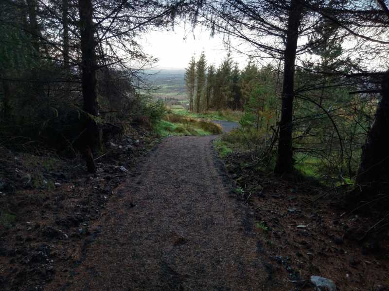
A new pathway around the summit has been installed over the summer.
Walkers are now met with a locked gate within circa 50 yards of the masts and trig point, but a new and quite attractive pathway to the left leads around the perimeter of the summit area and leads to another, unlocked, gate which gives access to the summit proper.
Somewhat bizarrely, the visitor is still greeted with a misleading "No unauthorised persons beyond this point" sign at the gate at the foot of the access road. Linkback: mountainviews.ie/summit/974/comment/20203/
Read Less
Read More
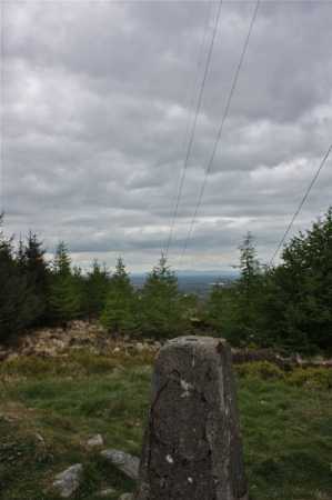
Picture: Summit cairn an the view NW.
No escape from the modern world
by csd
9 May 2010
Despite its modest elevation, Corn Hill has one of the largest TV/telecommunications installations adorning its summit I've seen on this island. The forestry is beginning to encroach on the view from the top, and the constant drone of the air conditoners in the service building take away from the attraction of this summit, but at least it's very easily gained! The presence of such a large telecomms installation means that I'm typing this as I sit beside the summit cairn, with a good 3G signal to speed the upload of the photo I've just taken! Is this MV's first 'live on the scene' comment? :) Linkback: mountainviews.ie/summit/974/comment/4697/
Read Less
Read More
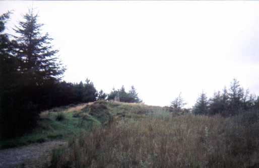
Picture: The mast. Some say its ugly, to me its like a modern art instillation at the summit.
Well worth the walk - even from the wrong direction
by tomasocarthaigh
1 May 2014
I came up the wrong face, over fields and bog not on paths, to spite my best efforts to follow the "maer ditch" by kind permission of a local landowner. It was worth it though, the views that end are spectacular.
Coming down the correct path, and walking to Edenmore via Mallons Cross, Aughadowery Cross was a walk in itself.
As a writer - according to myself, I wrote these few words after: http://www.writingsinrhyme.com/index.php/cairn-hill-stanzas-from-the-summit/ Linkback: mountainviews.ie/summit/974/comment/16048/
Read Less
Read More
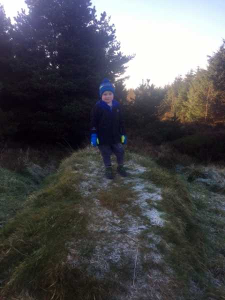
Picture: My Summit Picture
My Climb in Longford 02-01-2017
by ShaunDunne
4 Jan 2017
I climbed Corn Hill on the 02-01-2017 with my Grandad.
It was cold today, but I was excited as this was my second county high point today Linkback: mountainviews.ie/summit/974/comment/18790/
Read Less
Read More
Picture: Trig point on Corn Hill
murphysw on Corn Hill
by murphysw
15 Sep 2008
I climbed this the same day as Mullaghmeen in Westmeath and Slieve na Caillagh in Meath thus bagging three county high points in the one day. It was away back in 2005 so dont remember much other than that it was maybe the easist high point of the lot. There is only one room for a car to park at the bottom of the tv road. The views are good but not 360 degrees owing to the tv mast and the accompanying clump of trees at the top Linkback: mountainviews.ie/summit/974/comment/3321/
Use of MountainViews is governed by conditions and a privacy policy.
Read general information about the site. Opinions in material here are not necessarily endorsed by MountainViews.
Hillwalking is a risk sport. Information in comments, walks, shared GPS tracks or about starting places may
not be accurate for example as regards safety or access permission. You are responsible for your safety and your permission to walk.
See the credits and list definitions.


 Our Facebook page.