This website uses cookies, which are small text files that the website puts on your device to facilitate operation. Cookies help us provide a better service to you. They are used to track general user traffic information and to help the website function properly.
Feature count in area: 19, all in Mayo,
OSI/LPS Maps: 22, 23, EW-WNN
Highest Place: Maumakeogh 379m
Starting Places (9) in area North Mayo: Bangor Trail Head, Carnhill, Carrowmore Wood, Erris Head, Portacloy Bay, Proesoon, Sralagagh West, Termon Hill Road, Tower Hill South
Summits & other features in area North Mayo: Cen: Pulathomas: Barnacuillew 260m E: Ballycastle Hills: Knockaghaleague 237m, Knockboha 186m, Maumakeogh 379m N: Benwee Head Cliffs: Benwee Head 255m, Barradeegin 229m, Glinsk 304m, Illanmaster 238m, Illanmaster Island 105m, Porturlin Hill 155m, Srahataggle 182m, Tawnaghmore 340m S: Bangor Erris Hills: Carrafull 269m, Knocklettercuss 370m, Knocknascollop NW Top 244m, Sheean 295m, Slieve Fyagh 335m W: Belmullet: Aghaglasheen 132m, Termon Hill 103m
Note: this list of places may include island features such as summits, but not
islands as such.
Tawnaghmore, 340mHill An Tamhnach Mhór A name in Irish,
Place Rating ..
(Ir. An Tamhnach Mhór [logainm.ie], 'the big field'), Mayo County in Connacht province, in Binnion Lists, Tawnaghmore is the third highest hill in the North Mayo area and the 1074th highest in Ireland.
Grid Reference F95964 39539,
OS 1:50k mapsheet 23 Place visited by: 9members, recently by: Wilderness, TommyV, Fergalh, sandman, Garmin, chalky, FilHil, Geansai, IncaHoots
I visited this place: NO (You need to be a logged-in member for this.)
Longitude: -9.598552, Latitude: 54.294035, Easting: 95964, Northing: 339539,
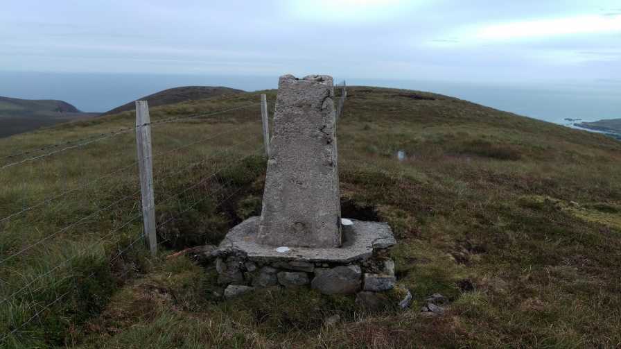
Prominence: 275m, Isolation: 2.8km, Has trig pillar
ITM: 495936 839541 Bedrock type: Monotonous massive to banded psammites., (Broad Haven Formation) Notes on name: Tawnaghmore appears to be identical with Thauney, one of the peaks mentioned by Máire MacNeill, which is visited on Garland Sunday by the children of Belderg. Berries are gathered, and if the berries are plentiful, it is said that the crops will be good [MacNeill, 189]. Walks: for a cliff-top route from Porturlin to Belderg, passing near Tawnaghmore, see Whilde & Simms, New Irish Walk Guide - West and North, 78-79.
Short or GPS IDs, 6 char: Twnghm, 10 char: Twnghmr Linkback: https://mountainviews.ie/summit/910/
Gallery for Tawnaghmore (An Tamhnach Mhór) and surrounds
No summary yet for this place
.
Member Comments for
Tawnaghmore (An Tamhnach Mhór)
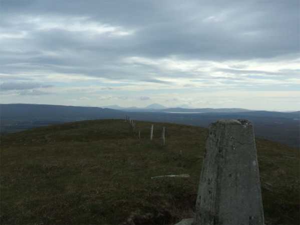
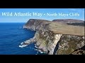
Picture: Looking towards Slieve Mor on Achill Island
Vista over North Mayo
by Geansai
2 Jul 2011
A track leads to the saddle between Tagwnaghmore and point 303 meters from A (G980 402). It was a bit awkward trying to park on the side of the road there without blocking a gate or the road so I had a look round and parked outside the school where there's a shoulder off the road, this being a saturday. The school is marked on the os map due east of the track about a fifteen minute walk away but maybe it wouldn't be a good idea on weekdays. The track peters out into clusters of stones and then a boggy section. There's a fence to be negotiated at the saddle. I had asked a farmer I ran into at the start if it was ok to go up the mountain this way and he said no problem so I hopped over the fence and turned left to make the final ascent. Nice views over to Glinsk and the coastline and to the south the shapes of Slieve Mor, Slieve Carr Nephin Beg Nephin Mor and others inbetween are clearly visible. Linkback: mountainviews.ie/summit/910/comment/6394/
Read Less
Read More
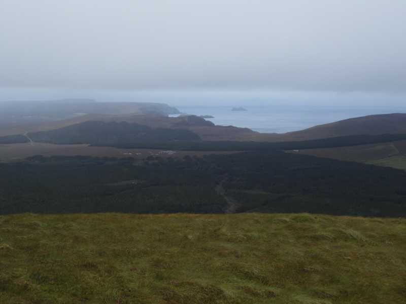
Picture: The North Mayo Coastline
Rural Mayo
by TommyV
9 Sep 2019
Followed the directions provided by Geansai. Just to mention with a bit of tidy parking it's possible to fit a car at the start of the bog road at B (F97993 40155). I wouldn't recommend driving any further if you value your car in any way. Surprisingly good views at the summit. Linkback: mountainviews.ie/summit/910/comment/20649/
Read Less
Read More
Picture: Summit Area.
The Big One.
by sandman
2 Sep 2016
As mentioned in the previous comment parking is difficult on the tarred road but in a vehicle with normal ground clearance you can turn and park at the end of the bog track, C (F97137 40388), after this point the track is of a bygone era not pretty in wet weather. Alternative route from the opposite side parking at farm road D (F95442 41331) . Truly good views from summit trig. Linkback: mountainviews.ie/summit/910/comment/18625/
Use of MountainViews is governed by conditions and a privacy policy.
Read general information about the site. Opinions in material here are not necessarily endorsed by MountainViews.
Hillwalking is a risk sport. Information in comments, walks, shared GPS tracks or about starting places may
not be accurate for example as regards safety or access permission. You are responsible for your safety and your permission to walk.
See the credits and list definitions.


 Our Facebook page.