Cookies.
This website uses cookies, which are small text files that the website puts on your device to facilitate operation. Cookies help us provide a better service to you. They are used to track general user traffic information and to help the website function properly.
Features
Nearby features appear when you click the map.
Declutter tracks on map.
Place Search
Video
X
Pub: by
Dublin Area , S: Saggart Subarea
Feature count in area: 18, by county: Dublin: 16, Wicklow: 7, Kildare: 1, of which 6 are in both Dublin and Wicklow, OSI/LPS Maps: 43, 50, 56, AWW, EW-DM, EW-WE, EW-WW
Highest Place: Kippure 757m

Starting Places (77) in area Dublin:
Allagour Road, Ballinascorney Golf Club, Ballylerane, Ballylow Bridge, Ballyreagh Wood, Ballyross Forest, Ballysmuttan Long Stone, Barnaslingan Wood, Bohernabreena North CP, Boranaraltry Bridge, Bray Harbour, Cabinteely House, Cannon's Corner, Carrickgollgan, Castelkelly Bridge, Clonkeen Road South, Cloon Wood Cp, Cransillagh Brook , Crone Wood CP, Cruagh Forest Recreation Area, Cruagh Road Hairpin, Curtlestown Wood CP, Dunnes Bank, Enniskerry, Fernhill Estate, Gap Road, Garadhu Road, Glencree Reconciliation, Hell Fire Wood CP, Johnnie Fox Pub, Kilbride Army Camp Entrance, Kilgobbin Lane, Killakee Car Park, Killiney Hill Carpark, Kilmashoge Forest CP, Kilsaran Quarry, Kippure Bridge, Kippure Estate, Kippure Transmitter Gate, Knockbrack, Knockree west, Lackan Wood S, Lamb Doyles, Laughanstown Luas, Lee's Lane, Liffey Bridge, Liffey Head Bridge, Lough Bray Lower, Lough Bray Upper, Lynch's Park Road, Marley Park CP, Novara Avenue, Bray, Old Wicklow Way entrance, Pavilion Theatre, Pine Forest Road, Putland Road, Raheenoon, Rathmichael RC Church, Rathmichael Wood CP, Sally Gap, Sally Gap N, Seahan 265', Seahan 300', Sean Walsh Park, Seefin Trailhead, Shankill Byrnes Bar, Shankill Tributary Bridge, Slademore Road, Sraghoe Brook, St Catherine's Park, The Lamb Hill, The Scalp, Tibradden Forest Recreation Area, Tibradden Lane, Ticknock Forest, Vance's Lane, Wyattville Close

Summits & other features in area Dublin:
N: Howth: Ben of Howth 171m
N: Naul: Knockbrack 176m
S: Dublin South East: Carrickgollogan 275.2m, Glendoo Mountain 585.1m, Killiney Hill 153.5m, Knocknagun 555.3m, Montpelier Hill 383m, Prince William's Seat 553.5m, Tibradden Mountain 466.2m, Two Rock Mountain 536m
S: Kippure & Kilbride: Corrig Mountain 617.1m, Kippure 757m, Seahan 647.3m, Seefin 620.6m, Seefingan 722.9m
S: Saggart: Cupidstown Hill 378.6m, Knockannavea 400.8m, Saggart Hill 396.9m

Note: this list of places may include island features such as summits, but not islands as such.
Rating graphic.
Saggart Hill, 396.9m Hill Cnoc Theach Sagard A name in Irish,
Place Rating ..
(Ir. Cnoc Theach Sagard [OSI], 'hill of Teach Sagard or Saggart'), Dublin County in Leinster province, in Binnion Lists, Saggart Hill is the 964th highest place in Ireland. Saggart Hill is the second most westerly summit in the Dublin area.
Grid Reference O01673 22877, OS 1:50k mapsheet 50
Place visited by: 166 members, recently by: Tommer504, Carolineswalsh, NualaB, nupat, Kaszmirek78, miriam, tonibm, hak493r, johncusack, michaelseaver, glencree, FerdiaScully, megk971, pdtempan, Dee68
I visited this place: NO (You need to be a logged-in member for this.)
Longitude: -6.477653, Latitude: 53.246793, Easting: 301674, Northing: 222878, Prominence: 160m,  Isolation: 2.6km
ITM: 701600 722906
Bedrock type: Slate & greywacke, (Slate Quarries Formation)

  Short or GPS IDs, 6 char: Sgr397, 10 char: Sagart Hil

Linkback: https://mountainviews.ie/summit/848/
Gallery for Saggart Hill (Cnoc Theach Sagard) and surrounds
Summary for Saggart Hill (Cnoc Theach Sagard): Summary
Summary created by simon3, Dessie1 2013-06-23 21:42:19
            MountainViews.ie picture about Saggart Hill (<em>Cnoc Theach Sagard</em>)
Picture: Saggart Hill from the south.
Starting at Lee Ln (O01355 22458), Parking at entrance gate walk approx 400m bearing 25 deg true until track sweeps around to the right.Take this route until the track takes another turn to the left after approx 180m.This track then leads to the mast covered 395m summit.
Nice views to the NW and a couple of overgrown passage tombs (A (O01761 23072) and B (O01962 22974)) are found near the summit.
Linkback: mountainviews.ie/summit/848/comment/5607/
Member Comments for Saggart Hill (Cnoc Theach Sagard)
Comment create / edit display placeholder

            MountainViews.ie picture about Saggart Hill (<em>Cnoc Theach Sagard</em>)
Picture: Passage tomb on summit
The back of a porcupine.
by padodes 23 Jun 2013
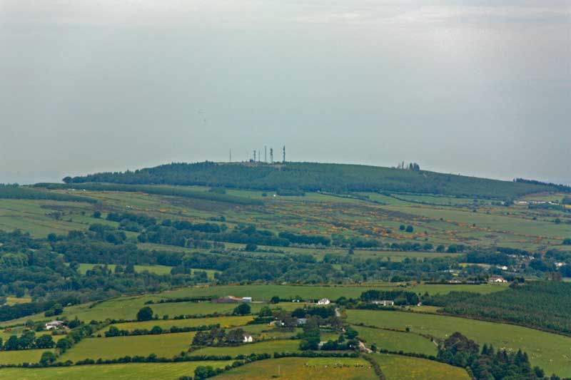
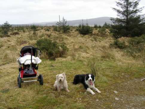
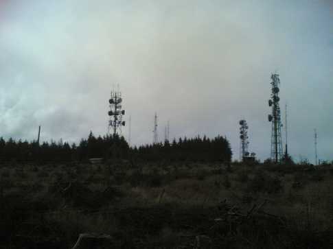
Saggart Hill (Slievethoul), with its bristling array of masts like quills on the back of a porcupine, is the westernmost of the Dublin Mountains. It’s a somewhat neglected place, no doubt, but it responds well to a bit of interest. Starting from the forest entrance at LynchRd (O024 235), a track circles the hill and comes close to the summit on its southwestern side, with an access route leading up.

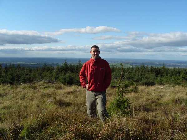
The hill doesn’t only give fine views of the plains of Kildare to the west and the rolling mountains to the east of Brittas and Blessingon. It also provides a glimpse of the past. To begin with, you find yourself walking here, not on Leinster granite, but on clayey deposits, sandstone, siltstone and shale, laid down at the end of the last glacial period along the rim of the midland ice sheet, where its meltwaters, together with those of the glaciers descending from the mountains to the east, formed a great lake, far bigger than the present Pollaphuca Reservoir. Who knows if Brittas Lake, of which there is a good view from Saggart Hill, is not a tiny remnant of the original lake, as some would suggest? The OS Map does identify a bushy island there as an age-old crannóg, but other accounts I have read say the lake was only created in the 19th century to form a head of water for mills on the Camac River, which flows on to meet the Liffey just downstream of Heuston Station. Paper and even gunpowder mills once used this watercourse in Clondalkin.

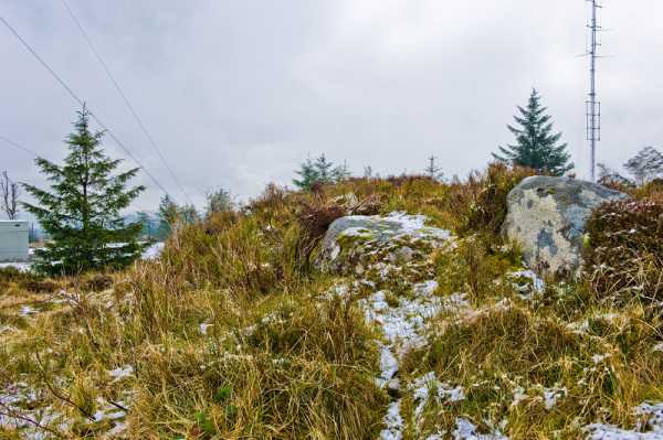
Another glimpse of the past comes from the numerous megalithic monuments that dot Saggart Hill and its northward prolongation, Knockananiller and Knockandreenagh. The passage grave on Saggart Hill itself is overshadowed now by a big mast but is still readily visible as an overgrown mound, which seems to mark the highest spot on the flat summit. The central chamber has been disturbed but the inner walls are discernible, as are two large kerbstones on the south side. It’s sad to see the legacy of the past pushed aside in this way by technocracy, but at least, as a 2006 study would assure us, radiant energy on the hill is within safe limits, so walkers can probably examine the megalith without fear of being fried! Linkback: mountainviews.ie/summit/848/comment/4405/
Read Less
Read More

            MountainViews.ie picture about Saggart Hill (<em>Cnoc Theach Sagard</em>)
Picture: The nicer side to Saggart Hill!
wicklore on Saggart Hill
by wicklore 15 Mar 2009
We took our 10 week old daughter on her first outing to the hills today. Our dogs joined us to share the occasion. We chose Saggart Hill, as a handy forest track leads to the summit area which we could push the buggy along. It is still the same ugly place as before, with evidence of car bonfires at the forestry entrance, random debris in the trees and a mini telecommunications city at the summit. However by turning our backs on the summit buildings it was possible to enjoy the part of the summit that is grassy and 'wild'. Views across to the Dublin/Wicklow range are restricted by forestry, but Seahan was visible. It is actually from the forestry entrance that the best views of the Dublin/Wicklow hills can be had-all the way south to Silsean and Moanbane, and SE to Mullaghcleevaun East Top and Duff Hill. Little Cupidstown Hill-the highest point in Kildare-is 2kms to the south of Saggart Hill, and is distinctive with its single phone mast sticking out above the forestry at the summit. Our little girl enjoyed her visit to Saggart Hill and brought some new life to this sad summit. Linkback: mountainviews.ie/summit/848/comment/3643/
Read Less
Read More

            MountainViews.ie picture about Saggart Hill (<em>Cnoc Theach Sagard</em>)
Picture: I Mast be mad!
I Mast be mad!!!
by Dessie1 24 Sep 2010
On my second attempt at this hill after abondoning first attempt due to a dead horse lying at the entrance to the access road ( Lee Ln (O013 225)). Walked on main track which veers to the left (Wrong way) and the right all the way to the buzzing summit. Masts everywhere ruin what has the makings of a nice summit and walk.Thankfully the clear weather allowed for great views all the way across to the hill of Allen in Kildare which made up for the monstrosoty behind the camera. Linkback: mountainviews.ie/summit/848/comment/6108/
Read Less
Read More

            MountainViews.ie picture about Saggart Hill (<em>Cnoc Theach Sagard</em>)
Picture: Fly-tipping at Saggart Hill
csd on Saggart Hill
by csd 29 Dec 2008
Having read wicklore's comments on Saggart Hill, I was greeted by the sight shown in the photo accompanying this comment when I parked at the suggested spot (whose co-ordinates should be Lee Ln (O013 225) rather than N). Safe to say, I wasn't expecting much, but Saggart Hill had a few surprises for me. Firstly is the view. While the summit area is littered with masts and other networking paraphernalia, the tree felling means that there are some great views over west Dublin and Kildare. The other thing I wasn't expecting was a herd of deer (see my other comment). Linkback: mountainviews.ie/summit/848/comment/3491/
Read Less
Read More

            MountainViews.ie picture about Saggart Hill (<em>Cnoc Theach Sagard</em>)
Picture: Anyone want to play 'count the masts'?
wicklore on Saggart Hill
by wicklore 28 Mar 2009
Taking advantage of a half day on this miserable rain-lashed Friday I decided to take a look at Saggart Hill. I was curious why no one had posted a report before, and why only one member had even claimed climbing it. Feeling like a pioneer braving a new frontier I donned my waterproofs and set off.
At Brittas on the N81 (about 10 minutes drive out of Tallaght) I took a right and found my way to the forestry road at Lee Ln (O014 225) (OS map 50). Walking up the forestry road I passed loggers and the inevitable "Do not Climb on Timber Stacks" signs. The rough road led to the top in about 10 minutes. There were three junctions along the track and I simply took the uphill option each time.
My pioneering hopes were dashed as I reached the most industrialised hilltop I have ever seen. At every turn there were masts, transmitters, buildings, spiked fences and, believe it or not, security cameras. I counted about 10 masts of various sizes, enclosed in separate compounds. It was like Ballymount Industrial Estate up there, and I wondered if security staff would appear from the many structures to chase me off.
The summit is relatively flat. It was obviously cleared of forestry in the past to make way for the masts and buildings. I think the bulldozers just pushed everything to the north and east, making the ground there difficult to walk on.
I searched in vain around the hilltop for a redeeming feature, but even the ringfort to the east of the "summit" was a sad affair, barely discernible from the surrounding wasteland. A forlorn looking dead tree stands over it for those of you seeking it.
The views out to the east and south would be great in clear weather. Even with the rain and cloud I could see across to Seahan and Corrig and further south to Sorrell and beyond.
As I left this miserable hilltop I took a route through the trees desperate to find something of interest to report to MV. I found a carefully made scrambler course in the forest and I was glad someone is getting pleasure from Saggart Hill. Linkback: mountainviews.ie/summit/848/comment/3284/
Read Less
Read More
EDIT Point of Interest
text
Videos

Recent Contributions
x
Conditions and Info
Use of MountainViews is governed by conditions and a privacy policy.
Read general information about the site.
Opinions in material here are not necessarily endorsed by MountainViews.
Hillwalking is a risk sport. Information in comments, walks, shared GPS tracks or about starting places may not be accurate for example as regards safety or access permission. You are responsible for your safety and your permission to walk.
See the credits and list definitions.

OSi logo
OSNI/LPS logo
Open Street Map
(Various variations used.)
British summit data courtesy:
Database of British & Irish Hills