Cookies.
This website uses cookies, which are small text files that the website puts on your device to facilitate operation. Cookies help us provide a better service to you. They are used to track general user traffic information and to help the website function properly.
Features
Nearby features appear when you click the map.
Declutter tracks on map.
Place Search
Video
X
Pub: by
Antrim Hills Area , Cen: Central Antrim Hills Subarea
Feature count in area: 27, all in Antrim, OSI/LPS Maps: 14, 15, 4, 5, 8, 9
Highest Place: Trostan 550m

Starting Places (3) in area Antrim Hills:
Donalds Carn, Rathlin Island Ferry Port, Whitehead Golf Club

Summits & other features in area Antrim Hills:
Cen: Central Antrim Hills: Carncormick 436m, Collin Top 429m, Crockalough 402m, Mid Hill 440m, Skerry Hill 459m, Slieveanorra 508m, Slievenahanaghan 418m, Soarns Hill 403m, Tievebulliagh 402m, Trostan 550m
Central Antrim Hills: Slievenanee 543m
N: North Antrim Hills: Carnanmore 379m, Croaghan 417m, Crockaneel 403m, Cross Slieve 206m, Knocklayd 514m, Lannimore Hill 207m
N: Rathlin Island: Kilpatrick (Rathlin Island) 134m
S: Islandmagee: Donalds Carn 141m, Muldersleigh Hill 131m
S: South Antrim Hills: Agnew's Hill 474m, Big Collin 353m, Black Hill 381m, Carnearny 319m, Douglas Top 402m, Slemish 437.9m
W: West Antrim: Long Mountain 215m

Note: this list of places may include island features such as summits, but not islands as such.
Rating graphic.
Soarns Hill, 403m Hill Sliabh Bán A name in Irish,
Place Rating ..
(Ir. Sliabh Bán [OSI], 'white or fallow mountain') Slievebane an extra name in English, Antrim County in Ulster province, in Carn Lists, Soarns Hill is the 927th highest place in Ireland.
Grid Reference D21085 14081, OS 1:50k mapsheet 9
Place visited by: 32 members, recently by: Colin Murphy, Paddym99, garybuz, Andy1287, Kilcoobin, eamonoc, Fergalh, Xiom5724, LorraineG60, MichaelG55, Ulsterpooka, trostanite, Wilderness, whoRya, Peter Walker
I visited this place: NO (You need to be a logged-in member for this.)
Longitude: -6.110526, Latitude: 54.959558, Easting: 321085, Northing: 414081, Prominence: 38m,  Isolation: 1.8km
ITM: 721007 914066
Bedrock type: Olivine basalt lava, (Upper Basalt Formation)
Notes on name: The Irish name, Sliabh Bán, is fairly transparent. However, the origin of the English name, Soarns Hill, is obscure. It may be derived from Ir. sorn, 'kiln', but the hill seems rather too high and remote for this. There were limekilns near the coast at Carnlough.
  Short or GPS IDs, 6 char: SrnsHl, 10 char: Soarns Hil

Linkback: https://mountainviews.ie/summit/810/
Gallery for Soarns Hill (Sliabh Bán) and surrounds
Summary for Soarns Hill (Sliabh Bán): Long, tough tramp through high heather & grass
Summary created by Colin Murphy 2023-09-14 11:09:57
            MountainViews.ie picture about Soarns Hill (<em>Sliabh Bán</em>)
Picture: High point
One approach is via Mid Hill - starting from the Cargan Dam car park at A (D19239 17217). Cross the dam and turn left, crossing two stiles and following a narrow trail along the south side of the reservoir, crossing over a small bridge to roughly B (D19759 17078), where you can strike out in a southerly direction towards the summit. The climbing is gentle (roughly 150m over 1.5km) but the terrain is very rough and covered in long reeds, knee-high heather and equally long grass almost the whole way. From Mid Hill, continue SE over shortish grass, boggy in places, along the edge of the forest to C (D20686 14632), and proceed SE up a fire break to D (D21264 14439). Turn SW up another fire break for about 500m to unmarked high point. Return via same route.
Linkback: mountainviews.ie/summit/810/comment/5569/
Member Comments for Soarns Hill (Sliabh Bán)
Comment create / edit display placeholder

            MountainViews.ie picture about Soarns Hill (<em>Sliabh Bán</em>)
Picture: The forest on top of Soarns Hill
Forested summit
by slemish 22 May 2013
Getting to the summit of Soarns Hill is difficult and the extensive forestry means that views are severely limited. But as it qualifies under MV prominence rules, off I went to climb it. I parked at the bottom of the access road to the Quolie reservoirs (E (D174 114)). This is also a good spot to park if climbing neighbouring Carncormick. Unfortunately this route involves a lot of road walking - this is no problem to me but some people don't like using paved surfaces as part of a hillwalk. You follow the road up the Quolie valley past the two reservoirs - about 2 miles. This part of the walk was easy and very peaceful with only the sound of the running water and the occasional bleating of sheep breaking the silence. Once past the higher reservoir there are a couple of stiles to negotiate. Follow the Soarns river uphill from here, climbing gradually. Eventually you come over the crest of the hill and the huge forest opens up in front of you. If you head on in a north-easterly direction you will soon see a firebreak to your right (F (D200 140)). Ignore this firebreak and keep going in the same direction until you reach the next one (G (D205 144)). This is the one you want - head on through here, past the first firebreak 'crossroads' in the forest then uphill to the 403m summit just at the second 'crossroads' that you come to. As Harry Goodman notes the summit position listed here on MV isn't in fact the summit at all [now fixed]. Just outside the forest is the best place for views - to the south, Slemish and the Braid valley and to the west the outline of Slieve Gallion was easy to pick out. Mid Hill and Carncormick unfortunately block the view north to the higher Antrim hills. I returned to the car by way of ascent. Took much longer than I expected - well over 2 hours - the walk along the reservoirs was pleasant enough but after that the terrain becomes difficult. I wouldn't really recommend this hill unless like me you were ticking it off. Linkback: mountainviews.ie/summit/810/comment/4647/
Read Less
Read More

            MountainViews.ie picture about Soarns Hill (<em>Sliabh Bán</em>)
Picture: Gloves mark the spot
Firebreak Bliss
by eamonoc 31 Mar 2019
Visited Soarns Hill on Thursday 21st March in atrocious weather, almost zero visibility and the 20km trek around Carncormick, Mid Hill and Colin top was akin to Mid Antrim water torture. Spent most of the day up to me Ankles in water
and the only respite came in the shape of the firebreak on Soarns Hill!!. In the midst of a 5hr soul searching exercise and repeating the mantra Why Oh Why!. Spotted a pair of Gloves beside the fence at entrance to said firebreak, rstored my faith in Mountainviews as gloves belonged to Fergal H. he had visited on 2nd December, dedicate this comment to the other 25 members who dared to visit Soarns Hill, If in Antrim well worth a viisit, if you must Linkback: mountainviews.ie/summit/810/comment/20475/
Read Less
Read More

            MountainViews.ie picture about Soarns Hill (<em>Sliabh Bán</em>)
Picture: The view NW across to Mid Hill from the summit of Soarns Hill
Local summit visit
by Harry Goodman 24 Jul 2013
Climbed Soarns Hill to-day (17 Oct 09) as one of the 100 listed hills nearest to my home. I used three5four0's very helpful route description. The following additional information may be useful. The second farm up the lane is called "Cleggan Cottage" and is a short distance from the old gate mentioned by three5four0. This gate and the right turn immediately after it are at H (D20800 11150). The next gate is still padlocked and is the entrance to Cleggan Forest with a name board to the left. After the gate the turn to the left off this track is at I (D21300 12700) and heads NNE for about 700m to J (D21550 12300)and the next left turn. Seven hundred metres along this track is the firebreak which goes to the top. It is at K (D20900 13600) and heads NNE. Although only 500 metres long it is the sting in the tail for this walk. The going is heavy without any sign of a path. Clearly a road less travelled.

Once at the top an important point must be made regarding the summit at 403m.
* three5four0 suggests that you can descend to the track by a shorter route down the firebreak going NE, this should in fact read NW and takes you down to the track at L (D207 143) where a left turn takes you along past the firebreak taken earlier to the top. From there simply re-trace your outward route. three5four0 did this walk on a rainy day. To-day was dry and bright and the views across to Slemish and the hills along the edge of the Antrim Plateau were very pleasant indeed.

One final point, the Glens of Antrim Activity Map Scale 1:25,000 is a must for anyone wanting want to check where they are along the tracks in the forest as this is the only map on which they are marked. Linkback: mountainviews.ie/summit/810/comment/4190/
Read Less
Read More

three5four0 on Soarns Hill
by three5four0 21 Oct 2008
Soarns Hill, a hill for bad weather.

With a forecast of high winds and rain, Soarns Hill with its extensive forestry, seemed a good choice for the prevailing conditions this Sunday. With little in the way of parking in the area, we choose to park at the Half Way House pub's car park (M (D210 096)), with the full intention of purchasing several pints on our return, as way of payment.
Cross the road and take the Longmore Road till 
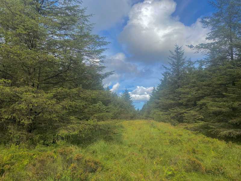
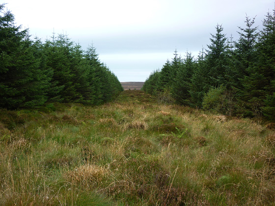
N (D207 100), follow this lane up hill, past two farms (one currently for sale) and through an old gate (watch it doesn't fall down when you close it!). Take the track on your right (immediately after the gate) following it to another gate, this time padlocked, but easy to get over. You are now in Gleggan Forest, which is run by the Forestry Service, so there should be no problems with access. Those who have wisely invested in the new 1:25000 Glens of Antrim Activity Map, by the Ordnance Survey of Northern Ireland will confidently stride out along the forestry tracks. Those with the older 1:50000 series, may feel a little less confident, usually the result of trying to follow tracks and firebreaks in a forest with a 1:5000 map before!
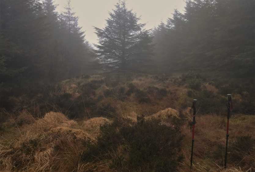
Follow this forestry track to first junction and turn left at it, then left again at the next track junction till the firebreak at 
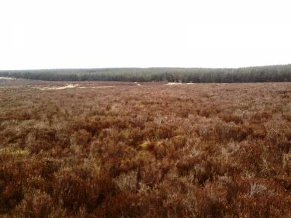
O (D208 136). Follow this up hill over the usual tussocks and holes (going north, north east) to a 4 way firebreak junction and that's the summit, a small rise just before the junction looks slightly higher, but you walked over this to get to the junction. You can descend the firebreak going north east, which is shorter and perhaps not as bad as the route of ascent, crossing a small ditch when you arrive back at the track. Turn left and follow the tracks & lanes back to the Half Way House Inn / Pub, which serves a good pint of Guinness, and judging by the amount of people eating meals there, tasty food as well. Linkback: mountainviews.ie/summit/810/comment/3393/
Read Less
Read More

            MountainViews.ie picture about Soarns Hill (<em>Sliabh Bán</em>)
Picture: Firebreak Heaven
Maybe, a not so hidden Central Antrim Gem of a hill
by eamonoc 3 Jan 2023
A bit of a treat to have this one out of the way Linkback: mountainviews.ie/summit/810/comment/23783/
Read Less
Read More
EDIT Point of Interest
text
Videos


Recent Contributions
x
Conditions and Info
Use of MountainViews is governed by conditions and a privacy policy.
Read general information about the site.
Opinions in material here are not necessarily endorsed by MountainViews.
Hillwalking is a risk sport. Information in comments, walks, shared GPS tracks or about starting places may not be accurate for example as regards safety or access permission. You are responsible for your safety and your permission to walk.
See the credits and list definitions.

OSi logo
OSNI/LPS logo
Open Street Map
(Various variations used.)
British summit data courtesy:
Database of British & Irish Hills