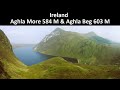
Of the seven sisters in the Derryveagh range Na Leargacha must be considered the saddest. For most walkers, myself included, Na Leargacha is often considered as the barrier on the main walk to the Aghla’s. A mere footnote in walking terms. And I would still think of it in the same way had I not climbed it in full sunshine and with new eyes.
I walked Na Leargacha in early April 2008 when the sun was shining and the breeze would cut you in two, perfect walking weather, on my way to (you guessed it) the Aghla’s. But I soon gained a new respect for Na Leargacha for its wonderful rocky crags and cliff faces and I will consider climbing it again specifically, maybe as a circular walk.
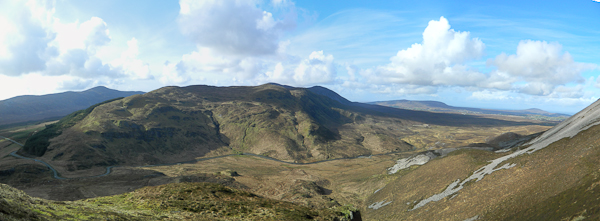
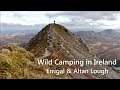
OSI sheet 2 is the map to use. Getting to the start point is very easy, on the road from Letterkenny to Gweedore you will pass the entrance to Glenveagh National Park, about 2 or 3 miles on you will see a sign for Falcarragh on the right. This will lead you up to Muckish Gap where you can park beside the grotto. Behind the grotto is Muckish and much has been said about it, but turn around and face the other way and you will see the start of Na Leargacha(
A (B998 269)). Interesting point, when I parked there last it was actually a hundred yards further on from the grotto and it offered a great view of the relatively dramatic northern face of Na Leargacha, crags and slopes galore.
From the start point, climb the steep slope, keeping as close as possible to the fence. The fence will guide you well to the top. Once you have past the forestry the top of the hill opens out onto sheep-grazed tundra. The actual top of Na Leargacha is 3 or 400 hundreds yards to the right of the fence line at
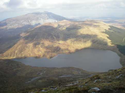
D (B984 262). From there I went back to the fence and lunched on the sheltered northern shore of Lough Dog. From this point on, the view is dominated by the Aghla’s rising out of the far shore of Lough Aluirg. I descended with the upper crags on my right, skirted the top of the lower crags and descended with the lower crags on my left. I followed the stream down the Lough’s shore and rested at its northern exit (
E (B971 256)).
As I said before I was on a mission to the Aghla’s, but for anybody that wanted to call it a day at this point will have a choice of exit, to return to Muckish Gap. You either follow the stream flowing out of the northern end of Lough Aluirg, called the Ballyness on the map, or you can exit at the southern end through the forestry. Either way will get you back to the road. The OSI map is pretty accurate as regards the lanes and bog roads in this area.
Linkback: mountainviews.ie/summit/545/comment/3066/
Read Less


 Add a Place Comment for Crocknalaragagh, Na Leargacha


 Our Facebook page.