This website uses cookies, which are small text files that the website puts on your device to facilitate operation. Cookies help us provide a better service to you. They are used to track general user traffic information and to help the website function properly.
Feature count in area: 14, all in Clare,
OSI/LPS Maps: 51, 51A, 57, 63, 64
Highest Place: Knockardakin 203m
Starting Places (7) in area Clare Coastal Hill: Abbey Hill, Ballyvelaghan Lough, Burrane National School, Kilconnell CP, Kilmore House, Loop Head NE Top, Shanganagh
Summits & other features in area Clare Coastal Hill: Ballard Hill 75m, Burrane Upper 65m, Corbally Top 102m, Kilcloher Head 55m, Kilmore 68m, Knockardakin 203m, Knockvorneen 77m, Lislorkan Top 175m, Loop Head NE Top 78m, Luogh South 186m, Munnia Top 65m, Rehy Hill 116m, Shanganagh 66m, Stockeen Cliff Top 185m
Note: this list of places may include island features such as summits, but not
islands as such.
Munnia Top, 65mCoastal Hill Cartron Top A name in English,
Place Rating ..
, Clare County in Munster province, in no lists Grid Reference M29015 11983,
OS 1:50k mapsheet 51 Place visited by: 6members, recently by: markmjcampion, eamonoc, Fergalh, melohara, conormcbandon, sandman
I visited this place: NO (You need to be a logged-in member for this.)
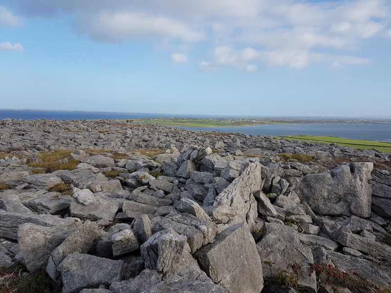
Best to access this hill via the farm gate located on the the coastal side at A (M29291 12163) in order to avoid the houses on the opposite side. Just a quick up and down over grazing land to begin and then over the natural stone of The Burren. Views across Galway Bay and Aughinish Island. Linkback: mountainviews.ie/summit/5087/comment/19795/
Use of MountainViews is governed by conditions and a privacy policy.
Read general information about the site. Opinions in material here are not necessarily endorsed by MountainViews.
Hillwalking is a risk sport. Information in comments, walks, shared GPS tracks or about starting places may
not be accurate for example as regards safety or access permission. You are responsible for your safety and your permission to walk.
See the credits and list definitions.


 Our Facebook page.