Welcome to MountainViews
If you want to use the website often please enrol (quick and free) at top right.
If you want to use the website often please enrol (quick and free) at top right.
Overview

For more map options click on any overview map area or any detail map feature.
Detail Map Features
Find Suggested Walks
Find hill, mountain, island, coastal feature.
Videos


Recent Contributions
 Get Notifications
Get Notifications
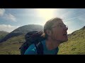
Hag's Tooth: This might hurt
 No1Grumbler
Galtymore: Dawn on Galtymore
 DeirdreM
One of Irelnad`s finest routes
Keale Mountain: Hard to access the top
Half Glencoaghan
East Girt Hill: Short trek from West Girt Hill
 Fergalh
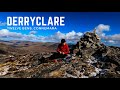
Traverse of Lackavrea
 glencree
West Girt Hill: Short trek to summit
 Fergalh
Belmore from NW - SOUTH route CLOSED
Hill of Stake: East trek along track to mines followed by wet heather bash
 Fergalh
Carrane from SSW
Fynloch Hill: Outlier of Kilpatrick Hills
 Fergalh
Conditions and Info
Use of MountainViews is governed by conditions and a privacy policy.
Read general information about the site.
Opinions in material here are not necessarily endorsed by MountainViews.
Hillwalking is a risk sport. Information in comments, walks, shared GPS tracks or about starting places may not be accurate for example as regards safety or access permission. You are responsible for your safety and your permission to walk.
See the credits and list definitions.
 Visit our Facebook page.
Video display
Maamturks
Area N: Maumturks N Cen Subarea
Place count in area: 27,
OSI/LPS Maps: 37, 38, 44, 45, EW-CON
Highest place: Binn idir an dá Log, 702m
Maximum height for area: 702 metres,
Maximum prominence for area: 629 metres,
Places in area Maamturks:
N: Leenaun:Maumturkmore 488mBúcán 550mLeenaun Hill 618mLeenaun Hill Far North-West Top 556mLettershanbally 324mMeall Cheo 578mTaobh Dubh 422m
N: Maumturks N Cen:Barrlugrevagh 558mLetterbreckaun 667mLetterbreckaun NE Top 603mKnocknahillion 607mKnocknahillion North Top 541mCúlóg 435m
S: Maumturks S Cen:Binn Chaonaigh 633.5mBinn idir an dá Log 702mBinn idir an dá Log SE Top 659.3mBinn Mhairg 612.4mKnocknagur 310m
S: Maumturks South:Binn Mhór 660.6mBinn Mhór NE Top 641.2mBinn Mhor West Top 595.8mBinn Mhor East Top 631.3mLissoughter 401mCorcogemore 610.1mMullach Glas NE Top 432mLackavrea 396mMullach Glas 621.3m
Note: this list of places includes island features such as summits, but not islands as such.
Highest place:
Binn idir an dá Log, 702mPlaces in area Maamturks:
N: Leenaun:
Maumturkmore 488mBúcán 550mLeenaun Hill 618mLeenaun Hill Far North-West Top 556mLettershanbally 324mMeall Cheo 578mTaobh Dubh 422mN: Maumturks N Cen:
Barrlugrevagh 558mLetterbreckaun 667mLetterbreckaun NE Top 603mKnocknahillion 607mKnocknahillion North Top 541mCúlóg 435mS: Maumturks S Cen:
Binn Chaonaigh 633.5mBinn idir an dá Log 702mBinn idir an dá Log SE Top 659.3mBinn Mhairg 612.4mKnocknagur 310mS: Maumturks South:
Binn Mhór 660.6mBinn Mhór NE Top 641.2mBinn Mhor West Top 595.8mBinn Mhor East Top 631.3mLissoughter 401mCorcogemore 610.1mMullach Glas NE Top 432mLackavrea 396mMullach Glas 621.3mNote: this list of places includes island features such as summits, but not islands as such.

Bedrock type: Pale quartzites, grits, graphitic top, (Bennabeola Quartzite Formation)
Binn Bhriocáin (mullach thoir thuaidh) is the 276th highest place in Ireland.
Linkback: https://mountainviews.ie/summit/264/
COMMENTS for Letterbreckaun NE Top (Binn Bhriocáin (mullach thoir thuaidh)) 1 of 1  Follow this place's comments

|
|
|
|
||
| MountainViews.ie, a Hill-walking Website for the island of Ireland. 2400 Summiteers, 1480 Contributors, maintainer of lists: Arderins, Vandeleur-Lynams, Highest Hundred, County Highpoints etc | |||