This website uses cookies, which are small text files that the website puts on your device to facilitate operation. Cookies help us provide a better service to you. They are used to track general user traffic information and to help the website function properly.
Feature count in area: 57, by county: Cork: 32, Kerry: 36, of which 11 are in both Cork and Kerry,
OSI/LPS Maps: 83, 84, 85, 88
Highest Place: Hungry Hill 682m
Starting Places (51) in area Caha Mountains: Ardgroom, Barley Lake North, Bere Island Pier, Caha Pass, Canshanavoe South, Carriganine, Cashelkeelty Stone Circles Carpark, Castletownbere Lifeboat Harbour, Clashduff River Farm, Coolieragh Harbour Road, Coomadayallig Lake Road N, Coomadayallig Lake Road S, Cooryeen Lane, Cummer Lough East Road, Derreenataggart Stone Circle Road, Dromoghty Lough North, Dunboy Wood, Esk Boreen, Eyeries, Fehanah Lane, Garinish Island Pier, Glantrasna Bridge, Glenbeg Lough N, Glengarriff, Glengarriff Nature Reserve CP, Gleninchaquin Waterfall, Gowlaun Lough, Healy Pass, Healy Pass Hairpin, Ilnacullin Car Park, Kenmare Bridge, Knockacullin Lane, Leahill Bog, Leitrim Beg Standing Stone, Lough Inchiquin SE, Magannagan Stream, Molly Gallivan's Visitor Centre, Nora's Cottage, Old Lansdowne School, Owgarriff River Lane, Peg's Shop, Pooleen Wood Car Park, Red Trout Lake, Reenroe Bridge, River Drimminboy Track, Rossmackowen Bridge, Rossmackowen Cemetery, Shronebirrane Farm, Shronebirrane Road, Toberbanaha, Turner's Rock Tunnel
Summits & other features in area Caha Mountains: Cen: Hungry Hill: Coombane 510m, Derryclancy 554m, Hungry Hill 682m Cen: Knockowen: Cushnaficulla 594m, Glenkeel Top 417m, Knockastumpa 398m, Knockeirky 577m, Knockeirky South Top 523m, Knockowen 658m, Stookeennalackareha 412m E: Glengarriff: Derrynafulla SW 375m, Gowlbeg Mountain 362m, Nareera 530m, Nareera North Top 503m, Nareera South-West Top 505m, Shrone Hill 283m, Sugarloaf Mountain 574m, Sugarloaf Mountain Far West Top 560m, Sugarloaf Mountain West Top 565m N: Coomnadiha: Baurearagh Mountain 489m, Caha Far SE Top 555m, Caha SE Top 585m, Coomnadiha 644m, Coomnalack Top 435m, Cummeenbaun 510m, Droppa 522m, Killane Mountain 537m, Killane Mountain South-West Top 533m, Knockagarrane 414m, Knockreagh 500m N: Knockeirka: Barraduff Mountain 400m, Killaha Mountain 400m, Knockeirka 426m N: Knocknagorraveela: Derrysallagh 410m, Feorus East 474m, Knocknagorraveela 507m, Knocknagorraveela NE Top 464m N: Lauragh: Knockanoughanish 386m, Knockatee 330m S: Castletownbere: Disert 205m, Knockanallig (Bear Island) 267m W: Ardgroom: Derryvour Hill 160m W: Eskatarriff: Coomacloghane 599m, Eskatarriff 600.5m, Eskatarriff East Top 532.7m, Knocknaveacal North Top 509.1m, Knocknaveacal South Top 507.2m, Lackabane 603m, Tooreenbaha 408.7m, Tooreennamna 524m, Tooth Mountain 592m W: Knocknagree: Knocknagree 586m, Knocknagree East Top 461m, Knocknagree SE Top 442m, Lackawee 572m, Maulin 621m, Maulin North Top 579m
Note: this list of places may include island features such as summits, but not
islands as such.
Tooreennamna, 524mMountain Eskatarriff NW Top A name in English,
Place Rating ..
, Cork County in Munster province, in Arderin Beg Lists, Tooreennamna is the 496th highest place in Ireland.
Grid Reference V71575 53957,
OS 1:50k mapsheet 84 Place visited by: 32members, recently by: maoris, chelman7, Grumbler, a3642278, johncusack, jackos, annem, mountainmike, John.geary, thomas_g, bandre, daitho9, hivisibility, Ulsterpooka, Fergalh
I visited this place: NO (You need to be a logged-in member for this.)
Short or GPS IDs, 6 char: Trnmn, 10 char: Torenamna Linkback: https://mountainviews.ie/summit/1491/
Gallery for Tooreennamna (Eskatarriff NW Top) and surrounds
Summary
for Tooreennamna (Eskatarriff NW Top):
Steep climb for great views and possible further walks.
Summary created by simon3
2018-06-01 19:01:23
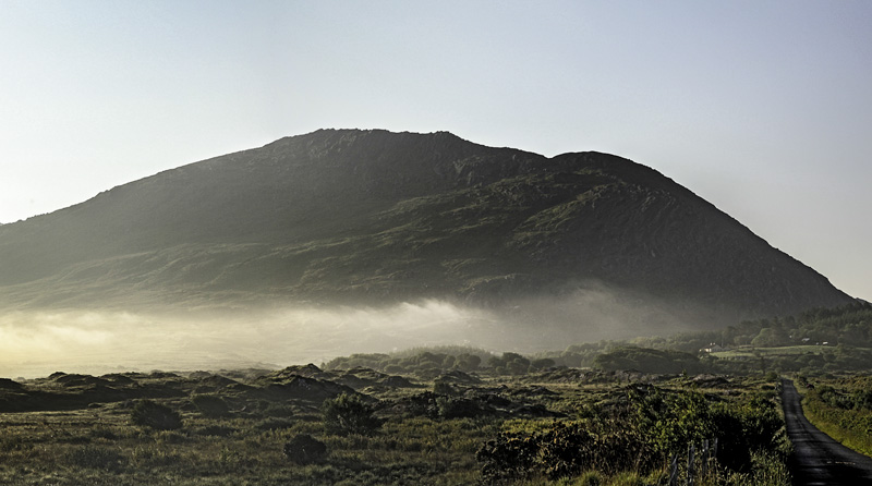
Picture: This early morning photo show the long ridge to the top.
The easiest place to start this is from the Glanbeg Lough carpark at A (V70197 53853). Go east from here on boggy rough ground up the long nose that leads to the summit. Walking time to top is around 1h15. Descent could be the same way however for variety it is also possible to drop towards the lake. The ground here is unpleasant and boggy but easier to go down than up.
Tooreennamna lies just west of the Cummeengeera circuit above Ardgroom, As it it is tricky to include in that circuit, it is probably best included as a circuit of Glenbeg Lough or climbed by itself.
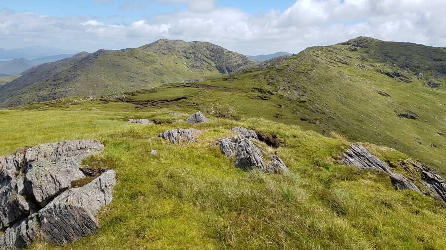
Approaching from the lough, Tooreennamna presents a rocky face and an apparently obvious peak. This however, is only the first of many false summits from this direction, each one craggier than the next, which unfold as you climb. The actual summit, when finally reached is somewhat of an anti-climax, a small plateau surrounded by perhaps eight prominences, at least 5 of which are contenders for the actual peak.
The climb upwards from the lough can be as easy or as hard as you like. There are plenty of opportunities to scramble, but equally all obstacles can be avoided by picking your way up.
I descended into the valley, aiming to hit the lough about halfway along its length. This is straighforward except for the 300m width of the most aggressive elephant grass I have yet encountered, which lies between you and the lough. Linkback: mountainviews.ie/summit/1491/comment/18685/
Read Less
Read More
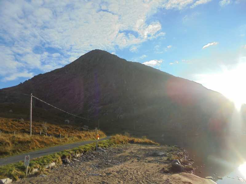
Picture: A contender!
False Summits abound
by Onzy
27 Oct 2016
This summit, at least on the approach from Glenbeg Lough, is characterised by the number of false summits that emerge as you gain height. Linkback: mountainviews.ie/summit/1491/comment/18687/
Read Less
Read More
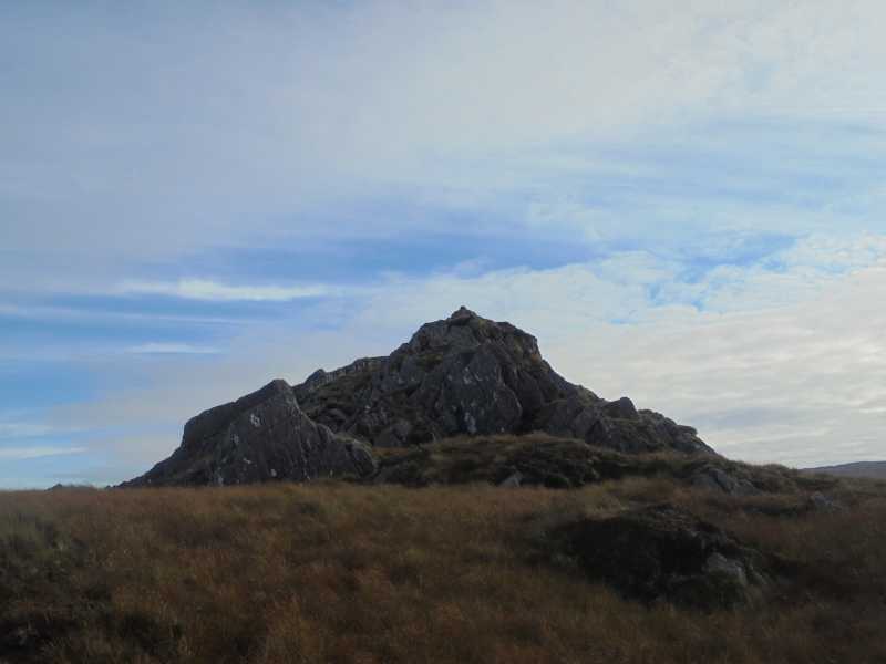
Picture: There and back again !
A worthy outlier
by eamonoc
26 Jan 2021
I visited the Arderin Beg Tooreennamna as part of an extended circuit of Cummeenageera, departed ridge from B (V72630 53914) and made my way out over fairly reasonably dry rocky ground with a few small craggy areas easily
circumnavigated to the top of Tooreennmna. The actual top was fairly evident, a round trip from the circuit took me
40 mins. Thanks to my fellow traveller Onzy for the patience. Well worth a visit from the round, pick a clear day ! Linkback: mountainviews.ie/summit/1491/comment/22202/
Use of MountainViews is governed by conditions and a privacy policy.
Read general information about the site. Opinions in material here are not necessarily endorsed by MountainViews.
Hillwalking is a risk sport. Information in comments, walks, shared GPS tracks or about starting places may
not be accurate for example as regards safety or access permission. You are responsible for your safety and your permission to walk.
See the credits and list definitions.


 Our Facebook page.