This website uses cookies, which are small text files that the website puts on your device to facilitate operation. Cookies help us provide a better service to you. They are used to track general user traffic information and to help the website function properly.
Feature count in area: 14, all in Clare,
OSI/LPS Maps: 51, 52, 57, 58
Highest Place: Slievecallan 391m
Starting Places (16) in area West Clare: Abbey Hill, Ballyvaughan, Ballyvelaghan Lough, Ben Dash, Derroolagh, Feenagh, Fermoyle Cottage, Glenfort, Leimaphuca, Lough Gaelan, Murroogh, Murrooghtoohy CP, Slieve Callan Wind Farm, Slieve Elva, Slievecarron, Toberkieran
Summits & other features in area West Clare: Cen: Ennistymon Hills: Clifden Hill 189m, Knocknalarabana 204m NE: Burren East: Abbey Hill 240m, Bouleevin 222m, Knockanes 205m, Mullagh More 180m, Slievecarran 326m NW: Burren West: Aillwee 304m, Gleninagh Mountain 316.1m, Slieve Elva 344m S: Ennis Hills: Ben Dash 267m, Cloontohil 190m, Slieveacurry 255m, Slievecallan 391m
Note: this list of places may include island features such as summits, but not
islands as such.
Mullagh More, 180mHill An Mullach Mor A name in Irish,
Place Rating ..
The Big Summit, Clare County in Munster province, in Local/Historical/Cultural Lists, Mullagh More is the 1428th highest place in Ireland. Mullagh More is the second most easterly summit in the West Clare area.
Grid Reference R32849 95545,
OS 1:50k mapsheet 52 Place visited by: 89members, recently by: chelman7, glencree, BarnabyNutt, JohnRea, DeirdreM, amgall, Wes, rquirke27, Krzysztof_K, tsheehy, jimmytherabbit, ronand, mdoc1969, JoHeaney, Ghreallaigh
I visited this place: NO (You need to be a logged-in member for this.)
Longitude: -9.001081, Latitude: 53.006699, Easting: 132849, Northing: 195545,
Prominence: 50m, Isolation: 1.9km ITM: 532813 695578 Bedrock type: Visean limestone and calcareous shale Notes on name: It featured very largely in the Irish psyche and culture back in the nineties on account of the controversy surrounding a proposed interpretive centre. During & after this long debate, Mullaghmore became central in our attitude to the environment, specifically the preservation of wilderness, access
Short or GPS IDs, 6 char: Mlg180, 10 char: MlghMore Linkback: https://mountainviews.ie/summit/1390/
Gallery for Mullagh More (An Mullach Mor) and surrounds
Summary
for Mullagh More (An Mullach Mor):
Iconic hill with waymarked ways.
Summary created by simon3, aidand
2017-10-11 11:50:50
There is a way marked route up this iconic mountain. To get to the start drive out of Corofin in the direction of Kilfenora. After less than 2 miles turn right at a sign for 'Kilnaboy Church and School'. Drive 3 miles up this road until you reach a parking area on the right. There is a choice of way-marked routes from here. Father Ted's house is a mile further up this road.
Allow about 2.5 to 3 hours.
Uninterpreted, that is - except by the individual on his or her walk? If you were to ask people in general to name a mountain in Clare chances are they would name this one. It entered public consciousness in a big way back in the nineties over a controversial plan to build an interpretive centre. The plans were shot down so now it stands in all its natural glory, untainted by the diggers and shovels. And what a glorious place it is: limestone rocks full of grykes that shelter the Burren's famous flora and fauna, and while you're there take a short hike up Sliabh Rua, which has even more interesting limestone whorls than Mullaghmore.
Getting there is easy. Turn right off the R476 Corofin-Kilnaboy road and drive a few miles into the Burren National Park. Stop the car or bike at a map & info board on your left. The path takes you down around Lough Gealain and then up along a landscape that looks like it belongs to another planet. Linkback: mountainviews.ie/summit/1390/comment/17884/
Read Less
Read More
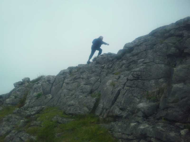
Picture: UP AND OVER
WRONG OPTION
by Buny Clare
12 Oct 2017
As we advance in years some of us do not put the same effort in planning as we would have In previous years. I had climbed Mullaghmore on two previous occasions (see 10/6/2016) Last Friday I was joined by two friends. Actually, it was not my original intention to climb this hill , I was going to bypass Mullaghmore in my stage walk from Limerick to Ballyvaughan. However, I was determined to show my pals the magnificent scenery from the peak. We travelled by car to Cooloorta first as this was the area where I had previously finished a stage of my Ballyvaughan trek. For a few reasons we decided not to climb Mullaghmore from this Eastern direction and travelled by car to the usual popular Southern route , where we would also have an option to climb Knockanes after reaching the Mullaghmore summit
Commencing at approximately 13.00 hrs ,all went well but the weather was poor when we reached the peak ,it was wet with very little wind. We discussed our three options: the first was to return on the same route, the second (marked) to circuit the Hill , the third to walk to the base of Knockanes (680m) and then if the weather improved we could climb to the peak and return to our car via the road on the west side of the Hill or walk on to Carron where another car awaited. We selected the third option . Without a track, I can only describe the going as difficult on the slippery limestone pavements . At approximately 15.30 we were at the Base of Knockanes and as it was still raining and cloud appearing over the Hill , we decided not to climb but to try and locate the track leading from the road to the Hill. I had seen this track on an old Burren map.. Once we located this track we could easily reach the road . NOT SO EASY !!!!.We could not locate the track. We could see a farmer a few hundred metres in front of us taking his cattle up the Hill so we decided it might be wiser not to proceed further north. I now believe the track was probably very close to where the farmer was taking his cattle. Anyway, we decided to walk over very rough ground to try and reach the road . We could see Father Ted’s house in the distance and we assumed the road was adjacent . We got, with difficulty, to within a few hundred metres of the meadow which would have taken us to the road. Here we made a wrong decision ,instead of trying to walk through the hazel trees to reach the fields and the road, we decided instead to walk back south and try and make our way over to the east in order to re-join the The Mullaghmore track,. After almost 2 hours of difficult walking which included having to climb down a 20 foot gully, cross a stream and scramble with difficulty , up the opposite rocky face , we eventually reached the Mullaghnore track and arrived at our car at 18.15…A challenging day! BUNY CLARE Linkback: mountainviews.ie/summit/1390/comment/19746/
Read Less
Read More
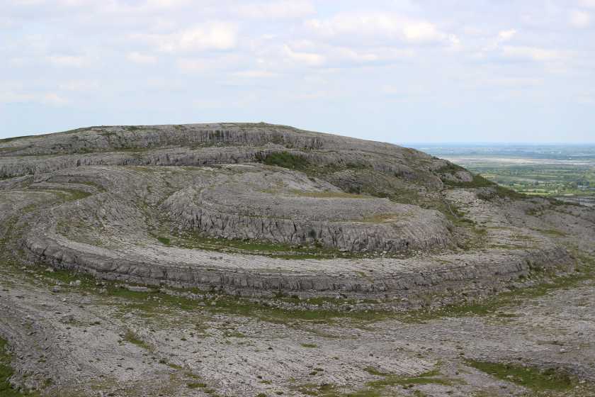
Picture: Summit Area.
The Burren.
by sandman
15 Apr 2015
Mullagh More situated on the eastern side of the Burren National Park the hill is a swirl of contorted limestone and is one of the most impressive landmarks in the Burren.
The National Park has three well marked trails,Green Red and Blue with information provided on the trail board at the start of the routes where there is also ample parking L Galen (R31475 94356) The Blue trail which is a loop walk will take you to the summit (A (R32850 95545)), easy walking app 5km in length taking app 2 hrs allowing time to take in the spectacular views across Clare, and not forgetting Fr Ted's house. Linkback: mountainviews.ie/summit/1390/comment/17931/
Read Less
Read More
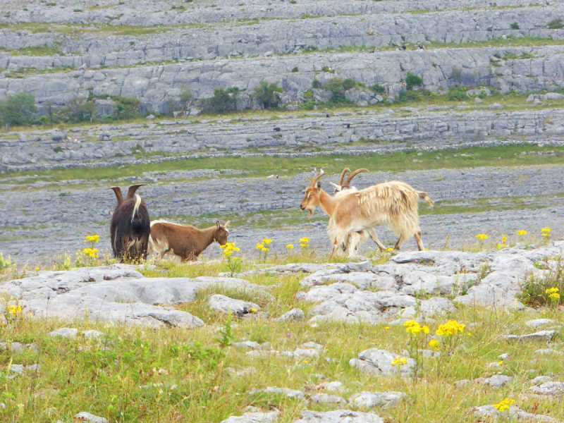
Picture: The Burren's Feral Goat herd
Acting the goat...
by Colin Murphy
7 Aug 2019
Besides the fascinating landscape, one of the most interesting sights were the wild goats wandering around relatively close to the walkers. I saw as many as 20, and they've obviously gotten used to humans as they didn't particularly shy away from us. I took the trouble to look them up later, and apparently they are Feral Goats, descended from domestic populations brought to Ireland around 4,000 years ago.They have specially adapted hooves which have spongy pads and a thick layer of skin on their front knees, which greatly assists their climbing. I also discovered that goats have rectangular pupils, that more people in the world eat goat meat, drink goat milk and eat goat's cheese than any other animal including cows and chickens. And my last goat factoid - in 9th Ethiopia, a century goat herder called Kaldi saw goats behaving more energetically after eating from a particular bush. He tried it himself and felt awake and full of energy - his goats had just discovered coffee! Linkback: mountainviews.ie/summit/1390/comment/20597/
Read Less
Read More
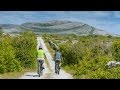
Picture: STONE !
a very relaxing day in the burren but watch your foot
by Buny Clare
10 Jun 2016
Climbed on the 27th May 2016 . Not much to say about route as it is waymarked .Its worth an effort to climb this hill as the scenery is very good and unusual, Got some excellent photos, Linkback: mountainviews.ie/summit/1390/comment/18575/
Use of MountainViews is governed by conditions and a privacy policy.
Read general information about the site. Opinions in material here are not necessarily endorsed by MountainViews.
Hillwalking is a risk sport. Information in comments, walks, shared GPS tracks or about starting places may
not be accurate for example as regards safety or access permission. You are responsible for your safety and your permission to walk.
See the credits and list definitions.


 Our Facebook page.