Cookies.
This website uses cookies, which are small text files that the website puts on your device to facilitate operation. Cookies help us provide a better service to you. They are used to track general user traffic information and to help the website function properly.
Features
Nearby features appear when you click the map.
Declutter tracks on map.
Place Search
Video
X
Pub: by
Dunkerron Mountains Area , SW: Caherdaniel Subarea
Feature count in area: 65, all in Kerry, OSI/LPS Maps: 78, 83, 84, 85, EW-KNP, EW-R
Highest Place: Stumpa Dúloigh 784m

Starting Places (66) in area Dunkerron Mountains:
Ballaghasheen Coilte, Ballaghasheen Pass Viewpoint, Ballaghbeama Gap, Bohacullia, Bridia Valley End, Cahersavane Road, Cahersavane Schoolhouse, Cloon Lough NE, Cloon Lough SE, Coad Cemetery, Coad Road End, Com an Chiste, Coomaclarig Bridge, Coomnahorna River, Coomyanna Bridge, Dereenavurrig, Derreendarragh Church, Derrynane Quay, Dunkerron Mid, Eagles Lough Access Trailhead, Esknaloughoge Forest Trailhead, Fermoyle Farm, Foot Stick Ford Road, Gap of Dunloe Head of, Glashaknockbrassel Stream, Glasheenoultagh Stream, Gortaclohane Lane End, Gortaclohane Lane NE Branch, Gortagowan Wood, Gowlane School Ruin, Gowlanes Wood, Graces Landing, Inchimore West, Isknagahinney Lough E, Kenmare Bridge, Knockanamadane, Knockanaskill N, Knocknasullig, Knocknsallagh Bridge, Laghtacallow, Lissatinnig Bridge Boreen, Looscaunagh Lough W, Lough Barfinnihy CP, Lough Brin S, Lough Coomeen SE, Lough Dromtine NE, Lough Dromtine SE, Lough Fada N, Lough Iskanamacteery N, Lough Iskanamacteery NW, Lough Reagh N, Maghanlawaun Bridia Valley, Molls Gap, Ochtiabh Road, Poulacapple, River Owroe Source, River Sneem Fermoyle Loop, Rossacoosane Mid, Sahaleen Bridge, Scarriff Island, Shamrock Farmhouse B&B, Sneem, Tooreenboy Lough, Tooreennafersha Mid, Tooreennafersha South, Waterville Promenade

Summits & other features in area Dunkerron Mountains:
Knocknagantee Near West Top 628m
Cen: An Bheann Mhór: An Bheann Mhór 674.7m, An Bhinn Láir 514m, Coomcallee 648.9m, Beann na Stiocairí 673.1m, Coomnahorna 590m, Glanbeg 485.8m, Slievenashaska 578m, Slievenashaska South Top 565.4m
Cen: Knocknagantee: Knockmoyle 682.1m, Finnararagh 667m, Cnoc Breasail 591m, Knocknagantee 674.3m, Knocknagantee West Top 553m, Coomnacronia 636m, Coomura Mountain 666m
Cen: Mullaghanattin: An Cnoc Riabhach 534m, Beann 752m, Beann Far SW Top 636.2m, Beann NE Top 692m, Beann South Top 639m, Beann SW Top 657m, Sallagh 570m, Mullaghanattin 773m, Mullaghanattin East Top 594m, Sallagh South-West Top 543m
E: Kenmare: Gortamullin 205m, Knockanaskill 356m, Letter South 362m
N: Knocknacusha: Knocknacusha 547m
NE: Knocknabreeda Ridge: Crossderry 489m, Knocknabreeda 569m, Mothaillín 506m
NE: Knocknagapple: Bascadh 595m, Bascadh West Top 569m, Boughil 631m, Cnoc na gCapall 639m, Knocklomena 641m
NE: Stumpa Dúloigh: Broaghnabinnia 745m, Knockaunanattin 569m, Knockaunanattin West Top 466.1m, Stumpa Dúloigh 784m, Stumpa Dúloigh SE Top 780m, Stumpa Dúloigh SW Top 663m
SW: Caherdaniel: Farraniaragh Mountain 468m, Eagle Hill 155m, Reenearagh 162m, Beenarourke 304m, Knocknasullig 117m, Cahernageeha Mountain 498.7m
SW: Coad ( Castle Cove ): Beenrour 418m, Eagles Hill 549m, Mullaghbeg 509m
SW: Coomduff: Coomduff 244m
SW: Deenish: Deenish Island (2) 144m
SW: Esknaloughoge: Esknaloughoge 416m, Esknaloughoge North Top 420m
SW: Scarriff: Scarriff Island 252m
SW: Sneem: An Bheann Mhór 309.3m, Dereenavurrig Hill 261m, Knockanamadane 270m, Knocknafreaghane 316.5m, Knocknagullion 413m
SW: Staigue: Staigue Top 459m, Staigue NE Top 435m

Note: this list of places may include island features such as summits, but not islands as such.
Rating graphic.
Reenearagh, 162m Hill An Rinn Iarthach A name in Irish,
Place Rating ..
Ir. An Rinn Iarthach [logainm.ie], 'the western promontory', Kerry County in Munster province, in Binnion Lists, An Rinn Iarthach is the 1454th highest place in Ireland.
Grid Reference V46800 60800, OS 1:50k mapsheet 83
Place visited by: 13 members, recently by: maoris, eamonoc, colmo23, Fergalh, MichaelE, Dbosonnet, trekker, wicklore, ciarraioch, chalky, Conor74, conormcbandon, thomas_g
I visited this place: NO (You need to be a logged-in member for this.)
Longitude: -10.220553, Latitude: 51.779083, Easting: 46800, Northing: 60800, Prominence: 115m,  Isolation: 3.4km
ITM: 446783 560864
Bedrock type: Purple sandstone & siltstone, (Ballinskelligs Sandstone Formation)

  Short or GPS IDs, 6 char: Rnrgh, 10 char: Reenearagh

Linkback: https://mountainviews.ie/summit/1335/
Gallery for Reenearagh (An Rinn Iarthach) and surrounds
Summary for Reenearagh (An Rinn Iarthach): 360 degree views
Summary created by thomas_g 2014-04-12 07:08:45
For a low summit Reenearagh offers excellent views in all directions. The summit is on farmland so requesting access is advised. Access is via a small subsidiary top to the east, the trip takes longer than you'd expect, budget an hour round trip.
Linkback: mountainviews.ie/summit/1335/comment/15579/
Member Comments for Reenearagh (An Rinn Iarthach)
Comment create / edit display placeholder

            MountainViews.ie picture about Reenearagh (<em>An Rinn Iarthach</em>)
Picture: The Summit at Ceann Muice
Blue skies and showers scudding across the shining sea.
by ciarraioch 4 Aug 2015
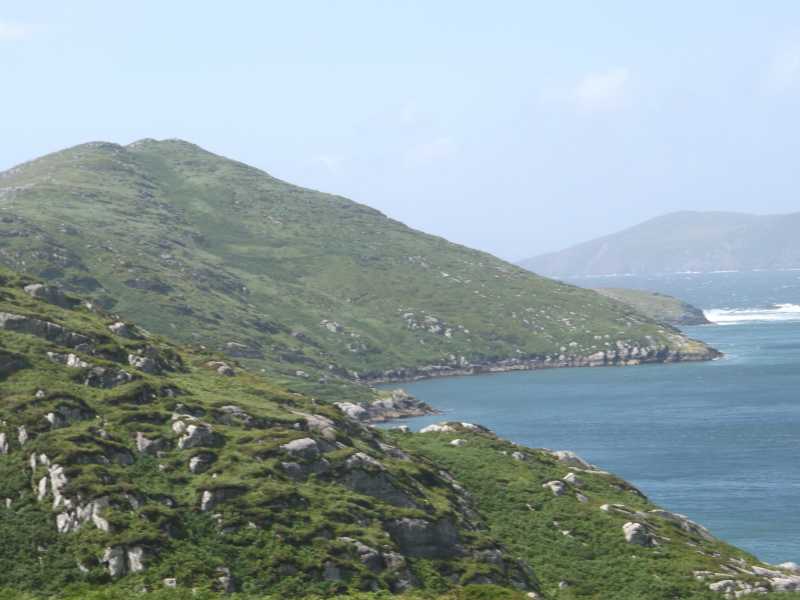
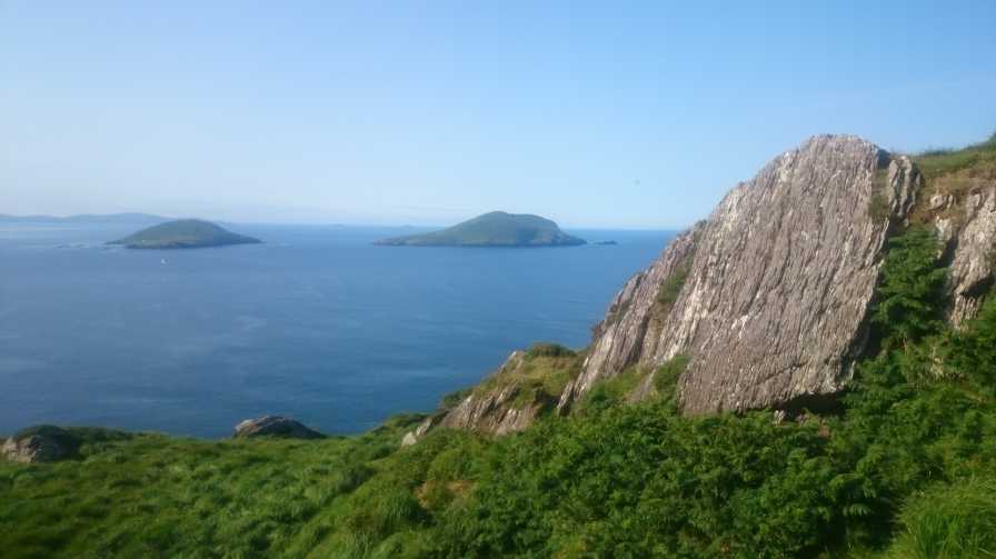
Our small country with its fractal coastline and hillscapes constantly throws up unexpected delights.

On the wet August holiday weekend of 2015, we parked at A (V49323 61565) shown as 'slipway' on the OSI map. Followed the wonderfully scenic tarred roadway until we reached a gate with sign for 'The Paddocks' at B (V47289 60478). Passed through the gate and followed the green road, but keeping straight along the coast as opposed to turning right towards the holiday home (presumably the eponymous 'Paddocks'). When a band of rocks is reached, turn right following same towards summit.

Blue skies and showers scudding across the shining sea.

Met a resident and true gentleman on the way who advised (a) that there were no access issues and (b) that one should retrace one's steps on descending the hill - following the temptation to travel east from the summit apparently leads into shoulder-high ferns and gorse.

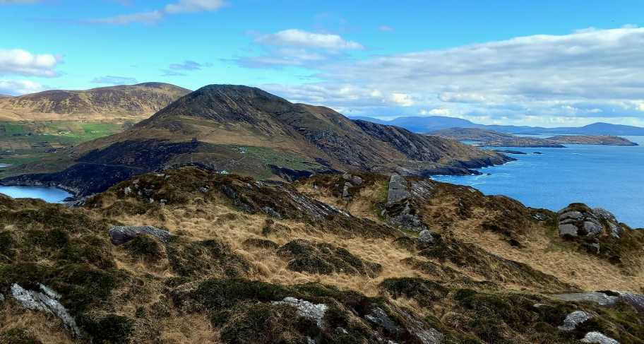
Had intended following the ridge up to Beenarourk and Coomakista, but this looked like a surprisingly steep scramble which we decided against given the close to gale force winds. Instead we visited the impressive Napoleonic tower at C (V48464 60815) by taking the southern right hand branch on the roadway on the return leg. Don't be tempted to cut downhill and due north from same onto the roadway - this was overgrown and nasty. Instead the green road near the tower will apparently bring you onto the tarred road a few hundred metres east as indicated on the MV map.

Bring the family and be respectful to the landowners. Linkback: mountainviews.ie/summit/1335/comment/18227/
Read Less
Read More

            MountainViews.ie picture about Reenearagh (<em>An Rinn Iarthach</em>)
Picture: Deenish (L) and Scarriff (R) from Reenearagh
An amazing small hill on a good day
by wicklore 4 Sep 2015
I visited Reenearagh In July 2015. Unlike Ciarraioch who also climbed this hill soon after, I was lucky to have had wonderful weather. As Ciarraioch says, the drive to the parking point is fantastic, and the further I drove along the scenic road I couldn’t believe that there were people living in such a secluded place. On a good day I’d say they are in heaven, but when a nasty Atlantic storm rolls in I’d say it’s hell.

I had spoken to one local resident who told me to park at the end of the road at the gates to ‘The Paddocks’. (B (V47289 60478) ). It is possible to park one car here without blocking the road or gate. It’s comforting to hear that Thomas_G and Ciarraioch also received a friendly welcome re access, as this starting point does initially pass along the gated lane to The Paddocks. The Paddocks is a lovely stone built holiday home and is one of several with similar design tucked away on this quiet road.

I took an anticlockwise route to the summit, which is less than a kilometre from the starting point. After leaving the track I wandered up through long grass and heather to approach the summit from the east. It was indeed quite an effort (In July anyway!) I returned by dropping south and completing a mini-circuit. The return part of the walk was much easier over short grass and slabs of rock. This is one of the best of the small summits I have walked – the views are sublime. To the south the green of Deenish and Scarriff islands contrasted with the blue of the ocean. About 25 kms to the west the distant jagged Skelligs rise from the Atlantic. Ballinskelligs Bay glistened in the sunlight to the north, and the wide expanse of the Atlantic veered away to the south and west. This is the place for whales, sharks and dolphins, for multitudes of wheeling seabirds and fishing boats plying their trade.

The very tip of the small peninsula Reenearagh occupies is actually an island, and is separated from Reenearagh by a narrow deep channel. It would not be possible for non-climbers to reach. You can look down to it from the summit to see the seabirds that make it their home, knowing that landlubbers won’t get across the narrow channel to disturb them! Linkback: mountainviews.ie/summit/1335/comment/18286/
Read Less
Read More

a chance meeting
by thomas_g 12 Apr 2014
I parked at D (V479 607), where a gravel area offers room for 2 cars. While walking along the road I chanced to meet the farmer out feeding the sheep in her jeep. A lovely lady, a long chat ensued and permission was sought to walk out to the end of the head; since I was unlikely to eat the grass on the sheep, permission was granted. Linkback: mountainviews.ie/summit/1335/comment/15987/
Read Less
Read More

            MountainViews.ie picture about Reenearagh (<em>An Rinn Iarthach</em>)
Picture: View to Knockstooka
Another super Kerry Binnion
by eamonoc 4 Mar 2023
Met local farmer who informed that it was okay to park at end of road just outside gate mentioned in earlier comments, a wonderful walk on a wonderful day, superb location very rewarding hill. Linkback: mountainviews.ie/summit/1335/comment/23852/
Read Less
Read More
EDIT Point of Interest
text
Videos
Recent Contributions
x
Conditions and Info
Use of MountainViews is governed by conditions and a privacy policy.
Read general information about the site.
Opinions in material here are not necessarily endorsed by MountainViews.
Hillwalking is a risk sport. Information in comments, walks, shared GPS tracks or about starting places may not be accurate for example as regards safety or access permission. You are responsible for your safety and your permission to walk.
See the credits and list definitions.

OSi logo
OSNI/LPS logo
Open Street Map
(Various variations used.)
British summit data courtesy:
Database of British & Irish Hills