This website uses cookies, which are small text files that the website puts on your device to facilitate operation. Cookies help us provide a better service to you. They are used to track general user traffic information and to help the website function properly.
Feature count in area: 19, all in Mayo,
OSI/LPS Maps: 22, 23, EW-WNN
Highest Place: Maumakeogh 379m
Starting Places (9) in area North Mayo: Bangor Trail Head, Carnhill, Carrowmore Wood, Erris Head, Portacloy Bay, Proesoon, Sralagagh West, Termon Hill Road, Tower Hill South
Summits & other features in area North Mayo: Cen: Pulathomas: Barnacuillew 260m E: Ballycastle Hills: Knockaghaleague 237m, Knockboha 186m, Maumakeogh 379m N: Benwee Head Cliffs: Benwee Head 255m, Barradeegin 229m, Glinsk 304m, Illanmaster 238m, Illanmaster Island 105m, Porturlin Hill 155m, Srahataggle 182m, Tawnaghmore 340m S: Bangor Erris Hills: Carrafull 269m, Knocklettercuss 370m, Knocknascollop NW Top 244m, Sheean 295m, Slieve Fyagh 335m W: Belmullet: Aghaglasheen 132m, Termon Hill 103m
Note: this list of places may include island features such as summits, but not
islands as such.
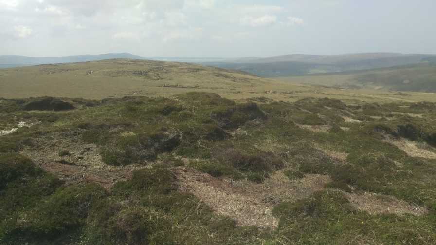
Srahataggle, 182mHill
Place Rating ..
, Mayo County in Connacht province, in Binnion Lists, Srahataggle is the 1424th highest place in Ireland.
Grid Reference F91652 41507,
OS 1:50k mapsheet 23 Place visited by: 8members, recently by: Wilderness, thrifleganger, Fergalh, gerrym, sandman, Garmin, chalky, IncaHoots
I visited this place: NO (You need to be a logged-in member for this.)
The village beside the hill is of the same name and the villagers are very proud of the culture in the area which has been around for some time. I refer to that clear liquid in a bottle which makes your toes curl. For a quick ascent park at A (F91639 40554) and your route to the summit is across open common. Linkback: mountainviews.ie/summit/1312/comment/18556/
Use of MountainViews is governed by conditions and a privacy policy.
Read general information about the site. Opinions in material here are not necessarily endorsed by MountainViews.
Hillwalking is a risk sport. Information in comments, walks, shared GPS tracks or about starting places may
not be accurate for example as regards safety or access permission. You are responsible for your safety and your permission to walk.
See the credits and list definitions.


 Our Facebook page.