This website uses cookies, which are small text files that the website puts on your device to facilitate operation. Cookies help us provide a better service to you. They are used to track general user traffic information and to help the website function properly.
Fermanagh & South TyroneArea, E: Aughnacloy
Subarea
Feature count in area: 15, by county: Fermanagh: 9, Tyrone: 7, Monaghan: 1, of which 2 are in both Fermanagh and Tyrone,
OSI/LPS Maps: 11, 17, 18, 19
Highest Place: Belmore Mountain 398m
Starting Places (15) in area Fermanagh & South Tyrone: Aghanaglack, Carn Road, Carrickreagh Viewpoint, Crackrawer Road, Cullen Hill, Derrin, Dooletter, Largy S, Largy W, Lendrum Bridge Windfarm, Pollnagollum, Screggagh Windfarm, Slievemore, Tempo, Tullybrack
Summits & other features in area Fermanagh & South Tyrone: Cen: Tempo Hills: Brougher Mountain 317m, Derrin 268m, Stranisk 312m, Topped Mountain 277m E: Aughnacloy: Rehagy Mountain 194m N: Largy: Largy 230m NE: Ballygawley Hills: Cappagh Mountain 286m, Slievemore 314m S: Slieve Beagh: Slieve Beagh 380m, Slieve Beagh SE Top 373m W: Derrygonnelly: Belmore Mountain 398m, Cullen Hill 201m, Knockmore 277m, Legg 343m, Tullybrack 386m
Note: this list of places may include island features such as summits, but not
islands as such.
Rehagy Mountain, 194mHill
Place Rating ..
, Tyrone County in Ulster province, in no lists, Rehagy Mountain is the 1408th highest place in Ireland. Rehagy Mountain is the most easterly summit in the Fermanagh & South Tyrone area.
Grid Reference H71070 53398,
OS 1:50k mapsheet 19 Place visited by: 23members, recently by: Jai-mckinney, Oscar-mckinney, ElaineM76, eflanaga, trostanite, Kirsty, Carolyn105, dregishjake, dregish, LorraineG60, NICKY, wicklore, MichaelG55, AntrimRambler, Ulsterpooka
I visited this place: NO (You need to be a logged-in member for this.)
Short or GPS IDs, 6 char: RhgyMn, 10 char: RhgyMntn Linkback: https://mountainviews.ie/summit/1299/
Gallery for Rehagy Mountain and surrounds
Summary
for Rehagy Mountain :
Bag it, tick it and forget it !
Summary created by Harry Goodman
2015-03-31 16:29:18
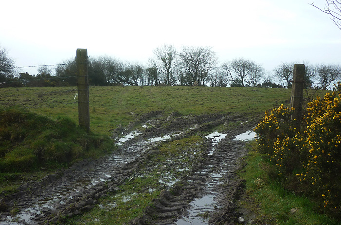
Picture: The summit field !
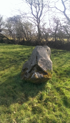
From Aughnacloy take the B128 east to A (H713 531) and turn left up Rehargy Road. A short way along park on the left beside a Water Service station. Walk up a very muddy track immediately past the station on it's right side and follow it up a short way to gain access to a couple of fields. The high point lies in the second field near to a large "standing" stone which may or may not have some archaeological significance. This apart there is nothing of interest to a walker on the virtually flat hedge and tree surrounded field. Only a top of interest !! to peak baggers and even that is stretching it !
Take the B128 east of Augnacloy..Turn up Rehagy (Carricklongfield road) and park beside a water station (B (H71186 53484)) there is a track just beside this walk up track to top.
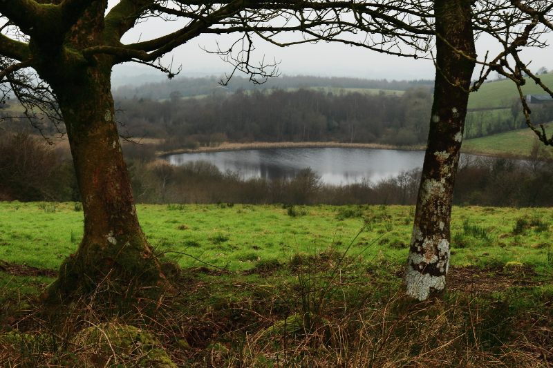
A very murky day for my visit so I'll give it the benefit of the doubt, but there were no views at all really in the haze. I got the impression that even on a good day, views would be at best pleasant, rather than impressive. Only 2 minutes to the top from Rehagy Road up a very mucky track. It was redeemed a little by the sighting of a woodcock. Wouldn't walk this hill unless, as I was, you are passing very close by anyway. Linkback: mountainviews.ie/summit/1299/comment/17841/
Use of MountainViews is governed by conditions and a privacy policy.
Read general information about the site. Opinions in material here are not necessarily endorsed by MountainViews.
Hillwalking is a risk sport. Information in comments, walks, shared GPS tracks or about starting places may
not be accurate for example as regards safety or access permission. You are responsible for your safety and your permission to walk.
See the credits and list definitions.


 Our Facebook page.