This website uses cookies, which are small text files that the website puts on your device to facilitate operation. Cookies help us provide a better service to you. They are used to track general user traffic information and to help the website function properly.
Feature count in area: 7, all in Cork,
OSI/LPS Maps: 80, 86, 87, 89
Highest Place: Knockshanawee 209m
Starting Places (5) in area South Cork: Ballincollop, Cooligboy Hill West, Doolieve East, Inniscarra, Timoleague Friary
Summits & other features in area South Cork: E: Doolieve: Doolieve 182.5m N: Garravagh: Garravagh North Top 164m N: Knocknaheeny: Knocknaheeny 161m N: Knockshanawee: Knockshanawee 209m S: Timoleague Hills: Ballincollop Hill 141m, Cooligboy Hill 144m, Slieveadrohid 201m
Note: this list of places may include island features such as summits, but not
islands as such.
Knockshanawee, 209mHill
Place Rating ..
, Cork County in Munster province, in Binnion Lists, Knockshanawee is the highest hill in the South Cork area and the 1382th highest in Ireland.
Grid Reference W45445 68859,
OS 1:50k mapsheet 86 Place visited by: 17members, recently by: DeirdreM, Pizzagirl, chelman7, Glanman2, Wildrover, Fergalh, Juanita, Daingean, CaminoPat, PeakPaul, eamonoc, tommccarthy, Pepe, jackill, chalky
I visited this place: NO (You need to be a logged-in member for this.)
Did this and Garravagh on 4/3/16. Hard to find Knockshanawee but got lucky - took the turn for Coachford off the main Cork-Macroom road. Could see the hill up on my right. Drove around to the northern side and took single track road L6218. Boreen off this on RHS. Ignored boreen and kept driving past a house or two. Ignored farmgate on RHS. Parked about 150 yards short of a house on RHS, where there is an opening to a field. From here it's straight up for 10-15 minutes - it's a zigzag route though because of plenty of barbed wire, ditches and electric fencing to negotiate on private land, which lends a furtive air to the whole experience. Not really recommended, perhaps worth it just to see the trig sitting on top, and I mean on top, of a ditch separating two summit fields. Linkback: mountainviews.ie/summit/1280/comment/18453/
Read Less
Read More
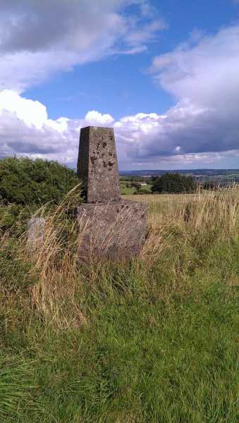
Picture: Summit Area.
On a Cork Farm.
by sandman
6 May 2015
In an area where land is valuable the trig on this hill is located app 50m from the summit in the hedge growth.Access is slightly restricted as you have to cross private land. Linkback: mountainviews.ie/summit/1280/comment/17979/
Read Less
Read More
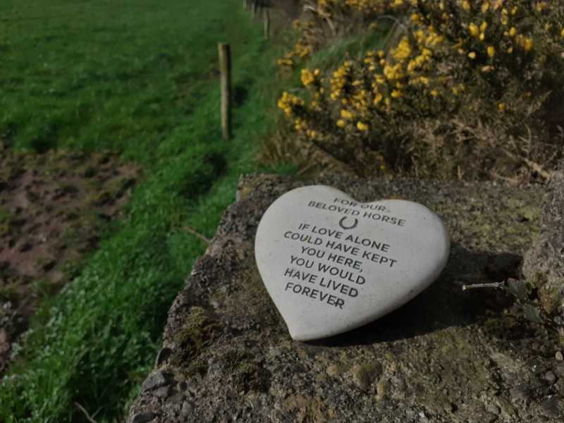
Picture: Seen on the trig
Easy stroll, just ask permission
by DeirdreM
15 Mar 2024
I took a route up from the southern side, off the N22 at Farnanes Cross Roads. I parked up at The Thady Inn and strolled up the road to the Castlemore Riding School. I had phoned ahead to make sure they had no problem with me being on their land. They told me that the fields around the trig didn't belong to them but to a farmer called Murphy. They gave me his number and when I phoned him he was more than happy to let me wander around as there was no cattle up there at the time. He seemed happy that I had asked for permission and even gave me directions to the field I needed.
It was a clear day and the views were fantastic. I could see all the way to Temple Hill, Galtymore and the Knockmealdowns.
Impressive for a hill just over 200m Linkback: mountainviews.ie/summit/1280/comment/24155/
Use of MountainViews is governed by conditions and a privacy policy.
Read general information about the site. Opinions in material here are not necessarily endorsed by MountainViews.
Hillwalking is a risk sport. Information in comments, walks, shared GPS tracks or about starting places may
not be accurate for example as regards safety or access permission. You are responsible for your safety and your permission to walk.
See the credits and list definitions.


 Our Facebook page.