Cookies.
This website uses cookies, which are small text files that the website puts on your device to facilitate operation. Cookies help us provide a better service to you. They are used to track general user traffic information and to help the website function properly.
Features
Nearby features appear when you click the map.
Declutter tracks on map.
Place Search
Video
X
Pub: by
South East Midlands Area , N: Newbridge Hills Subarea
Feature count in area: 31, by county: Laois: 6, Carlow: 1, Offaly: 1, Kildare: 2, Kilkenny: 13, Tipperary: 8, OSI/LPS Maps: 28A, 28B, 47, 48, 49, 53, 54, 55, 59, 60
Highest Place: Slievenamon 720.2m

Starting Places (16) in area South East Midlands:
Ballinvarry West, Clodiagh Church, Coolnahau, Coppanagh Wood South, Freney's Well, Glynn, Gorlough Wood, Hill of Allen, Inistioge, Killamery Wood East, Kylebeg Wood, Lingaun River, Mount Alto Wood, Mullenbeg Wood South, Newtown Upper School, Slievenamon Walk Head

Summits & other features in area South East Midlands:
E: Barrow: Clogrennan Hill 336m, Newtown Hill 208m
N Cen: Timahoe Hills: Ballaghmore Hill 268m, Cullenagh Mountain 317m, Fossy Mountain 332m, Hewson Hill 261m
N: Croghan: Croghan Hill 234m
N: Newbridge Hills: Dunmurry Hill 233m, Hill of Allen 219m
S: Mullinavat: Coolnahau Hill 265m, Corbally Hill 285m, Mount Alto 276m, Tory Hill 292m
S: Slievenamon: Knockahunna 502.8m, Sheegouna 553.5m, Slievenamon 720.2m, Slievenamon North-West Top 564m
S: Windgap: Carricktriss Gorse 314m, Carrigadoon Hill 296.9m, Faranaree Hill 283m
SE: Brandon Hill: Brandon Hill 515m, Coppanagh 365m, Croghan 365m
W Cen: Durrow: Ballynalacken Hill 314m, Caponellan Hill 253m, Knockmannon Hill 315m
W Cen: Slieveardagh: Clomantagh Hill 349m, Knocknamuck 340m, Monabrogue 284m
W: Horse & Jockey: Kill Hill 241m, Killough 235m

Note: this list of places may include island features such as summits, but not islands as such.
Rating graphic.
Dunmurry Hill, 233m Hill
Place Rating ..
, Kildare County in Leinster province, in Binnion Lists, Dunmurry Hill is the 1327th highest place in Ireland.
Grid Reference N71385 16943, OS 1:50k mapsheet 55
Place visited by: 52 members, recently by: Colin Murphy, Kaszmirek78, michaelseaver, chelman7, benjimann9, Jai-mckinney, Oscar-mckinney, Carolyn105, SenanFoley, annem, Ansarlodge, flynnke, Dee68, oreills8, Prendo
I visited this place: NO (You need to be a logged-in member for this.)
Longitude: -6.93261, Latitude: 53.198408, Easting: 271385, Northing: 216943, Prominence: 127m,  Isolation: 5.7km, Has trig pillar
ITM: 671318 716972
Bedrock type: Green greywacke, (Dunmurry Formation)

  Short or GPS IDs, 6 char: Dnm233, 10 char: DnmryHil

Linkback: https://mountainviews.ie/summit/1244/
Gallery for Dunmurry Hill and surrounds
Summary for Dunmurry Hill : Simple walk up tarmac road.
Summary created by Colin Murphy 2024-02-12 12:38:29
            MountainViews.ie picture about Dunmurry Hill
Picture: Trig pillar in grassy field
You can just about park one car at a gated entrance at A (N71920 16807). Cross gate and follow a tarmac road up a gentle slope for about 700m. The road is fenced in on either side. Around B (N71405 16809) you will see a gate into a grassy field. Cross this and climb the grassy slope to a trig pillar. There is also a telecoms mast nearby. (Do not enter the field if it will disturb livestock.) It is also possible to continue up the road to the telecom mast and cross the fence on the right where it is lower (and unfortnately there had been some fly tipping.)
Linkback: mountainviews.ie/summit/1244/comment/15488/
Member Comments for Dunmurry Hill
Comment create / edit display placeholder

            MountainViews.ie picture about Dunmurry Hill
Picture: Grange Hill from Dunmurry Hill
The Chair of Kildare
by Bunsen7 20 Dec 2017
No matter how seemingly dull a hill might initially appear, the more I investigate my local 100 list, the more I expect a second visit to be made to many.

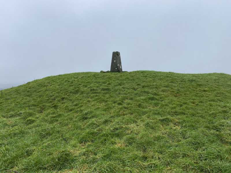
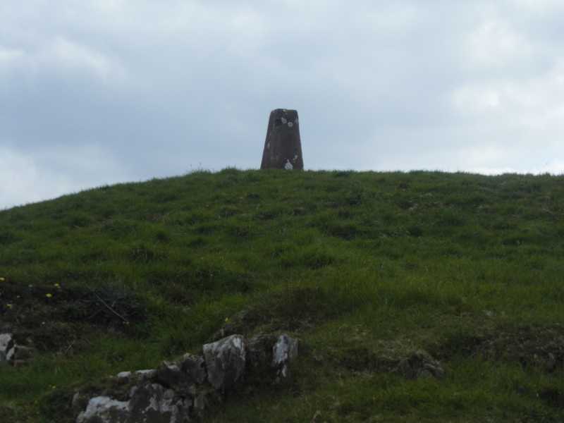
Dunmurry Hill could be one such hill. Really? A simple tarmac road to follow beside fields filled with grazing cattle, a trig pillar and a mast. No challenge, isolated, and hard to make any sort of walk out of. A quick hill-bag and home. Ticked off the list last February - forgotten again.

And yet. A little further investigation suggests there is more to this place.

I came across a name - the Chair of Kildare. Intriguing - what is this?

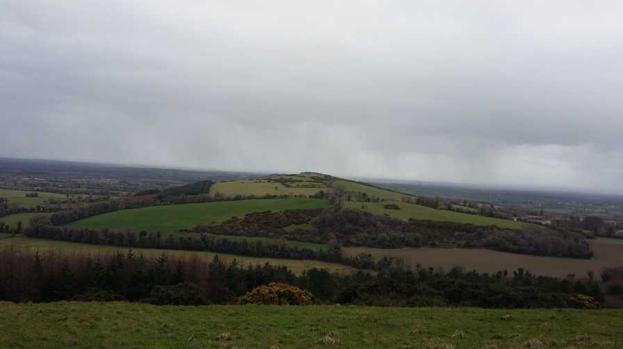
Firstly it is a mound, lying just north east of Dunmurry Hill, on Grange Hill (which itself doesn't meet the MV prominence criteria), at C (N71979 17307). This is marked on the OS. The mound is something of a curiosity, an antiquity on top of a rocky outcrop, what with rocky outcrops being quite unusual for the area. The geological analysis from 1858 suggests it is a natural protrusion of various older rocks including old red sandstone above the main body of upper limestone that covers the area. It suggests that the Old Red sandstone derives from a prehistoric time when these little hills stood like islands surrounded by sea against which sand washed up on the shore, if you can fathom that.

Secondly, it was taken on as the name for this small low lying range of hills including Dunmurry and the Hill of Allen to the North of Kildare town. This is quoted in many places, including the Geological Survey of Ireland of 1858, and some modern day references. Dividing the Chair range, a marshy valley between Grange Hill and the Hill of Allen serves as a feeder for the grand canal.

The folklore is also rich. There is an account of a fairy-woman, or a witch, Moll Anthony, living at the Chair in the 1800s, who had special healing powers. There is enough in the ether to suggest there was genuine belief in her abilities! Has she a cure for curiosity?

So maybe there's more than initially meets the eye! Linkback: mountainviews.ie/summit/1244/comment/19817/
Read Less
Read More

            MountainViews.ie picture about Dunmurry Hill
Picture: Night Hike
A Mint of a hill!
by Dessie1 17 Jan 2014
Park at A (N71920 16807) at entrance to gate(Enough room for 1 car).Take the tarmac track all the way to the mast buildings but stop just short of the compound and turn right through the low barbed wire fence.Over the fence head east to point D (N71368 16925) to the large trig pillar which sits on a raised mound.Views over Kildare are excellent for such a short trek. Round trip of approx 30 mins. Linkback: mountainviews.ie/summit/1244/comment/15788/
Read Less
Read More

            MountainViews.ie picture about Dunmurry Hill
Picture: Trig on the hill
A nice easy bag
by TommyV 31 Oct 2018
Followed the same route as Dessie1. A very easy walk along an access road to a mast at the top of the hill. The trig point is on a hill to the right of the masts. It's prominence over what must be the flattest county in Ireland allows for great views for minimal effort. Linkback: mountainviews.ie/summit/1244/comment/20131/
Read Less
Read More
EDIT Point of Interest
text
Videos
(none available)
Recent Contributions
x
Conditions and Info
Use of MountainViews is governed by conditions and a privacy policy.
Read general information about the site.
Opinions in material here are not necessarily endorsed by MountainViews.
Hillwalking is a risk sport. Information in comments, walks, shared GPS tracks or about starting places may not be accurate for example as regards safety or access permission. You are responsible for your safety and your permission to walk.
See the credits and list definitions.

OSi logo
OSNI/LPS logo
Open Street Map
(Various variations used.)
British summit data courtesy:
Database of British & Irish Hills