This website uses cookies, which are small text files that the website puts on your device to facilitate operation. Cookies help us provide a better service to you. They are used to track general user traffic information and to help the website function properly.
Feature count in area: 14, all in Clare,
OSI/LPS Maps: 51, 52, 57, 58
Highest Place: Slievecallan 391m
Starting Places (16) in area West Clare: Abbey Hill, Ballyvaughan, Ballyvelaghan Lough, Ben Dash, Derroolagh, Feenagh, Fermoyle Cottage, Glenfort, Leimaphuca, Lough Gaelan, Murroogh, Murrooghtoohy CP, Slieve Callan Wind Farm, Slieve Elva, Slievecarron, Toberkieran
Summits & other features in area West Clare: Cen: Ennistymon Hills: Clifden Hill 189m, Knocknalarabana 204m NE: Burren East: Abbey Hill 240m, Bouleevin 222m, Knockanes 205m, Mullagh More 180m, Slievecarran 326m NW: Burren West: Aillwee 304m, Gleninagh Mountain 316.1m, Slieve Elva 344m S: Ennis Hills: Ben Dash 267m, Cloontohil 190m, Slieveacurry 255m, Slievecallan 391m
Note: this list of places may include island features such as summits, but not
islands as such.
Slieveacurry, 255mHill
Place Rating ..
, Clare County in Munster province, in no lists, Slieveacurry is the 1272th highest place in Ireland. Slieveacurry is the second most westerly summit in the West Clare area.
Grid Reference R12294 79568,
OS 1:50k mapsheet 57 Place visited by: 9members, recently by: TommyV, Krzysztof_K, JohnRea, FrankMc1964, eamonoc, Jamessheerin, conormcbandon, sandman, Fergalh
I visited this place: NO (You need to be a logged-in member for this.)
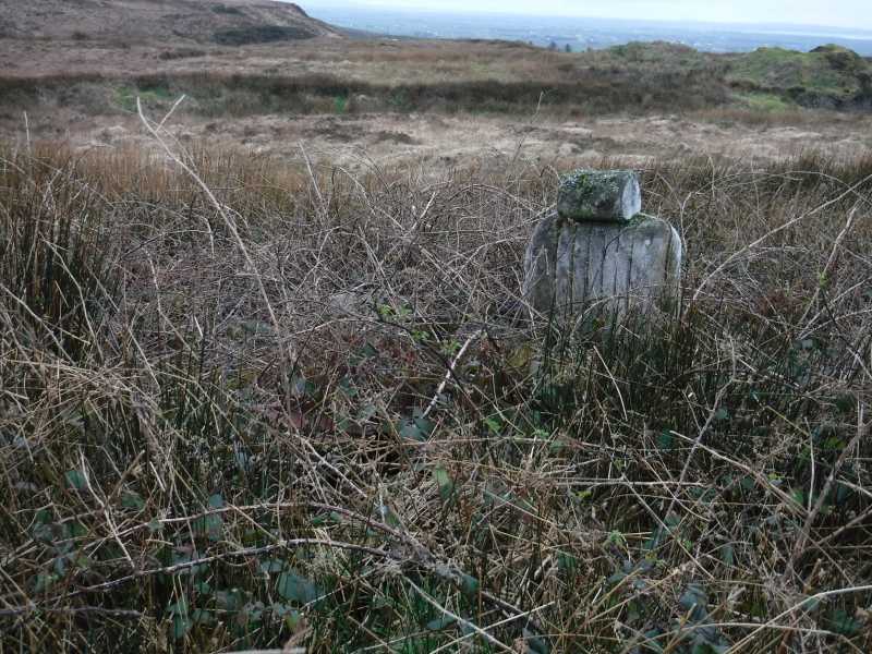
For an alternative way up and especially if you are stuck for time, turn at A (R09959 79101), go through gate and park at abandoned house B (R10567 79047). Be careful if ground clearance in your car is an issue? Take right fork at C (R11004 79072), follow track left at D (R11128 78979) and it will curve around to the east... straight to the summit, eventually.
I would take issue with the grid reference given for this mountain though, its about 200m off. I found the highest spot to be I spent some time at this, checking all the high spots and lumps, both with GPS and altimeter. I would be reasonably certain that my grid ref is the proper summit?
And the tractor in the photo? It's not mine... I just borrowed it for the day! Linkback: mountainviews.ie/summit/1209/comment/18655/
Read Less
Read More
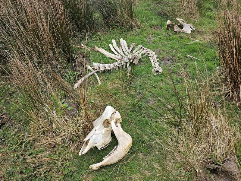
Picture: cow skeleton
Look what I found! Dinosaur!
by Krzysztof_K
28 Apr 2023
During my hiking trips, I found skeletons of sheep many times. Once I came across a deer's feet and head. From these more pleasant views, I was only a few minutes late to witness the birth of a goat in the middle of winter in the mountains of Kerry.
Meanwhile, on my way to Slieveacurry, I came across the skeleton of a cow. It is certainly a loss for the farmer. Unfortunately, it wasn't a dinosaur skeleton, but it looks impressive. Linkback: mountainviews.ie/summit/1209/comment/23939/
Read Less
Read More
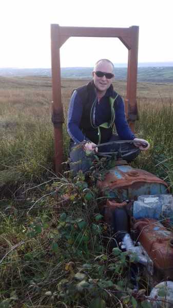
Picture: The high seat of Clare
The tractor, a shadow of it`s former glory
by eamonoc
4 Mar 2019
Visited Slieveacurry on 27th Feb, was eagerly looking forward to finding the tractor as mentioned in James Sheerin`s
post dated 14th Oct 2016. Found it ! a shadow of it`s former glory and a sad testament to a culture of dumping in the Hils of Ireland. Having said all that Slieveacurry is a testy littlle hill with great views north to the Cliffs of Moher and Lahinch Linkback: mountainviews.ie/summit/1209/comment/20445/
Read Less
Read More
Clare's finest
by Fergalh
15 Jun 2014
Park at E (R11066 79942) cross gate and proceed up track and take sharp first right. When you get near edge of forest turn due east to visible top and cross boggy hinterland. Linkback: mountainviews.ie/summit/1209/comment/17499/
Read Less
Read More
Picture: Slieve Callan from summit of Slieveacurry
Slieve Callan's little brother
by TommyV
18 May 2023
Some summit baggers will have visited Slieve Callan to bag the highest point in West Clare, but few will have crossed the R460 to take in Slieveacurry. I found parking tight at the spot mentioned by Fergalh so I parked further North where the road meets a forestry track at F (R11324 80760). There is a gate a few metres down the road on the left which gives access to a farm track that leads partially up the hill. After the track ends there is little choice but to cross the wet boggy terrain, cross under a fence on a ditch, hop a drain and finally climb over a Grand Nationalesque embankment. All the hard work is rewarded by a bland unmarked summit. Still it was good to finally bag my 14th and final West Clare summit. Linkback: mountainviews.ie/summit/1209/comment/23950/
Use of MountainViews is governed by conditions and a privacy policy.
Read general information about the site. Opinions in material here are not necessarily endorsed by MountainViews.
Hillwalking is a risk sport. Information in comments, walks, shared GPS tracks or about starting places may
not be accurate for example as regards safety or access permission. You are responsible for your safety and your permission to walk.
See the credits and list definitions.


 Our Facebook page.