This website uses cookies, which are small text files that the website puts on your device to facilitate operation. Cookies help us provide a better service to you. They are used to track general user traffic information and to help the website function properly.
Feature count in area: 19, all in Mayo,
OSI/LPS Maps: 22, 23, EW-WNN
Highest Place: Maumakeogh 379m
Starting Places (9) in area North Mayo: Bangor Trail Head, Carnhill, Carrowmore Wood, Erris Head, Portacloy Bay, Proesoon, Sralagagh West, Termon Hill Road, Tower Hill South
Summits & other features in area North Mayo: Cen: Pulathomas: Barnacuillew 260m E: Ballycastle Hills: Knockaghaleague 237m, Knockboha 186m, Maumakeogh 379m N: Benwee Head Cliffs: Benwee Head 255m, Barradeegin 229m, Glinsk 304m, Illanmaster 238m, Illanmaster Island 105m, Porturlin Hill 155m, Srahataggle 182m, Tawnaghmore 340m S: Bangor Erris Hills: Carrafull 269m, Knocklettercuss 370m, Knocknascollop NW Top 244m, Sheean 295m, Slieve Fyagh 335m W: Belmullet: Aghaglasheen 132m, Termon Hill 103m
Note: this list of places may include island features such as summits, but not
islands as such.
Sheean, 295mHill
Place Rating ..
, Croohaun, Cruachán, Mayo County in Connacht province, in Binnion Lists, Sheean is the 1175th highest place in Ireland. Sheean is the second most southerly summit in the North Mayo area.
Grid Reference F90033 19738,
OS 1:50k mapsheet 23 Place visited by: 10members, recently by: Geo, Wilderness, eamonoc, Fergalh, sandman, Garmin, liz50, simoburn, chalky, garrettd
I visited this place: NO (You need to be a logged-in member for this.)
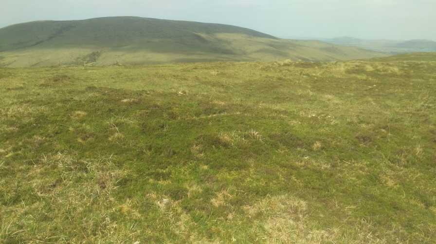
The summit of this hill is surrounded by a forestry the type of trees you do not wish to encounter so when the mountain sheep manage to find there way in the farmer has no choice but to await there return. Deciding to access the hill via Briska i asked permission from a farmer at A (F88575 21088) to allow me access to the open hillside thru his property. The farmer had no problem even giving me a pointer to where best get thru the trees at B (F89152 20260). His neighbor is a bit more restrictive and is located at the end of the tract shown on the OS map. Having made your way thru you will find a grassy summit with good view of Slieve Carr. Linkback: mountainviews.ie/summit/1152/comment/18559/
Read Less
Read More
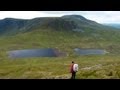
Picture: Top of Sheean
An adventurous walk.
by Wilderness
21 Apr 2022
I accessed this hill coming from Knocklettercuss. The terrain in-between the two hills was mostly dry and easy going.
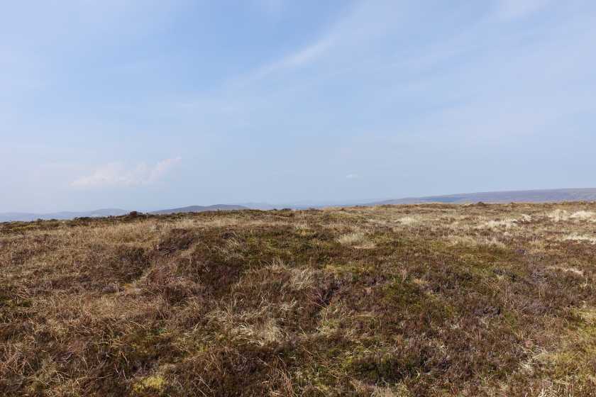
The narrow line of forest I had to go through to get to the top of Sheean was no bother to walk through as the trees here were sparse with plenty of gaps. C (F895 198) The top is relatively flat and has no cairn. The biggest mistake I made was on my decent straight towards Briska were I tried to go through the forest at D (F893 205). There is a tempting gap here going in a northeasterly direction towards the rivers and track , but the trees only get denser the further down you go. At times I had to get down on my hands and knees and crawl my way through. Eventually I saw light through the trees and reached the narrow river tributary ,very close to where it joins the much larger Owenmore river. I then followed the track out. Linkback: mountainviews.ie/summit/1152/comment/23492/
Use of MountainViews is governed by conditions and a privacy policy.
Read general information about the site. Opinions in material here are not necessarily endorsed by MountainViews.
Hillwalking is a risk sport. Information in comments, walks, shared GPS tracks or about starting places may
not be accurate for example as regards safety or access permission. You are responsible for your safety and your permission to walk.
See the credits and list definitions.


 Our Facebook page.