This website uses cookies, which are small text files that the website puts on your device to facilitate operation. Cookies help us provide a better service to you. They are used to track general user traffic information and to help the website function properly.
Summits & other features in area North East Midlands: Cen: Ballyjamesduff: Aghalion Hill 249m Cen: Oldcastle: Mullaghmeen 258m, Slieve Na Calliagh 276m, Spire of Lloyd 131m, The Hill of Mael 241m E: Kingscourt: Carrickleck Hill 173m N Cen: Cavan Town: Shantemon 218m, Slieve Glah 320m, Tievenanass 261m NE: Ballybay: Bunnanimma 268m NE: Carrickmacross: Corduff 243m NE: Castleblaney: Mullyash Mountain 317m NE: Cen Bailieborough: Cornasaus 339m, Taghart South 290m NW Cen: Arva: Bruse Hill 260m NW: Aughavas: Lugganammer 190m S Cen: Crookedwood: Cruckboeltane 199m, Knockeyon 214m S: Westmeath South West: Knockastia 200m SE: Boyne Valley: Hill of Slane 160.4m, Mount Oriel 251m, Tara 155m W: Ardagh: Bawn Mountain 200m W: Drumlish: Corn Hill 278m
Note: this list of places may include island features such as summits, but not
islands as such.
Mullyash Mountain, 317mHill
Place Rating ..
, Monaghan County in Ulster province, in Binnion Lists, Mullyash Mountain is the third highest hill in the North East Midlands area and the 1119th highest in Ireland. Mullyash Mountain is the most northerly summit in the North East Midlands area. Mullyash Mountain is the second highest point in county Monaghan.
Grid Reference H86847 26128,
OS 1:50k mapsheet 28 Place visited by: 30members, recently by: Oscar-mckinney, annem, Bernieor, madfrankie, Hoverla, trostanite, Kirsty, Vfslb1904, atlantic73, Jai-mckinney, Carolyn105, dregishjake, dregish, abcd, arderincorbett
I visited this place: NO (You need to be a logged-in member for this.)
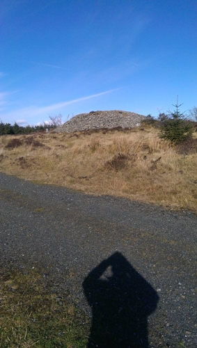
Mullyash "the hilltop of the forest " in Irish is situated on the Monaghan Way easily reached along forest track starting from point A (H87077 24674). Nice cairn on way to summit ...a summit which is not well defined .The shadow is a selfie. Linkback: mountainviews.ie/summit/1122/comment/15891/
Read Less
Read More
Picture: The undefined summit?
Lovely walk
by paddyhillsbagger
16 Mar 2014
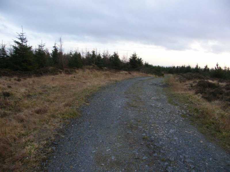
As far as I can make out the actual summit of Mullyash is a slight rise in the Monaghan Way that traverses the mountain situated halfway between the ancient cairn and a not so ancient broadband pylon. Not sure if the pylon will be left for future generations and cultures as an ancient monument. Linkback: mountainviews.ie/summit/1122/comment/15927/
Use of MountainViews is governed by conditions and a privacy policy.
Read general information about the site. Opinions in material here are not necessarily endorsed by MountainViews.
Hillwalking is a risk sport. Information in comments, walks, shared GPS tracks or about starting places may
not be accurate for example as regards safety or access permission. You are responsible for your safety and your permission to walk.
See the credits and list definitions.


 Our Facebook page.