This website uses cookies, which are small text files that the website puts on your device to facilitate operation. Cookies help us provide a better service to you. They are used to track general user traffic information and to help the website function properly.
Feature count in area: 31, by county: Leitrim: 22, Sligo: 10, of which 1 is in both Sligo and Leitrim,
OSI/LPS Maps: 16, 17, 25, 26
Highest Place: Truskmore 647m
Starting Places (22) in area Dartry Mountains: Aghavoghil Middle, Arroo Trail CP, Ballaghnatrillick, Ballintrillick Forest, Barrs East, Castletown, Crumpaun, Curraghan Road, Dough Mountain NW, Dough Mountain West, Drumcliff River Road, Eagles Rock, Edenbaun, Glencar Waterfall, Gleniff Horseshoe Road, Lough Cloonaquin North, Luke's Bridge, Mountain Wood, Poulveha River, Thur East, Tormore Car Park, Truskmore Transmitter Entrance
Summits & other features in area Dartry Mountains: N: Truskmore: Gortnagarn 445m, Tievebaun 611m, Truskmore 647m, Truskmore SE Cairn 631m NE: Arroo Keeloges: Aganny Top 482m, Aghalateeve 432m, Agow Top 423m, Arroo Mountain 523m, Conwal North 421m, Crocknagapple 372m, Keeloges 452m NW: Benbulbin: Annacoona Top 597m, Benbulbin 526m, Benwiskin 514m, Benwiskin South Top 508m, Kings Mountain 462m SE: Manorhamilton Hills: Ballaghnabehy Top 413m, Benbo 415m, Dough Mountain 462m, Lackagh Mountain 449m, Larkfield 305m, Naweeloge Top 441m, Thur Mountain 442m SW: Castlegal Hills: Copes Mountain 452m, Crockauns 463m, Hangmans Hill 400m, Keelogyboy Mountain 438m, Keelogyboy Mountain Far East Top 418m, Keelogyboy Mountain NE Top 435m, Keelogyboy Mountain SW Top 417m, Leean Mountain 417m
Note: this list of places may include island features such as summits, but not
islands as such.
Dough Mountain, 462mHill Sliabh Dúch A name in Irish,
Place Rating ..
(Ir. Sliabh Dúch [OSi], poss. 'the dark/misty mountain'), Leitrim County in Connacht province, in Carn Lists, Dough Mountain is the 685th highest place in Ireland.
Grid Reference G94200 42300,
OS 1:50k mapsheet 16 Place visited by: 31members, recently by: Colin Murphy, conormcbandon, Claybird007, FilHil, trostanite, melohara, LorraineG60, MichaelG55, magnumpig, FrankMc1964, eamonoc, Sao, scapania, Hilldweller, frankmc04
I visited this place: NO (You need to be a logged-in member for this.)
Longitude: -8.089923, Latitude: 54.329398, Easting: 194200, Northing: 342300,
Prominence: 267m, Isolation: 4.3km, Has trig pillar
ITM: 594150 842301 Bedrock type: Interbedded sandstone & thin shale, (Lacoon Flagstone Member) Notes on name: The meaning of dúch in this name is uncertain. It seems unlikely that it refers to 'ink', the usual sense of this word, but it may be a related adjective meaning 'dark' or 'misty', a shortened form of Ir. dubhach (or dumhach).
Short or GPS IDs, 6 char: DghMnt, 10 char: DghMntn Linkback: https://mountainviews.ie/summit/572/
Gallery for Dough Mountain (Sliabh Dúch) and surrounds
Summary
for Dough Mountain (Sliabh Dúch):
Broad Carn topped by transmitter.
Summary created by Colin Murphy
2023-06-23 09:36:12
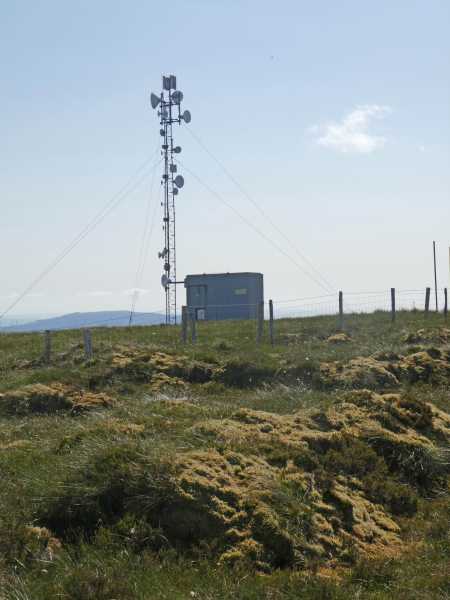
Picture: Summit area
It is possible to drive to A (G92648 42150), where there is a gate and space for several cars to park. Cross gate and follow the substantial track to Doo NW (G93330 42734), where it forks. Take track to right and continue along it for about 400m, passing trig pillar on left, which is not the high point, and where track ends. Continue across occasionally boggy, heather-covered terrain to the SE for 600m towards a small transmitter tower, which is close to highest point of the broad summit area. Allow approx. 1.25 hours for return journey.
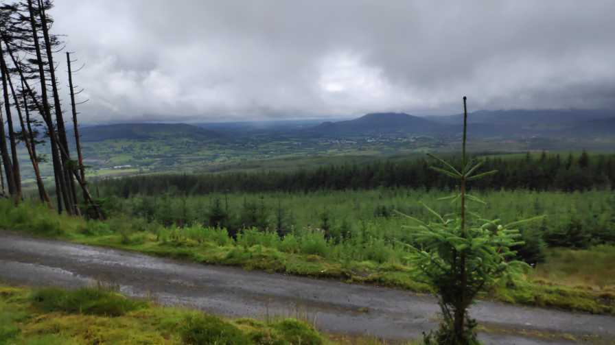
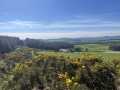
Picture: Views from the southwestern slope, with Manorhamilton and Benbo in the background.
Directions to the summit
by magnumpig
12 Aug 2019
I'd contend that Douagh isn't as ugly a hill as MadFrankie would suggest, with fine views from it's slopes towards Manorhamilton and Benbo especially. Plus it's always good for the soul to be in Lovely Leitrim. The summit is easily reached, and you can drive within about 30 metres of the trig point. I'd also suggest that this is probably the best way to walk to it to, unless you're a glutton for hardship. I'll give the driving instructions as if you're driving.
Although not shown on a number of the mapping databases there is a decent quality bog/forestry road at Doo W (G92054 42113) this road for about a mile and a half, until you come to a junction with a track (again decent quality) going off to the right. Take this track until it's end and the trig point is about 30m to your left. Linkback: mountainviews.ie/summit/572/comment/20618/
Read Less
Read More
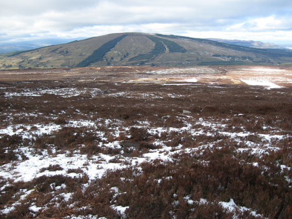
Picture: Doagh from the southeast
madfrankie on Dough Mountain
by madfrankie
1 Mar 2010
Whilst neighbouring Thur has at least some shape with a knolled summit, Doagh is a plain old spud of a hill, as you can see from this pic taken from Thur, to the southeast. Quite wet on it's upper reaches, if my memory serves. Linkback: mountainviews.ie/summit/572/comment/4456/
Use of MountainViews is governed by conditions and a privacy policy.
Read general information about the site. Opinions in material here are not necessarily endorsed by MountainViews.
Hillwalking is a risk sport. Information in comments, walks, shared GPS tracks or about starting places may
not be accurate for example as regards safety or access permission. You are responsible for your safety and your permission to walk.
See the credits and list definitions.


 Our Facebook page.