Welcome to MountainViews
If you want to use the website often please enrol (quick and free) at top right.
A small change needed. The page you went to with a url that has mountainviews.ie/mv/index.php is now superceded by the url at the top. Use this new form of url in future. Change any shortcuts or bookmarks you may have for the old format.
Overview

For more map options click on any overview map area or any detail map feature.
Detail Map Features
Find Suggested Walks
Find hill, mountain, island, coastal feature.
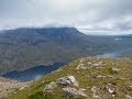
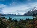
Videos
Recent Contributions
 Get Notifications
Get Notifications
Mount Kennedy: Red kites in the blue sky
 hibby
hibby
Half Glencoaghan
Belmore from NW - SOUTH route CLOSED
Arroo Mountain: Arroo from E, partial drive in
Knocklettragh: Knockletragh from North - school report
Carrane from SSW
Carricktriss Gorse: Safe access to this hill no longer seems possible
 TommyMc
Binnion: Tullagh Bay and Rockstown Harbour
 Jim_Brady
Knocklettragh from north
Crocknapeast: Long walk up windfarm roads.
 Collaborative entry
Arroo from east
Donations Drive, now finished.
Conditions and Info
Use of MountainViews is governed by conditions and a privacy policy.
Read general information about the site.
Opinions in material here are not necessarily endorsed by MountainViews.
Hillwalking is a risk sport. Information in comments, walks, shared GPS tracks or about starting places may not be accurate for example as regards safety or access permission. You are responsible for your safety and your permission to walk.
See the credits and list definitions.
 Visit our Facebook page.
Video display
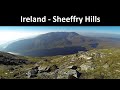
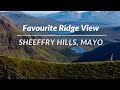
Sheeffry Hills
Area W: Doo Lough Subarea
Place count in area: 9,
OSI/LPS Maps: 37, MSW
Highest place: Barrclashcame, 772m
Maximum height for area: 772 metres,
Maximum prominence for area: 707 metres,
Places in area Sheeffry Hills:
E: Glenlaur:Laghta Eighter Hill 388mTawny Rower 510mTawnyard 436mTievnabinnia 742mTievnabinnia East Top 590mTievnabinnia SE Top 525m
W: Doo Lough:Barrclashcame 772mBarrclashcame North-West Top 580mTievummera 762m
Note: this list of places includes island features such as summits, but not islands as such.
Highest place:
Barrclashcame, 772mPlaces in area Sheeffry Hills:
E: Glenlaur:
Laghta Eighter Hill 388mTawny Rower 510mTawnyard 436mTievnabinnia 742mTievnabinnia East Top 590mTievnabinnia SE Top 525mW: Doo Lough:
Barrclashcame 772mBarrclashcame North-West Top 580mTievummera 762mNote: this list of places includes island features such as summits, but not islands as such.

Bedrock type: Mudrock, sandstone, tuff, (Sheeffry Formation)
This peak is named Storikeen nageer on on William Bald's map of Co. Mayo (1830). Previously in MV: Clashcame North-West. Barrclashcame North-West Top is the 337th highest place in Ireland. Barrclashcame North-West Top is the most westerly summit in the Sheeffry Hills area.
Linkback: https://mountainviews.ie/summit/312/
COMMENTS for Barrclashcame North-West Top (Starraicín na gCaor) 1 of 1  Follow this place's comments

|
|
|
|
||
| MountainViews.ie, a Hill-walking Website for the island of Ireland. 2400 Summiteers, 1480 Contributors, maintainer of lists: Arderins, Vandeleur-Lynams, Highest Hundred, County Highpoints etc | |||