This website uses cookies, which are small text files that the website puts on your device to facilitate operation. Cookies help us provide a better service to you. They are used to track general user traffic information and to help the website function properly.
Onzy: Track/3357 in area near Ben Bury, Mweelrea Mountains (Ireland)
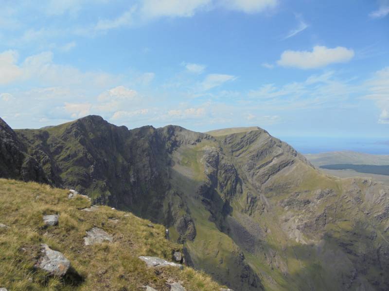
Mweelrea and the Ben Lugmore Ridge
Ascent: 746m,
Length: 15.1km,
Creator time taken: 5h 1m
Descent: 1206m,
Time predicted from Naismith's rule: 4h 16m + breaks
Click here to rate track
PlacesStart at L81076 67676, Ben Bury, Mweelrea, Ben Lugmore West Top, Ben Lugmore, Ben Lugmore East Top, end at Doo Lough N (DooL N) L82796 69548, 2.5km NE from Start
Track Rating ..
[RWD version 1 ]
Route taking in Mweelrea, Ben Bury and the 3 Ben Lugmores. Ascent is by the ramp and the decent by the SE spur of Ben Lugmore East Top. Car parking is around L828 695, about 300m south of the Doo Lough Memorial, where there are a couple of spaces on the edge of the road. Otherwise there is plenty of parking at the memorial itself.
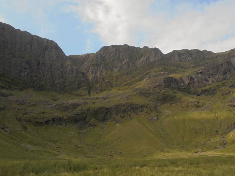
Approach to the ramp from the east, the ramp visible rising from left to right
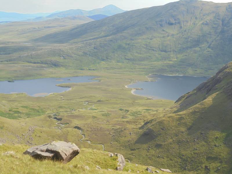
View east from low on the ramp, the ascent route between the loughs
Few glitches in the gps ... the track doesn't seem to begin until half way up the ramp! Actual stats are around 18k, ascent of 1,200m and time of 6h 45m.
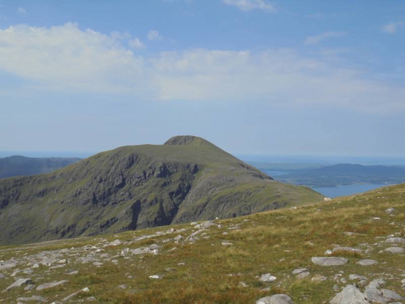
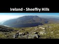
Mweelrea
My last minute trip west having been prompted by the forecast of good weather, the planning of this route had been a little hasty. In particular, I was ensconsed in Hamilton's post-walk before I read the comments on the site concerning the descent off BLET. That descent, as rightly pointed out by many contributors, is both long and challenging, and when combined with a further c.5k from the bottom to the car, makes for a somewhat frustrating finish. Interestingly, the Open Street map records a track on the spur, and I am aware that the Leenaun Walking Festival used the spur for an ascent. On the ground however, there is nothing obvious; you do periodically come across trampled ground, but keeping to it is impossible given the broken nature of the terrain.
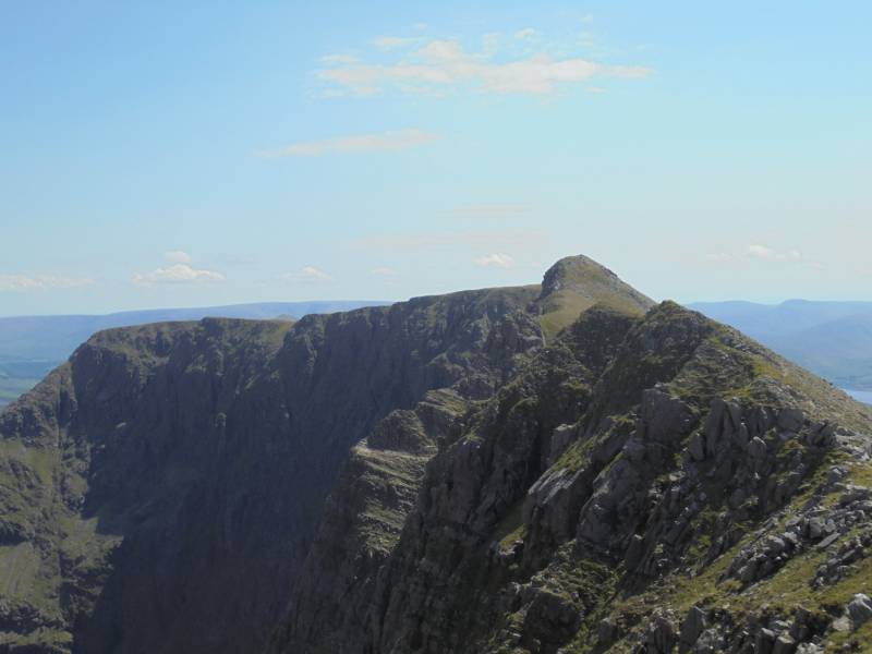
Ben Lugmore Ridge from west
Ben Lugmore Ridge from east, early on the descent
That being said, this is a stunning walk over some of our highest rated hills ... one of the best days walking I have had.
Editing Details for track/3357
NOTE: ALL information such as Ascent, Length and Creator time taken etc should be regarded as approximate. The creator's comments are opinions and may not be accurate or still correct.
Your time to complete will depend on the speed of the slowest plus break time and your mode of transport.
NOTE: It is up to you to ensure that your route is appropriate for you and your party to follow bearing in mind all factors such as safety, weather conditions, experience and access permission.
Uploaded on: Wed, 20 Jul 2016 (21:29:42), Linkback: https://mountainviews.ie/track/3357/
* Note: A GPS Height in the elevation profile is sourced from the device that recorded the track. An "SRTM" height is derived from a model of elevations for parts of the earth. More detail
Use of MountainViews is governed by conditions and a privacy policy.
Read general information about the site. Opinions in material here are not necessarily endorsed by MountainViews.
Hillwalking is a risk sport. Information in comments, walks, shared GPS tracks or about starting places may
not be accurate for example as regards safety or access permission. You are responsible for your safety and your permission to walk.
See the credits and list definitions.


 Our Facebook page.