I took on Carrauntoohil on the 25th June 2010 leading a group from the UK who were doing the five peaks challenge and attempting to do so within forty eight hours. I had never been up here before but I never let that stop me from exploring new horizons. Amongst the group of six walkers I was the only one with map and compass skills so I decided on a route via Caher as I have heard the Devils ladder route has become quite badly eroded in recent times. I also had some selfish reasons in choosing this route as I wanted to tick a few more peaks off my list at the same time
We started at
 Hydro Rd (V772 871)
 at the gate to the Hydro track. This track has a steep and punishing start having just jumped out of the car but it quickly warms the legs. Mercifully after maybe ten minutes of walking the track levels off as it turns South at approx
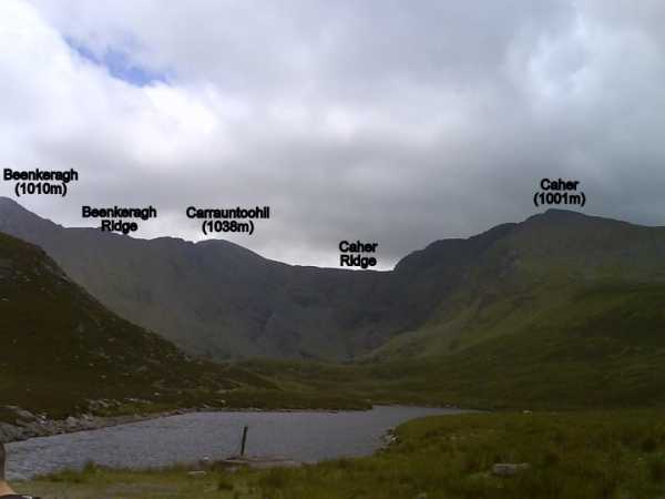
E (V777 868). The track continues with Skregbeg (573m) and Skregmore (848m) on your left hand side before opening up at Lough Eighter and revealing the full view of Beenkeragh, Carrauntoohil and Caher (assuming the weather is clear that is)
After another hop over a locked gate we crossed a flat marshy section of ground before climbing onto the spur that would lead us directly up Caher. We got onto the spur at approx
F (V776 857) before following it south-east all the way to Caher West top at
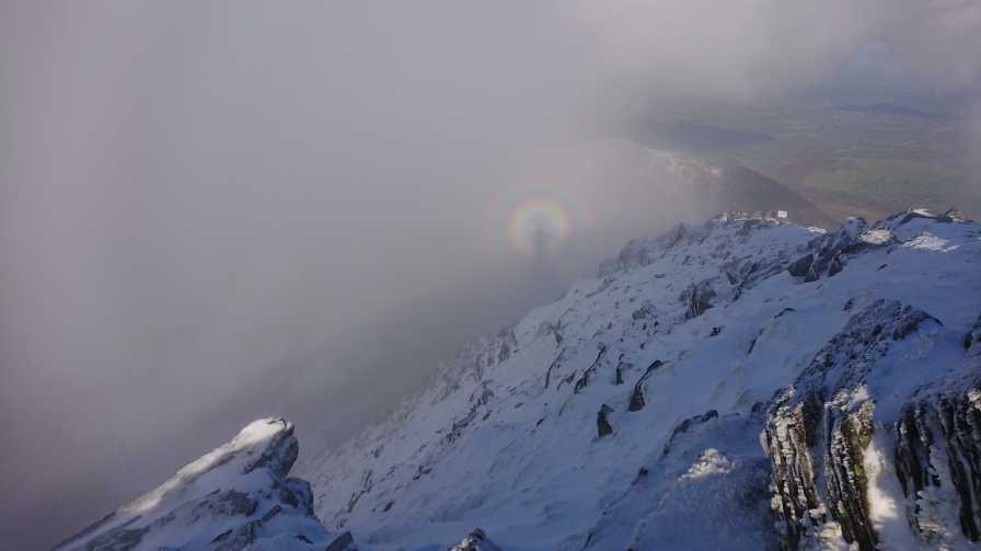
G (V789 840). The last 500m of the spur is steep but thankfully the ground is quite good so progress should not be hindered. By the time we got to the first of the three Caher summits we were dipping in and out of the clouds. The fall away from the West top when heading for Caher in the clouds can be a little worrying if unsure of your bearings so care is definitely needed. The best approach would be to keep well to the right, we were fortunate however, just as I took a safe bearing the cloud cleared just enough for me to get an eyeshot of our target, a small gap in the wall, which seemed to settle the nerves of my fellow hikers
The walk to Caher from the West top is quick, a small amount of uphill climbing remains before the third highest summit in Ireland at 1 metre above 1000m. The small cairn at
H (V792 838) is all that marks the top and as we were under some time pressure we did not hand around long either
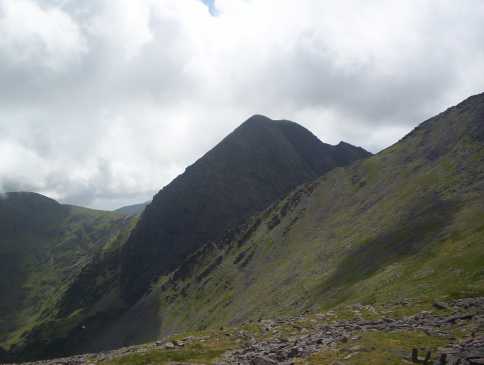
Crossing the Caher ridge to Carrauntoohil was fantastic, some of the scenery that magically appeared from the cloud was breathtaking. There is a very noticeable track that leads across the ridge which makes navigation a lot easier. We were practically on the summit before we could see the cross marking it at
I (V803 844), the cloud and wind had really picked up during the intervening time, so much so that we only took a few moments to take a few pictures and took off via the same route home. It was a very respectable five and a half hour round trip and a good start to the five peaks challenge for the other guys
Linkback: mountainviews.ie/summit/1/comment/5911/
Read Less


 Our Facebook page.