This website uses cookies, which are small text files that the website puts on your device to facilitate operation. Cookies help us provide a better service to you. They are used to track general user traffic information and to help the website function properly.
Feature count in area: 24, all in Donegal,
OSI/LPS Maps: 10
Highest Place: Slieve League 596.4m
Starting Places (1) in area Donegal SW: Port Pier
Summits & other features in area Donegal SW: Maum 325m N: Sliabh Tuaidh: Tormore Island South 94m, Tormore Island North 139m, Crockuna 400m, Slievetooey 511m, Slievetooey Far West Top 460m, Slievetooey West Top 472m NE: Glengesh: Balbane Hill 472m, Glengesh Hill 390m, Common Mountain 499.7m, Crocknapeast 497m, Croaghavehy 372m, Mulmosog Mountain 351m, Mulnanaff 475m NW: Glencolmkille: Croaghacullion 374m, Croaghloughdivna 310m S: Killybegs Hills: Croaghacullin 405m, Croaghmuckros 275m, Crownarad 493m, Crownarad SW Top 471m SW: Slieve League: Crockrawer 435.2m, Leahan 427m, Slieve League 596.4m, Slieve League SE Top 576.7m
Note: this list of places may include island features such as summits, but not
islands as such.
Crocknapeast, 497mHill Cnoc na Péiste A name in Irish,
Place Rating ..
(prob. Ir. Cnoc na Péiste [PDT], 'hill of the serpent'), Donegal County in Ulster province, in Carn Lists, Crocknapeast is the 579th highest place in Ireland.
Grid Reference G69340 83778,
OS 1:50k mapsheet 10 Place visited by: 35members, recently by: Colin Murphy, kernowclimber, annem, markmjcampion, eamonoc, PPruzina, LorraineG60, MichaelG55, mcrtchly, simon3, pmeldrum, IndyMan, Peter Walker, Fergalh, PPruz
I visited this place: NO (You need to be a logged-in member for this.)
Longitude: -8.47634, Latitude: 54.701099, Easting: 169340, Northing: 383778,
Prominence: 113m, Isolation: 0.9km ITM: 569296 883770 Bedrock type: Banded semi-pelitic & psammitic schist, (Termon Formation) Notes on name: This peak is located on the watershed between Mulnanaff and Common Mountain, and on the boundary between the townlands of Crowbane and Tieveskeelta.
Short or GPS IDs, 6 char: Crcknp, 10 char: Crcknpst Linkback: https://mountainviews.ie/summit/465/
Gallery for Crocknapeast (Cnoc na Péiste) and surrounds
Summary
for Crocknapeast (Cnoc na Péiste):
Long walk up windfarm roads.
Summary created by Colin Murphy
2024-04-29 13:58:39
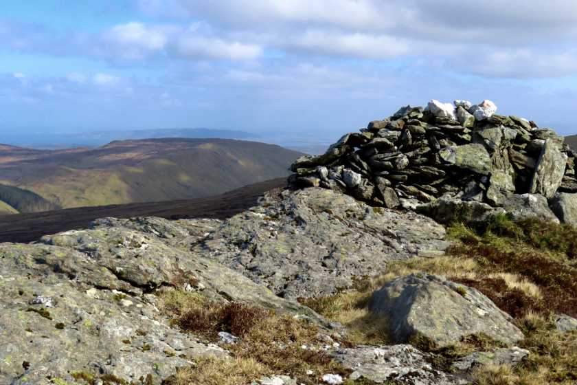
Picture: Summit cairn
Crocknapeast is reached via a longish walk of about 13km return, mostly along windfarm tracks, and can be combined with a visit to Mulnanaff and Balbane Hill (unlisted) if you wish. There is parking for a couple of cars at a forestry entrance at A (G70138 81131). Cross over gate and walk up as far as a T-junction then turn right. Continue along gently rising gravel track to B (G68298 82971), turn right and walk as far as the second last windmill at C (G68962 83076). At this point you are at 440m elevation. Leave track turning north onto open hillside, dropping down to a col about 10m below. continue across the open hillside - mostly grass, boggy/mossy areas, with a few pools - for about 800m and a climb of about 60m to reach the summit, which is marked by a large cairn.
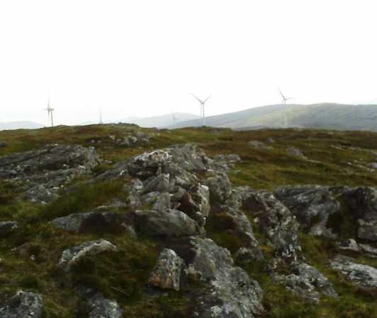
Cnoc Na Péiste summit, taken while on a circuit just shy of 15K, which began at Glengesh Viewpoint, taking in order - Common Mtn, Cnoc Na Péiste, Balbane Hill and Maol Na nDamh. As can be seen from the photograph Balbane's windturbines can be seen in the background as can Maol Na nDamh (right). Excellent views all around - no serpents or beasties to be seen but there were quite a few midges, not encountered on the other three hills. Perhaps, they were attracted by the locheen a short distance NNW of the summit proper. Linkback: mountainviews.ie/summit/465/comment/3793/
Read Less
Read More
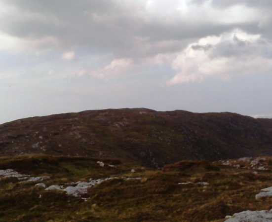
Picture: Cnoc Na Péiste from Balbane Hill
eflanaga on Crocknapeast
by eflanaga
1 Jun 2009
The picture I took from the Spot Height 442 ID (G69917 85272) which provides a much better profile of Cnoc Na Péiste was poor so I'm including this one taken on the opposite side of the mountain from Balbane Hill. A short drop from the top of the former and a short traverse over rather marshy ground, with the windfarm to your right, will take you from summit to summit in 15-20 minutes. Linkback: mountainviews.ie/summit/465/comment/3794/
Use of MountainViews is governed by conditions and a privacy policy.
Read general information about the site. Opinions in material here are not necessarily endorsed by MountainViews.
Hillwalking is a risk sport. Information in comments, walks, shared GPS tracks or about starting places may
not be accurate for example as regards safety or access permission. You are responsible for your safety and your permission to walk.
See the credits and list definitions.


 Our Facebook page.