This website uses cookies, which are small text files that the website puts on your device to facilitate operation. Cookies help us provide a better service to you. They are used to track general user traffic information and to help the website function properly.
Onzy: Track/5076 in area near Maiden Moor, Lake District - Central & Western Fells (Britain)
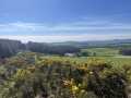
Lake District: Dale Head Horseshoe
Ascent: 1057m,
Length: 16.1km,
Creator time taken: 4h41m
Descent: 1056m,
Time predicted from Naismith's rule: 4h 59m + breaks
Click here to rate track
PlacesStart at NY23173 19384, Maiden Moor, High Spy North Top, High Spy, Dale Head, Hindscarth, Robinson, High Snab Bank, end at Start
Track Rating ..
[RWD version 1 ]
Round taking in 5 Wainwrights - Maiden Moor, High Spy, Dale Head, Hindscarth and Robinson. The standard round of this grouping adds Catbells and doesnt include Robinson. Catbells I got on an abortive attempt to do this round a couple of years ago - I was almost literally blown off the hill and felt it prudent to retreat, Robinson was a potential 'orphan' which this track ties up neatly. (151/214)
Editing Details for track/5076
NOTE: ALL information such as Ascent, Length and Creator time taken etc should be regarded as approximate. The creator's comments are opinions and may not be accurate or still correct.
Your time to complete will depend on the speed of the slowest plus break time and your mode of transport.
NOTE: It is up to you to ensure that your route is appropriate for you and your party to follow bearing in mind all factors such as safety, weather conditions, experience and access permission.
Uploaded on: Fri, 26 Apr 2024 (20:15:11), Linkback: https://mountainviews.ie/track/5076/
* Note: A GPS Height in the elevation profile is sourced from the device that recorded the track. An "SRTM" height is derived from a model of elevations for parts of the earth. More detail
Use of MountainViews is governed by conditions and a privacy policy.
Read general information about the site. Opinions in material here are not necessarily endorsed by MountainViews.
Hillwalking is a risk sport. Information in comments, walks, shared GPS tracks or about starting places may
not be accurate for example as regards safety or access permission. You are responsible for your safety and your permission to walk.
See the credits and list definitions.


 Our Facebook page.