- Home
- Main Display
- Main Display (Old)
- Find a Walk
- Display INTRODUCTION
- DONATE
- Click below for your
profile & contributions
guestuser- New
- Tracks, Walks
- Challenge
- Community
- Lists & Logs
- Popular Lists:
- County Highpoints
- Range & Area Highpoints
- Local 100
- Highest Hundred
- Vandeleur-Lynams
- Arderins
- Carns
- Best rated
- Irish 900 up
- Irish Island
- Munros
- All Lists
- Shorter Irish
- County Highpoints
- Range & Area Highpoints
- Highest Hundred
- Local 100
- Local 100 (pre2014)
- Local Historical Cultural
- Best rated
- Irish 900 up
- Larger Irish
- Arderins
- Arderin Begs
- Arderins + Arderin Begs
- Vandeleur-Lynams
- Vandeleur-Lynams + Arderins
- Carns
- Binnions
- Highest 50 per Province
- Island Features
- Irish Island
- Coastal Hills
- Irish 600 up
- Irish 500 up
- British
- Munros
- British 600 up
- British 500-600
- British Marilyns
- Comprehensive
- All Irish summits
- All Irish features
- All British summits
- All Britain+ Ireland
- Special
- Analysis List
- Simple Irish Listings
- Simple Irish & British Listings
-
- More
- Motley Views
Welcome to MountainViews
If you want to use the website often please enrol (quick and free) at top right.OverviewFor more map options click on any overview map area or any detail map feature.Detail Map FeaturesShowing 20 of a total of 36 items:
Garraun 598m, Benchoona East Top 585m, Benchoona 581m, Garraun South Top 557m, Mweelrea SE Spur 495m, Teevnabinnia 379m, Letterettrin 333m, Lettershanbally 324m, Foher 223m, Carricklea 95m,Tracks:3640, 23km 2736, 20km 3075, 19km 4532, 17km 3241, 16km 928, 16km 2728, 13km 2553, 12km 4432, 11km 3159, 11km Find Suggested Walks
Find hill, mountain, island, coastal feature.Videos
Recent Contributions
 Get Notifications
Dún Briste: You must be joking
Letterettrin - a perspective on the N Connemara peaks
Knocklettercuss: Ascend via the spur
Doonvinalla E Top: Portacloy Cliff Walk
Erris Head Hill: Fantastic loop
Burren: Black Head Loop
Kilbrony Park Ramble
Aghaglasheen: Highest point on the peninsula
Knocknakilton & Cummeen, Dingle Penninsula
Blackstairs Mountain: Good access and a great viewpoint above a patchwork quilt
Silvermines Hydro Project
Carrigroe: Twin tops
Conditions and Info
Use of MountainViews is governed by conditions and a privacy policy.
Read general information about the site.
Opinions in material here are not necessarily endorsed by MountainViews.
Hillwalking is a risk sport. Information in comments, walks, shared GPS tracks or about starting places may not be accurate for example as regards safety or access permission. You are responsible for your safety and your permission to walk.
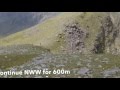
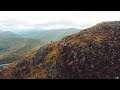
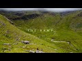
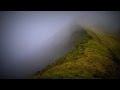
See the credits and list definitions.Video displayglencree: Track 5286 in area near Leitir Eitreann, Twelve Bens (Ireland)Letterettrin - a perspective on the N Connemara peaks Length: 9.2km, Creator time taken: 4h56m, Ascent: 325m,
Descent: 324m
Places: Start at L8183861098, Leitir Eitreann, end at Start
Logged as completed by 1

Park at L81005 61429, where there was space for 2 cars. The road leads in to Killary Harbour where there is a large mussel farm. Ensure the car is completely on the grass verge as large lorries are a regular feature. This modest mountain offers an excellent perspective on the north Connemara and Mayo higher peaks and their relative positions. On a good day the views are magnificent. As others have mentioned, the going is soft, even after the dry spell in Spring 2025.

Looking north to Ben Lugmore and Killary Harbour
After reaching the summit we headed north west and then made a steep descent to the Foher famine village and the track back past the mussel farm along the shore of Killary Harbour.

Looking south to Maamturks (L), Bens (R) and Lackavrea (Centre)

Letterettrin is the low hill on the left, overshadowed by its larger neighbour, Benchoona (taken from the Silver Strand in Mayo)
COMMENTSNo comments uploaded yet.NOTE: ALL information such as Ascent, Length and Creator time taken etc should be regarded as approximate. The creator's comments are opinions and may not be accurate or still correct.
Your time to complete will depend on your speed plus break time and your mode of transport. For walkers: Naismith's rule, an approximate though often inaccurate estimate, suggests a time of 2h 22m + time stopped for breaks
NOTE: It is up to you to ensure that your route is appropriate for you and your party to follow bearing in mind all factors such as safety, weather conditions, experience and access permission.
* Note: A GPS Height in the elevation profile is sourced from the device that recorded the track. An "SRTM" height is derived from a model of elevations for parts of the earth. More detail Height layer: © MapTiler

MountainViews.ie, a Hill-walking Website for the island of Ireland. 2500 Summiteers, 1480 Contributors, maintainer of lists such as: Arderins, Vandeleur-Lynams, Highest Hundred, County Highpoints etc

 TommyV
 glencree
 TommyV
 TommyV
 TommyV
 TommyV
 Collaborative entry
 Colin Murphy
 Visit our Facebook page.