Members and Supporters, the MountainViews Committee requests your help to meet the costs of the website and of other activities such as insured events or publications.
Feature count in area: 12, all in Mayo,
OSI/LPS Maps: 37, EW-CON, MSW
Highest Place: Mweelrea 814m
Starting Places (31) in area Mweelrea: Aasleagh Waterfall CP, Ben Creggan N, Bundorragha Estuary Cross, Bunleemshough River Source, Carraig Bar, Delphi Resort, Dernasliggaun, Doo Lough N, Doo Lough SE, Fee Lough SW, Foher, Glencraff Road End, Glencullin Lough CP, Glendavock, Glenummera River, Illaunroe North, Illaunroe South, Killary Boat Tour Pier W, Leenane, Leenane Hotel, unuseableLeenane R336, Lough Fee East, Muck Lough NW, Nambrackkeagh Lough, Owenduff River, Owengar Bridge, Owenwee River, Sean Scoil an Talaimh Bháin, Silver Strand Road, Tawnydoogan Forest Central, Tawnydoogan Forest North
Summits & other features in area Mweelrea: E: Ben Gorm Mountains: Ben Creggan 693m, Ben Creggan South Top 687m, Ben Gorm 700m W: Mweelrea: Ben Bury 795m, Ben Lugmore 803m, Ben Lugmore East Top 790m, Ben Lugmore West Top 790m, Corrymailley Hill 286m, Mweelrea 814m, Mweelrea SE Spur 495m, Tawnydoogan 312m, Teevnabinnia 379m
Note: this list of places may include island features such as summits, but not
islands as such.
Mweelrea SE Spur, 495mHill Derreennawinshin A name in English,
Place Rating ..
For origin of name, see Mweelrea., Mullán a Bhradá, Mullaunagrawdy, Mayo County in Connacht province, in Carn Lists, Mweelrea SE Spur is the 586th highest place in Ireland.
Grid Reference L79625 65439,
OS 1:50k mapsheet 37 Place visited by: 126members, recently by: annem, paulbrown, maitiuocoimin, eflanaga, GerSomers, wallr, elizauna, JohnRea, trevorf, John.geary, Mark1, nickywood, march-fixer, Carolyn105, dregish
I visited this place: NO (You need to be a logged-in member for this.)
Longitude: -9.820127, Latitude: 53.625077, Easting: 79625, Northing: 265439,
Prominence: 70m, Isolation: 1.5km ITM: 479601 765458 Bedrock type: Sandstone & conglomerate, ignimbrite, (Mweelrea Formation) Notes on name: This peak itself has no name on the Discovery map. However, a spot slightly to the west is named Tawnagradia on the OS 6 inch map. Breandán S. Mac Aodha suggests Tamhnach na gCreathaidí, 'green field of the small seed potatoes' as a possible interpretation (MNIMA, 147). If correct, this would be a graphic illustration of the desperate farming conditions here in the past, given the altitude, remote location and rugged terrain. Previously Derreennawinshin in MV.
Short or GPS IDs, 6 char: MwlrSE, 10 char: MwlrSESpr Linkback: https://mountainviews.ie/summit/474/
Gallery for Mweelrea SE Spur (Derreennawinshin) and surrounds
Summary
for Mweelrea SE Spur (Derreennawinshin):
Outpost of Mweelrea with views and character.
Summary created by simon3
2010-06-21 21:51:45
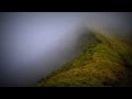
Picture: The summit from the NE in front of the 12 Bens.
Probably most will come to the this summit before or after going to Mweelrea to which it is joined by a broad col extending NE. It has good views of the 12 Bens, the Maamturks etc and in particular of the nearly sheer east side of Mweelrea.
One way to reach this summit is from the vicinity of the Delphi Mountain Resort. There is parking at the centre (it's polite to buy a drink if you are using it) or beside the road including at a nearby bridge.
The quickest way is along a forest track starting at around A (L84080 64678). Walk east from there following the west side of the trees until you can reach the col between the first smaller top you pass (Teevnabinnia, name not shown on the OS) and Mweelrea SE Spur. Climb up from the col -- it becomes very steep but feasible.
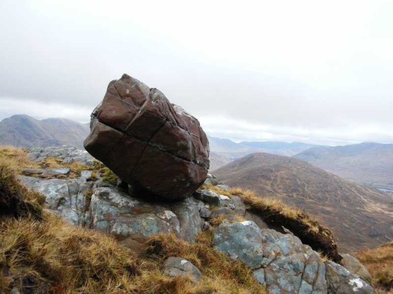
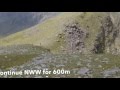
Picture: Boulder on SE Spur with Teevabinnia below.
Hard slog!
by paddyhillsbagger
16 Feb 2013
Did Mweelrea SE Spur along with Teevnabinnia to complete the Mweelrea area list. Started from B (L840 633) near the pier at Clogh. Proved to be a very steep, boggy and tiring walk through rough terrain. The views were magnificent however. There were a lot of large free standing boulders and rocks between the 2 tops and some rocky outcrops mark the summit of the SE Spur. Linkback: mountainviews.ie/summit/474/comment/14925/
Read Less
Read More
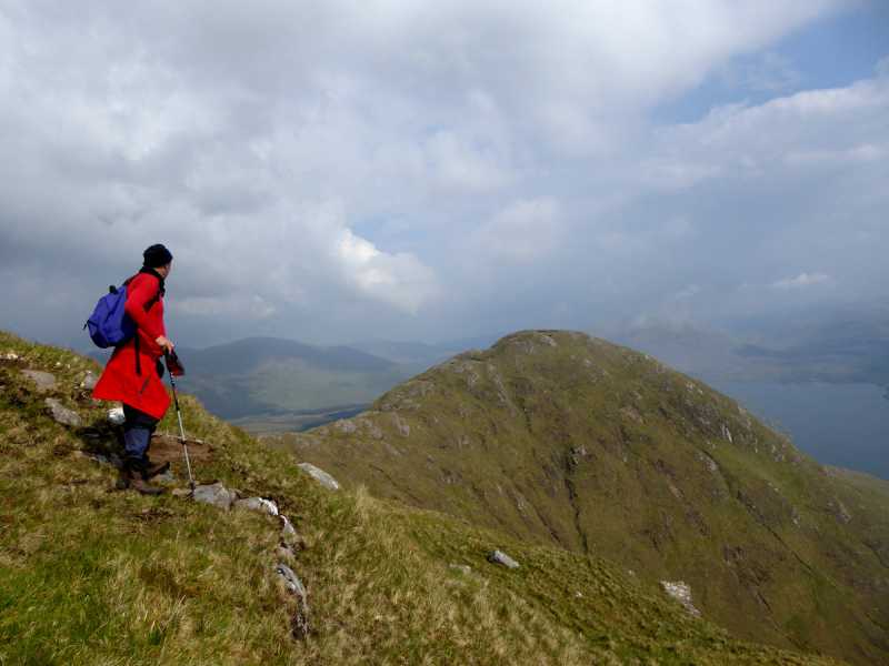
Picture: As seen from Mweelrea slopes
Fine hill with well defined summit.
by Colin Murphy
30 May 2016
Often the first or last stop on the Mweelrea-Lugmore circular route, this is a fine summit in itself and is just 5m short of Arderin status. Approaching from Mweelrea it is just 70m ascent from the col to a grass/boulder summit. Coming down initially is very steep, and as ground levels out the terrain becomes rough - long grass, spongy, uneven, young forestry, barbed wire fencing - before you eventually find the long track that emerges into Delphi Adventure Centre lodge and the road beyond. From summit to road is a good 5km. Linkback: mountainviews.ie/summit/474/comment/18550/
Read Less
Read More
narrow 'gullys'
by YoungJohn
9 Aug 2018
Be careful at the start of this mountain. Grass covers deep narrow 'gullys' or drains. Be sure of your footing. This is a hard slog of a mountain though we were blessed with a good day. Spectaculat views of killary harbour and conamara. Linkback: mountainviews.ie/summit/474/comment/20006/
Use of MountainViews is governed by conditions and a privacy policy.
Read general information about the site. Opinions in material here are not necessarily endorsed by MountainViews.
Hillwalking is a risk sport. Information in comments, walks, shared GPS tracks or about starting places may
not be accurate for example as regards safety or access permission. You are responsible for your safety and your permission to walk.
See the credits and list definitions.


 Our Facebook page.