Guestuser: Login or enrol?
- Home
- Main Display
- Main Display NEW
- Find a Walk
- Display INTRODUCTION
- Donate to MountainViews
- Click below for your profile
guestuserOverviewFor more map options click on any overview map area or any detail map feature.Detail Map FeaturesFind Suggested Walks
Find hill, mountain, island, coastal feature.Videos
Users Online:
Guests online: 292Recent Contributions
 Get Notifications
Corranabinnia SW Top: Maol Rua - a lot of reward for a moderate challenge
Nine Stones via Mount Leinster and Knockroe to Kiltealy
Croaghonagh: Broad tracks all the way to top.
Central Glenbeigh Horseshoe - 3 lakes and 4 peaks
Carrickbyrne Hill: Very overgrown but passable
Energy sapping trudge over, rough, sponge-like terrain.
Tievummera Highpoint: An obvious stop along the ridge
Long walk for one Carn.
Faha Ridge: Testing ridge with narrow irregular path. Often extreme.
Hare Island: A very pleasant four hours
Dull trek up forest tracks
Garinish Island: White-tailed sea eagles on Gairinish
Conditions and Info
Use of MountainViews is governed by conditions and a privacy policy.
Read general information about the site.
Opinions in material here are not necessarily endorsed by MountainViews.
Hillwalking is a risk sport. Information in comments, walks, shared GPS tracks or about starting places may not be accurate for example as regards safety or access permission. You are responsible for your safety and your permission to walk.
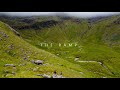
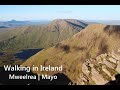
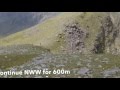
See the credits and list definitions.Video displayMweelrea Area W: Mweelrea SubareaPlace count in area: 12, OSI/LPS Maps: 37, EW-CON, MSW
Highest place: Mweelrea, 814m
Maximum height for area: 814 metres, Maximum prominence for area: 779 metres,
Places in area Mweelrea:
E: Ben Gorm Mountains:Ben Creggan 693mBen Creggan South Top 687mBen Gorm 700m
W: Mweelrea:Ben Bury 795mBen Lugmore 803mBen Lugmore East Top 790mBen Lugmore West Top 790mCorrymailley Hill 286mMweelrea 814mMweelrea SE Spur 495mTawnydoogan 312mTeevnabinnia 379m
Note: this list of places includes island features such as summits, but not islands as such.
For origin of name, see Mweelrea. Mayo County in Connacht Province, in Carn List, Sandstone & conglomerate, ignimbrite Bedrock
Height: 495m OS 1:50k Mapsheet: 37 Grid Reference: L79625 65439
Place visited by 126 members. Recently by: annem, paulbrown, maitiuocoimin, eflanaga, GerSomers, wallr, elizauna, JohnRea, trevorf, John.geary, Mark1, nickywood, march-fixer, Carolyn105, dregishI have visited this place: NO (You need to be a logged-in member to change this.)Longitude: -9.820127, Latitude: 53.625077 , Easting: 79625, Northing: 265439 Prominence: 70m, Isolation: 1.5km
ITM: 479601 765458 , GPS IDs, 6 char: MwlrSE, 10 char: MwlrSESpr
Bedrock type: Sandstone & conglomerate, ignimbrite, (Mweelrea Formation)
This peak itself has no name on the Discovery map. However, a spot slightly to the west is named Tawnagradia on the OS 6 inch map. Breandán S. Mac Aodha suggests Tamhnach na gCreathaidí, 'green field of the small seed potatoes' as a possible interpretation (MNIMA, 147). If correct, this would be a graphic illustration of the desperate farming conditions here in the past, given the altitude, remote location and rugged terrain. Previously Derreennawinshin in MV. Mweelrea SE Spur is the 586th highest place in Ireland.
Linkback: https://mountainviews.ie/summit/474/COMMENTS for Mweelrea SE Spur (Derreennawinshin) 1 of 1  Follow this place's comments


MountainViews.ie, a Hill-walking Website for the island of Ireland. 2400 Summiteers, 1480 Contributors, maintainer of lists: Arderins, Vandeleur-Lynams, Highest Hundred, County Highpoints etc

 ochils_trekker
 simon3
 Collaborative entry
 glencree
 DeirdreM
 Colin Murphy
 David-Guenot
 Colin Murphy
 Collaborative entry
 garrettd
 Colin Murphy
 garrettd
 Visit our Facebook page.