This website uses cookies, which are small text files that the website puts on your device to facilitate operation. Cookies help us provide a better service to you. They are used to track general user traffic information and to help the website function properly.
mlmoroneybb: Track/3668 in area near Shehy/Knockboy (Ireland)
The Beara-Breifne Way Day4
Ascent: 783m,
Length: 27.5km,
Creator time taken: 7h46m
Descent: 626m,
Time predicted from Naismith's rule: 6h 48m + breaks
Click here to rate track
PlacesStart at Glengarriff (Gl'gariff) V92958 56357, Foilastookeen, end at Gougane Barra Oratory (Goug Br Ch) W09293 65953, 19km NE from Start
Track Rating ..
[RWD version 1 ]
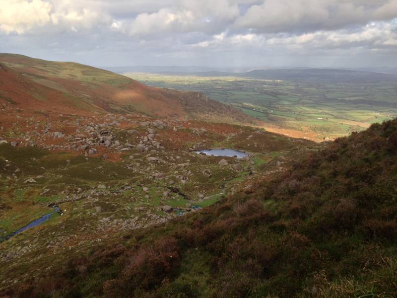
The Saturday trek started in the scenic village of Glengarriff. From here a short boat trip brought some of our members to the beautiful Garnish island. Others continued in the shadow of the Cabh Dudb mountain and over the Coomhola River, then into the valley of An Coinigeor, with views of the Shehy mountains to our right where we encountered a herd of Highland cattle. The days walk ended with weary legs as we descended to the glacier lake of Gougane Barra. We enjoyed our dinner in the views of this ancient religious setting.
Editing Details for track/3668
NOTE: ALL information such as Ascent, Length and Creator time taken etc should be regarded as approximate. The creator's comments are opinions and may not be accurate or still correct.
Your time to complete will depend on the speed of the slowest plus break time and your mode of transport.
NOTE: It is up to you to ensure that your route is appropriate for you and your party to follow bearing in mind all factors such as safety, weather conditions, experience and access permission.
Uploaded on: Thu, 7 Dec 2017 (11:28:41), Linkback: https://mountainviews.ie/track/3668/
* Note: A GPS Height in the elevation profile is sourced from the device that recorded the track. An "SRTM" height is derived from a model of elevations for parts of the earth. More detail
Use of MountainViews is governed by conditions and a privacy policy.
Read general information about the site. Opinions in material here are not necessarily endorsed by MountainViews.
Hillwalking is a risk sport. Information in comments, walks, shared GPS tracks or about starting places may
not be accurate for example as regards safety or access permission. You are responsible for your safety and your permission to walk.
See the credits and list definitions.


 Our Facebook page.