Donation Request 2024

DONATE
Members and Supporters, the MountainViews Committee requests your help to meet the costs of the website and of other activities such as insured events or publications.
You do not have to be logged in to donate.
Features
Nearby features appear when you click the map.
Declutter tracks on map.
Place Search
Video
X
Pub: by
Dartry Mountains Area , NE: Arroo Keeloges Subarea
Feature count in area: 31, by county: Leitrim: 22, Sligo: 10, of which 1 is in both Sligo and Leitrim, OSI/LPS Maps: 16, 17, 25, 26
Highest Place: Truskmore 647m

Starting Places (22) in area Dartry Mountains:
Aghavoghil Middle, Arroo Trail CP, Ballaghnatrillick, Ballintrillick Forest, Barrs East, Castletown, Crumpaun, Curraghan Road, Dough Mountain NW, Dough Mountain West, Drumcliff River Road, Eagles Rock, Edenbaun, Glencar Waterfall, Gleniff Horseshoe Road, Lough Cloonaquin North, Luke's Bridge, Mountain Wood, Poulveha River, Thur East, Tormore Car Park, Truskmore Transmitter Entrance

Summits & other features in area Dartry Mountains:
N: Truskmore: Gortnagarn 445m, Tievebaun 611m, Truskmore 647m, Truskmore SE Cairn 631m
NE: Arroo Keeloges: Aganny Top 482m, Aghalateeve 432m, Agow Top 423m, Arroo Mountain 523m, Conwal North 421m, Crocknagapple 372m, Keeloges 452m
NW: Benbulbin: Annacoona Top 597m, Benbulbin 526m, Benwiskin 514m, Benwiskin South Top 508m, Kings Mountain 462m
SE: Manorhamilton Hills: Ballaghnabehy Top 413m, Benbo 415m, Dough Mountain 462m, Lackagh Mountain 449m, Larkfield 305m, Naweeloge Top 441m, Thur Mountain 442m
SW: Castlegal Hills: Copes Mountain 452m, Crockauns 463m, Hangmans Hill 400m, Keelogyboy Mountain 438m, Keelogyboy Mountain Far East Top 418m, Keelogyboy Mountain NE Top 435m, Keelogyboy Mountain SW Top 417m, Leean Mountain 417m

Note: this list of places may include island features such as summits, but not islands as such.
Rating graphic.
Agow Top, 423m Hill
Place Rating ..
, Leitrim County in Connacht province, in Carn Lists, Agow Top is the 840th highest place in Ireland.
Grid Reference G86500 47200, OS 1:50k mapsheet 16
Place visited by: 21 members, recently by: Colin Murphy, conormcbandon, Wilderness, magnumpig, FrankMc1964, Wildrover, supersullivan, PeakPaul, Hilldweller, frankmc04, madfrankie, Garmin, eamonoc, Fergalh, Harry Goodman
I visited this place: NO (You need to be a logged-in member for this.)
Longitude: -8.208498, Latitude: 54.37327, Easting: 186500, Northing: 347200, Prominence: 38m,  Isolation: 2.8km
ITM: 586452 847200
Bedrock type: Pale orthoquartzitic sandstone, (Glenade Sandstone Formation)

  Short or GPS IDs, 6 char: AgwTp, 10 char: Agow Top

Linkback: https://mountainviews.ie/summit/725/
Gallery for Agow Top and surrounds
Summary for Agow Top : 4km walk up gently rising trails
Summary created by Colin Murphy 2024-03-21 17:22:34
            MountainViews.ie picture about Agow Top
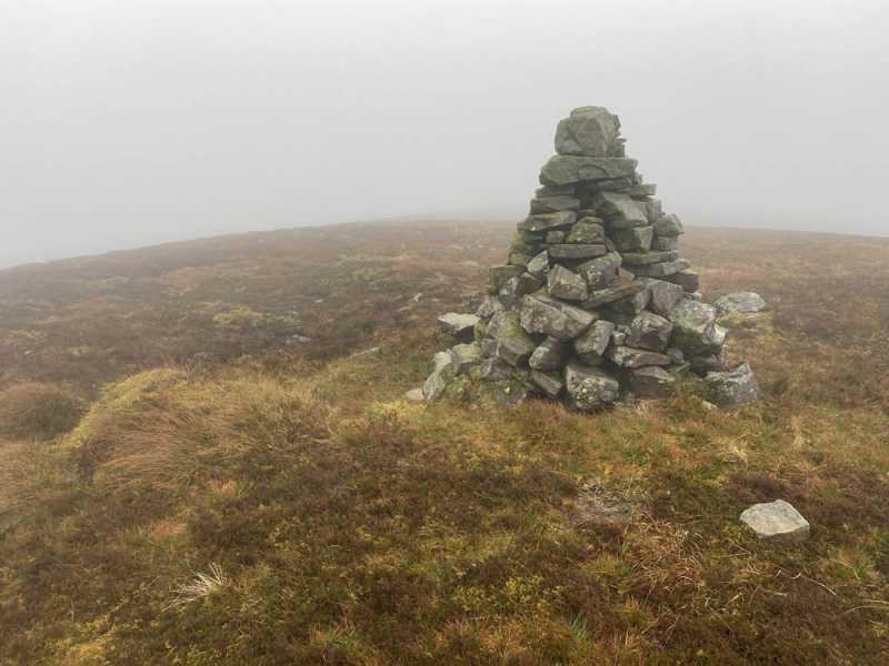
Picture: Summit cairn
The starting point at A (G87073 44228) has enough space for a couple of cars. Continue up the farm track, which rises very gently up for almost 1.5km through woods and then on to open hillside. At B (G87172 45480) you will see an old wall on the left running perpendicular to the track, with a short tree growing alongside it, leave track and head directly up the grassy slope. You should be able to pick up a faint trail running parallel to a tiny stream – this continues on and off all the way to the summit, which is a further 2km to the north, the slope gentle and mostly short grass underfoot. You will pass a pointy marker cairn along the way. A tall cairn marks the highpoint. Allow two hours up and down.
Linkback: mountainviews.ie/summit/725/comment/5484/
Member Comments for Agow Top
Comment create / edit display placeholder

            MountainViews.ie picture about Agow Top
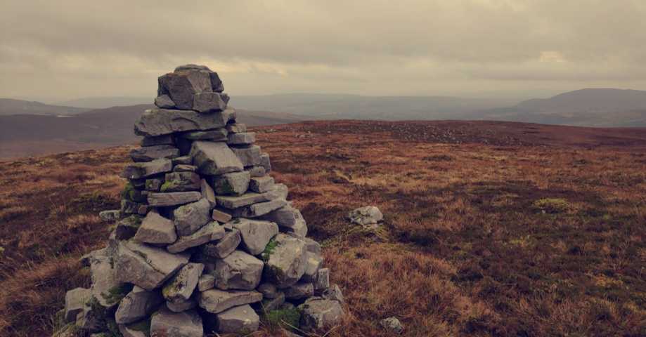
Picture: Looking west from summit
Southern top of a wonderful plateau
by gerrym 27 Jan 2013
Agow Top is at the southern end of the wonderful plateau dominated by the shapely figures of Keeloges and Arroo to the north. This does not diminish its part in the drama of a complete round of the plateau and it is a worthy additional challenge worth the 4km return trip from Aganny Top.

My visit was on a cool day in May, with dry conditions and a clear sky providing glorious walking. These conditions are what tempted me to include Agow Top as part of a round taking in the other 4 tops on the plateau.

Access was from Glenade, where there is parking at St Michaels church (C (G803 503)) leading to Keeloges, Arroo, Aganny Top.........from here there is a leisurely drop of 100m to Lough Nabrack, although I counted 6 loughs in total standing out brilliantly amongst the brown shades of the hillside. A fenceline comes in from the left and can be followed straight to the northern finger of Lough Nabrack, where stiles aid progress. This feels really obtrusive as there is a distinct lack of fences in the area, adding to that wilderness feeling.

It is then not too taxing a walk to the summit area itself......there is a cairn prior to the summit and a large collapsed area of boulders which may indicate an older cairn. The summit cairn itself would receive high marks indeed for its professional build, as would the views that surround it. Across the waters of Donegal Bay to the fine Bluestack Mountains. Barnesmore and the equally fine Sperrins. Dough Mountain dominates immediate views west but beyond The Playbank and Cuilcaigh are easily picked out as they vie for top spot. A continued sweep brings rugged Benbo and the Castelgal Hills and of course the big daddies of Truskmore and Tievebaun.

There are three little loughs just below the summit and I dropped off past one (Lough Agow) to pass by the opposite end of Lough Nabrack on my way back to the flanks of Aganny Top and then Aghalateeve, before the descent of Keeloges. When looking back along the plateau to Arroo it does seem like a long way (about 5km), reminding that it is a good days walk over this plateau.......but it is a good days walk. Linkback: mountainviews.ie/summit/725/comment/14912/
Read Less
Read More

evening walk 14/6/2011
by sandman 15 Jun 2011
Exit Manorhamilton on R280 for app 3km turn right on to minor rd L2127. In townland of Mullies take rd to righr D (G86430 43419). Room to park at A (G87073 44228) note farm access. Follow bog pass keep right at bridge and left at Y junction continue past small stone culvert turning left at B (G87172 45480) past old stone sheep pin continue uphill to cairnmarker at E (G86665 46359) where you will find a nice track leading to summit F (G86532 47166) NW of cone shaped cairn. Great views of its more famous neighbours.7km up and back to car app 2 hours Linkback: mountainviews.ie/summit/725/comment/6375/
Read Less
Read More

            MountainViews.ie picture about Agow Top
Burning off Christmas Dinner
by magnumpig 13 Jan 2020
Climbed Agow on 28th of December past, following Sandmans route to the top. The picture below was taken in the direction of Manorhamilton, with Crocknagapple visible on the left and Benbo on the right of the picture. Not a very strenuous climb and good views over Mullies and Rossinver. Linkback: mountainviews.ie/summit/725/comment/20737/
Read Less
Read More
EDIT Point of Interest
text
Videos

Recent Contributions
x
Conditions and Info
Use of MountainViews is governed by conditions and a privacy policy.
Read general information about the site.
Opinions in material here are not necessarily endorsed by MountainViews.
Hillwalking is a risk sport. Information in comments, walks, shared GPS tracks or about starting places may not be accurate for example as regards safety or access permission. You are responsible for your safety and your permission to walk.
See the credits and list definitions.

OSi logo
OSNI/LPS logo
Open Street Map
(Various variations used.)
British summit data courtesy:
Database of British & Irish Hills