Guestuser: Login or enrol?
- Home
- Main Display
- Main Display (Old)
- Find a Walk
- Display INTRODUCTION
- DONATE
- Click below for your
profile & contributions
guestuser- New
- Tracks, Walks
- Challenge
- Community
- Lists & Logs
- Popular Lists:
- County Highpoints
- Range & Area Highpoints
- Local 100
- Highest Hundred
- Vandeleur-Lynams
- Arderins
- Carns
- Best rated
- Irish 900 up
- Irish Island
- Munros
- All Lists
- Shorter Irish
- County Highpoints
- Range & Area Highpoints
- Highest Hundred
- Local 100
- Local 100 (pre2014)
- Local Historical Cultural
- Best rated
- Irish 900 up
- Larger Irish
- Arderins
- Arderin Begs
- Arderins + Arderin Begs
- Vandeleur-Lynams
- Vandeleur-Lynams + Arderins
- Carns
- Binnions
- Highest 50 per Province
- Island Features
- Irish Island
- Coastal Hills
- Irish 600 up
- Irish 500 up
- British
- Munros
- British 600 up
- British 500-600
- British Marilyns
- Comprehensive
- All Irish summits
- All Irish features
- All British summits
- All Britain+ Ireland
- Special
- Analysis List
- Simple Irish Listings
- Simple Irish & British Listings
-
- More
- Motley Views
Welcome to MountainViews
If you want to use the website often please enrol (quick and free) at top right.OverviewFor more map options click on any overview map area or any detail map feature.Detail Map FeaturesFind Suggested Walks
Find hill, mountain, island, coastal feature.Videos
Recent Contributions
 Get Notifications
Rinavore: Extensive Fencing
Lake Como: Como Greenway from Cadenabbia to Lenno
Lago Maggiore: Stresa to Belgirate
Knocknagussy: Mind the Gully
A circuit of Leenaun Hill.
Lateeve: Forest tamed
Garraun: Flat and Featureless Summit
Steep ascent, stunning views
Ben Gorm: Flattish Summit - high point of an exciting and rugged range.
Long trail to rewarding tops.
Rutland Island: Interesting history on small island
Silvermines Hydro Project
Conditions and Info
Use of MountainViews is governed by conditions and a privacy policy.
Read general information about the site.
Opinions in material here are not necessarily endorsed by MountainViews.
Hillwalking is a risk sport. Information in comments, walks, shared GPS tracks or about starting places may not be accurate for example as regards safety or access permission. You are responsible for your safety and your permission to walk.
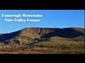
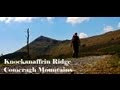
See the credits and list definitions.Video displayKnockmealdown Mountains Area E: East Knockmealdowns SubareaPlace count in area: 17, OSI/LPS Maps: 74, 82, EW-K
Highest place: Knockmealdown, 792.4m
Maximum height for area: 792.4 metres, Maximum prominence for area: 682.7 metres,
Places in area Knockmealdown Mountains:
Cen: Central Knockmealdowns:Crohan West 521mKnockmeal 559.5mKnockmealdown 792.4mKnockmoylan 767.1mKnocknafallia 666.5mKnocknagnauv 655.1mSugarloaf Hill 662.7m
E: East Knockmealdowns:Broemountain 430.4mKnocknanask 486mKnocknasheega 430.4mKnocksculloge 432.6m
S: Araglin:Knockadullaun 352.2m
W: West Knockmealdowns:Crow Hill 516.8mFarbreaga 518mKnocknalougha 629mKnocknalougha South Top 518.6mKnockshanahullion 653.3m
Note: this list of places includes island features such as summits, but not islands as such.
(Ir. Cnoc na nEasc [OSI], 'hill of the quagmires') Waterford County in Munster Province, in Carn List, Medium grained pink-purple sandstone Bedrock
Height: 486m OS 1:50k Mapsheet: 74 Grid Reference: S11655 07212
Place visited by 60 members. Recently by: Krzysztof_K, Wilderness, Josephineobrien, Nailer1967, DeirdreM, annem, abcd, nickywood, LiamG1951, TippHiker, sarahryanowen, Colin Murphy, chelman7, mlmoroneybb, conorjobI have visited this place: NO (You need to be a logged-in member to change this.)Longitude: -7.830258, Latitude: 52.216892 , Easting: 211655, Northing: 107212 Prominence: 131m, Isolation: 1.3km
ITM: 611599 607250 , GPS IDs, 6 char: Knc486, 10 char: Kncknnsk
Bedrock type: Medium grained pink-purple sandstone, (Knockmealdown Sandstone Formation)
The word easc has a number of meanings according to Dinneen, including a marsh or quagmire; a narrow glen between rocks; a stream. Knocknanask is the 609th highest place in Ireland.
Linkback: https://mountainviews.ie/summit/496/COMMENTS for Knocknanask (Cnoc na nEasc) 1 of 1  Follow this place's comments
 Height layer: © MapTiler

MountainViews.ie, a Hill-walking Website for the island of Ireland. 2500 Summiteers, 1480 Contributors, maintainer of lists such as: Arderins, Vandeleur-Lynams, Highest Hundred, County Highpoints etc

 TommyV
 TommyV
 simon3
 Collaborative entry
 Colin Murphy
 Collaborative entry
 Colin Murphy
 Fergalh
 Visit our Facebook page.