Guestuser: Login or enrol?
- Home
- Main Display
- Main Display (Old)
- Find a Walk
- Display INTRODUCTION
- DONATE
- Click below for your
profile & contributions
guestuser- New
- Tracks, Walks
- Challenge
- Community
- Lists & Logs
- Popular Lists:
- County Highpoints
- Range & Area Highpoints
- Local 100
- Highest Hundred
- Vandeleur-Lynams
- Arderins
- Carns
- Best rated
- Irish 900 up
- Irish Island
- Munros
- All Lists
- Shorter Irish
- County Highpoints
- Range & Area Highpoints
- Highest Hundred
- Local 100
- Local 100 (pre2014)
- Local Historical Cultural
- Best rated
- Irish 900 up
- Larger Irish
- Arderins
- Arderin Begs
- Arderins + Arderin Begs
- Vandeleur-Lynams
- Vandeleur-Lynams + Arderins
- Carns
- Binnions
- Highest 50 per Province
- Island Features
- Irish Island
- Coastal Hills
- Irish 600 up
- Irish 500 up
- British
- Munros
- British 600 up
- British 500-600
- British Marilyns
- Comprehensive
- All Irish summits
- All Irish features
- All British summits
- All Britain+ Ireland
- Special
- Analysis List
- Simple Irish Listings
- Simple Irish & British Listings
-
- More
- Motley Views
Welcome to MountainViews
If you want to use the website often please enrol (quick and free) at top right.OverviewFor more map options click on any overview map area or any detail map feature.Detail Map FeaturesShowing 13 items:
Seefin 493m, Coolroe 414m, Callahaniska 219m,Tracks:3793, 42km 3932, 41km 3320, 40km 2715, 38km 3742, 32km 2577, 27km 5171, 9km 4757, 8km 2016, 7km 4758, 2km Find Suggested Walks
Find hill, mountain, island, coastal feature.Videos


Recent Contributions
 Get Notifications
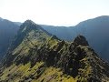
Mount Gabriel: Simple and stunning
Very fine Carn with stunning views.
Coomnalack Top: Lacks for nothing
GR 92: Estartit to l'Escala
Little Bin: Tough little climb
GR 92: Roses to Cadaques
Meikle Bin: Long trek to summit
GR 92: Cadaques to Port de la Selva
Cort-ma Law East Top: Do not climb in the rain !
Lecket Hill: Short trek to summit of around 2 Km from Crow road
GR 92: Torroella de Montgri to Begur
Silvermines Hydro Project
Conditions and Info
Use of MountainViews is governed by conditions and a privacy policy.
Read general information about the site.
Opinions in material here are not necessarily endorsed by MountainViews.
Hillwalking is a risk sport. Information in comments, walks, shared GPS tracks or about starting places may not be accurate for example as regards safety or access permission. You are responsible for your safety and your permission to walk.
See the credits and list definitions.Video displayGlenbeigh Horseshoe Area N: Glenbeigh SubareaPlace count in area: 20, OSI/LPS Maps: 70, 78, 83, EW-R
Highest place: Coomacarrea, 772.6m
Maximum height for area: 772.6 metres, Maximum prominence for area: 457 metres,
Places in area Glenbeigh Horseshoe:
Cen: Glenbeigh Horseshoe:Been Hill 651mBeenmore 660mBeenreagh 495mCoomacarrea 772.6mDrung Hill 640mKeamconneragh 593mMacklaun 607mMeenteog 714.7mMullaghnarakill 663.7mTeeromoyle Mountain 758.1m
N: Glenbeigh:Callahaniska 219mCoolroe 414mCurra Hill 275mSeefin 493m
S: Caunoge:Caunoge 502m
S: Knocknagapple:Colly 679mKnocknagapple 466mKnocknagapple NW Top 458mMeenteog South-East Top 565m
W: Mount Foley:Mount Foley 355m
Note: this list of places includes island features such as summits, but not islands as such.
(prob. Ir. Suí Finn [PDT], 'Fionn's seat') Kerry County in Munster Province, in Carn List, Purple sandstone & siltstone Bedrock
Height: 493m OS 1:50k Mapsheet: 78 Grid Reference: V68787 89962
Place visited by 70 members. Recently by: Ciarraioch03, maoris, Colin Murphy, Krzysztof_K, Cobhclimber, Grumbler, eamonoc, Taisce, chelman7, glencree, John.geary, learykid, Bissboy, annem, JohnAshtonI have visited this place: NO (You need to be a logged-in member to change this.)Longitude: -9.913278, Latitude: 52.046613 , Easting: 68787, Northing: 89962 Prominence: 168m, Isolation: 2.6km, Has trig pillar
ITM: 468765 590021 , GPS IDs, 6 char: See493, 10 char: Seefin 493
Bedrock type: Purple sandstone & siltstone, (Ballinskelligs Sandstone Formation)
Seefin is the 595th highest place in Ireland. Seefin is the second most easterly summit in the Glenbeigh Horseshoe area.
Linkback: https://mountainviews.ie/summit/480/COMMENTS for Seefin (Suí Finn) 1 of 1  Follow this place's comments
 Height layer: © MapTiler

MountainViews.ie, a Hill-walking Website for the island of Ireland. 2500 Summiteers, 1480 Contributors, maintainer of lists such as: Arderins, Vandeleur-Lynams, Highest Hundred, County Highpoints etc

 Colin Murphy
 Colin Murphy
 Collaborative entry
 Fergalh
 Fergalh
 Fergalh
 Fergalh
 Visit our Facebook page.